
Mt. Elbert via Black Cloud Trail
Buena Vista, Colorado
Details
Distance
10.69 miles
Elevation Gain
4967 ft
Route Type
Out-and-Back
Description
Added by Mike Stevens
Hike the tallest mountain of the Rockies with this unpopular route for solitude in the most stunning of views. This medium hard out and back hike is not for the timid but those that trek beyond the switchbacks will be rewarded with breathtaking scenery!
Directions:
Heading south from Leadville from U.S. 24: West on CO 82 for 10.5 miles to a hidden right turn that leads to a trail head. If you make it to the Mt. Elbert Lodge, you have gone just a bit too far. The parking lot (aka: dirt access) should be relatively empty as everyone tends to hike the more popular routes.
Hike:
This epic hike is an all day adventure so it is recommend to start at least by sunrise as the weather can become inclement to torrential by mid day. Typically it should be decent conditions for hiking through September, but we were unfortunately up against a potential cold front moving in from the west. We took a chance and caught a lucky break with some clear weather at the top but an hour later and we could have been in the beginnings of a whiteout. Again, start early, check the weather and prepare for the adventure.
As you start your ascent you will begin to notice that the lower elevation will come with a welcoming breeze that will keep you to only your base layers. If you time it right in the season, those aspens rustling in the wind will be shimmering like flakes of pure mother nature gold. The scene going up is filled with babbling stream crossings, the fresh scent of evergreens, and some birds chirping as you round each switch back.
When emerging from the timberline, you will be greeted with the southern face of Mt. Elbert's ridge. The elevation gain will start to increase at this point and the wind will change from a calm breeze to a steady flow. The group silently concurred that an extra layer was necessary at this point. The sea level hikers will begin to notice the altitude at the 1.5 hr mark.
After more switchbacks, a saddle emerges around 13,500' with excellent views of Twin Lakes. Take some time to catch you breath, grab a granola bar, or contemplate the universe. The ridge line progresses to the left (north west) with new obstacles to tackle but less climbing.
The journey continues but the trail can be hard to track on the ridge especially if you have low visibility. We had a few black clouds roll in on the ridge line and the wind was whipping around 20+ mph. A wind breaker or second layer is advisable at this point. The trail crosses over a few boulder fields and tundra. Light snow may be common while you cross over a few false summits. With the lack of visibility, it is even harder to spot the actual summit so check your location against your preferred GPS app.
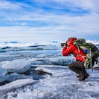
Once you reach the top you will be standing at the highest point in the Rockies! I always recommend taking in epic views of these magnitude first before rummaging for the camera. Soak it up, you deserved it!
As soon as we relaxed the clouds opened up, the wind died off and we were ecstatic about the 360 views of the surrounding landscape!
Once descending, remember there are loose rocks and gravel through the false summits of the ridge line. Approach with caution, as your body may start to notice the affects of the altitude depending on the length of stay at the summit. Stay on the high ground as you make it back to the saddle. From there its a clear shot going back down with the well marked trail and switchbacks.
Note: You can also hike Mt. Elbert from the North Mount Elbert Trailhead in Leadville.
Never. Stop. Exploring.
Download Outbound mobile app
Find adventures and camping on the go, share photos, use GPX tracks, and download maps for offline use.
Get the appFeatures
Mt. Elbert via Black Cloud Trail Reviews

This was a TOUGH, long hike but well worth it. Lots of aspens in peak color in mid-September. Incredible views all the way up.
5.0
This is a good option for Elbert to avoid the masses you will find on several of the more popular/known routes
4.0
Leave No Trace
Always practice Leave No Trace ethics on your adventures and follow local regulations. Please explore responsibly!
Nearby

Hope Pass via Willis Gulch

Mountain Bike the Colorado Trail near Mount Elbert

Kayak Twin Lakes

La Plata Peak Summer Route

Camp at Twin Lakes' White Star Campground
")
Mount Elbert via the Southeast Ridge Trailhead (Winter Route)
Discover
Community
Mobile Apps

© 2026 The Outbound Collective - Terms of Use - Privacy Policy