
Hope Pass via Willis Gulch
Buena Vista, Colorado
Details
Distance
8.75 miles
Elevation Gain
3297 ft
Route Type
Out-and-Back
Description
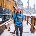
Added by Derrick Lytle
This trail is 9 miles roundtrip with 4500' of vert. Bring your dog and keep him/her off-leash for the hike. The trail follows the river, so water is easily accessible. Duration: Half Day.
Hope Pass is accessed from the Willis Gulch trailhead about 25 miles outside of Leadville, Colorado. To get to the trail head, follow Highway 24 East for about 16 miles until you arrive at the junction for Highway 82. Turn right and follow Highway 82 for about 8.3 miles. You will see a sign on the right that says "Willis Gulch Trailhead." Turn left into the dirt parking lot next to the river and park for free. At the trail head there's no map or bathrooms just a sign that warns of bears in the area. The hike starts at the bridge.
The trail is a total of 9 miles round trip with about 4500 feet of vert. There is no official trail for Hope Pass. Rather, it is done by connecting a few trails. Once you cross the bridge at the river, follow the trail to the first sign, turn left. From here follow the signs that say "Big Willis" or that are unofficially marked "Hope." If in doubt, follow the trail that leads up.
I day hiked to the pass to take photos with my dog and kept him off leash most of the time. The trail is not very crowded and follows a river most of the way so water is accessible if needed. In the basin before the pass there's a small beautiful lake at the treeline. Once you pass the treeline follow the trail through the scree and you will make it to the pass which offers stunning views of the surrounding mountains. Open camping is allowed without a permit.
Be sure to bring rain gear and other essentials for backcountry hiking and camping. In the summer rainstorms are frequent in the afternoon.
Download Outbound mobile app
Find adventures and camping on the go, share photos, use GPX tracks, and download maps for offline use.
Get the appFeatures
Hope Pass via Willis Gulch Reviews

I had the opportunity to take part in a three day TransRockies Run and this was day #2. We started in Vicksburg and ran 1.7 miles from the parking lot to Sheep Gulch Trailhead. It was a steady climb for the next 2.5 miles to summit of Hope Pass at 12,500' where we were greeted by volunteers. The trail is pretty technical and eventually leads to the historic town of Interlaken from the 1880s and was once a glamorous tourist resort. Overall, our point to point adventure totaled 13 miles and we were fortunate with the weather. I definitely recommend Hope Pass as a hike to acclimate to 14ers!
5.0
For a shorter but steeper route use the TH near the ghost town of Winfield.
5.0
I worked in Twin Lakes last summer and I loved waking up and seeing Hope every morning. Good recommendation!
Leave No Trace
Always practice Leave No Trace ethics on your adventures and follow local regulations. Please explore responsibly!
Nearby

Mt. Elbert via Black Cloud Trail

Kayak Twin Lakes

Camp at Twin Lakes' White Star Campground

Mountain Bike the Colorado Trail near Mount Elbert
")
Mount Elbert via the Southeast Ridge Trailhead (Winter Route)

Camp at Mt. Elbert Forebay Reservoir
Discover
Community
Mobile Apps

© 2026 The Outbound Collective - Terms of Use - Privacy Policy