
Missouri Mountain Trail
Buena Vista, Colorado
Details
Distance
10.38 miles
Elevation Gain
4430.67 ft
Route Type
Out-and-Back
Description
Added by Marisa Jarae
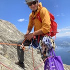
One of Colorado's 14ers, and easy Class 2 with a bit of Class 2+ at the top for added excitement. This is not as busy as other 14ers right next door to two other 14ers for a good weekend triple summit.
Getting there: The trail begins at Missouri Gulch TH. If you are a car camper or are trying to snag a sunrise summit, there are many many drive off sites in trees and near water before and after the trailhead. The road to get to the trailhead is not paved, but is well maintained - a super high clearance vehicle isn't necessary. The TH is about seven miles off of Chaffee County 390 road.
The Hike:Missouri Gulch Trail leads to both Missouri Mountain and Belford. The trail is obvious and well maintained. You will gain a decent amount of elevation as you hike over log bridges and through forrest. The first 3.5 miles have almost 3,740 ft of gain.
Once you start to reach tree line, you'll come upon the remnants of an old cabin. This is a popular place for backpackers to set up camp. Turn right at the cabin to stay on the trail.
At this point, you should be in an alpine valley. Depending on season, this area can be filled with wildflowers. There are several backpacking campsites through the valley as well. You'll still gain a bit through the valley, though the trail seems to flatten significantly.
Next you'll come to a fork in the road. If you go right, you'll head up Belford. To stay on the path to Missouri, you should go left. You'll go through some willows, cross the stream (it was icy when I crossed and I ended up going for a bit of a pre-sunrise swim...) and soon begin gaining elevation again.
The trail flattens once more as you reach the second plateau of the alpine valley, higher than the first. from here, you can see the ridge you'll have to walk along to reach the summit.
Once the valley starts gaining again, you should be close to the second fork in the trail (around 12,600ft). You'll want to stay right to get to Missouri. The other way will take you through Elkhead Pass with a trail up to Belford and Oxford.
From the second fork, the trail starts to gain elevation in the form of a traverse up a steep meadow and then straight line through a talus/boulder field. Again, it is well marked and easy to maneuver through.
You will eventually find yourself at the saddle of a craggy looking ridge. On reaching the saddle, turn left to walk along the ridge line. There are parts of the ridge that are decently exposed, but the views are incredible (especially at sunrise).
Missouri is a mountain that makes you work for the summit. While most 14er class 2 ridge lines are pretty straight forward/upward gain, the trail on Missouri's ridge actually loses elevation in spots, making the final ascent up to the summit steeper and a bit more challenging for tired legs.
Note: Several spots on the ridge line section of trail are steep, packed with dirt and gravel, and have some pretty serious exposure to one side. Use caution on the decent in these areas.
Download Outbound mobile app
Find adventures and camping on the go, share photos, use GPX tracks, and download maps for offline use.
Get the appFeatures
Missouri Mountain Trail Reviews
We did this in May to get some snow climbing in. It is super scenic and great to camp by tree line so you can do all three in the weekend. Just be prepared for snow if you're going in the spring. Belford and Oxford can be done earlier in the season without gear but Missouri cannot.
5.0
Leave No Trace
Always practice Leave No Trace ethics on your adventures and follow local regulations. Please explore responsibly!
Nearby

Missouri Mountain to Mount Oxford to Mount Belford

Mt. Belford and Mt. Oxford

Summit Mount Huron

Hope Pass via Willis Gulch

Hike Huron Peak

Mt. Elbert via Black Cloud Trail
Discover
Community
Mobile Apps

© 2026 The Outbound Collective - Terms of Use - Privacy Policy