Jefferson, Colorado
Looking for the best photography in Jefferson? We've got you covered with the top trails, trips, hiking, backpacking, camping and more around Jefferson. The detailed guides, photos, and reviews are all submitted by the Outbound community.
Top Photography Spots in and near Jefferson
-
Golden, Colorado
Hike Chimney Gulch Trail at Windy Saddle Park
4.05 mi / 1000 ft gainJust outside of Golden, CO is Lookout Mountain. If you’ve ever driven westbound on i70 from Denver to the mountains, you’ve undoubtedly seen this mountain to your right with antennas on the top. On the north side of Lookout Mountain lies Windy Saddle Park, about a 30 minute drive from Denver. Thi...Read more -
Golden, Colorado
Hike Lookout Mountain Trail at Windy Saddle Park
4.02.6 mi / 500 ft gainJust outside of Golden, CO is Lookout Mountain. If you’ve ever driven westbound on i70 from Denver to the mountains, you’ve undoubtedly seen this mountain to your right with antennas on the top. On the north side of Lookout Mountain lies Windy Saddle Park, about a 30 minute drive from Denver. Thi...Read more -
Littleton, Colorado
Hike or Bike Hildebrand Ranch
4.05.1 mi / 324 ft gainHildebrand Ranch Park is often overshadowed by the other nearby Jeffco Parks, but for the few that it does attract the trails do not disappoint. The Two Brands Trail starts at about 5600ft just off of Deer Creek Canyon Rd. It is a relatively flat trail that tops out at about 5821ft making it a...Read more -
Buena Vista, Colorado
Hope Pass via Willis Gulch
5.08.75 mi / 3297 ft gainHope Pass is accessed from the Willis Gulch trailhead about 25 miles outside of Leadville, Colorado. To get to the trail head, follow Highway 24 East for about 16 miles until you arrive at the junction for Highway 82. Turn right and follow Highway 82 for about 8.3 miles. You will see a sign on th...Read more -
Littleton, Colorado
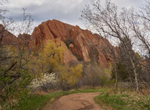
Hike the Fountain Valley Trail at Roxborough State Park
4.82.3 mi / 100 ft gainThe Fountain Valley Trail at Roxborough State Park is a very easy trail that's perfect for those that want to enjoy the outdoors but not subject themselves to the rigors of climbing a 14er. This very well maintained trail is wide and flat and perfect for groups, families, or for taking visitors t...Read more -
Littleton, Colorado
Hike to Carpenter Peak
4.56.2 mi / 1171 ft gainCarpenter Peak stands at 7,166 feet above sea level. While that altitude might not exactly take your breath away, the views from the top certainly will. Starting at the Visitor's Center, the trail to Carpenter's Peak begins as a relatively flat, well-traveled trail. A little less than a mile into...Read more -
Littleton, Colorado
Walk the Willow Creek Loop
1.4 miRoxborough State Park is located on the outskirts of Littleton, Colorado. Boasting incredible red rock formations and abundant wildlife, it is the perfect place for a quick escape outside.The Willow Creek Loop connects to the two parking lots in the park, so it is impossible to miss. With only th...Read more -
Golden, Colorado
Hike to Forgotten Valley
4.33.6 mi / 852 ft gainThere are over 35 miles of hiking trails in the park. The twelve trails in Golden Gate Canyon State Park are named after an animal and marked with the animal’s footprint.For a 2.6 round trip hike, start at the Burro Trailhead in Golden Gate Canyon State Park. You’ll immediately cross over a lit...Read more -
Leadville, Colorado
Savage Lakes Trail
5.03.97 mi / 1299 ft gainThe majority of this hike traverses through the beautiful forest that is part of the Holy Cross Wilderness. No significant views are to be had until you've climbed 1,300 ft over 2. miles and reach lower Savage Lake. The trail is easy enough to follow with no junctions along the way, and is adjace...Read more -
Buena Vista, Colorado
Mt. Elbert via Black Cloud Trail
4.510.69 mi / 4967 ft gainDirections: Heading south from Leadville from U.S. 24: West on CO 82 for 10.5 miles to a hidden right turn that leads to a trail head. If you make it to the Mt. Elbert Lodge, you have gone just a bit too far. The parking lot (aka: dirt access) should be relatively empty as everyone tends to hik...Read more -
Golden, Colorado
Hike the Mountain Lion Trail
6.7 mi / 1230 ft gainThere are three parking lots with direct access to the Mountain Lion Trail. The main one is off of Crawford Gulch Road, but any of them are good starting points! This loop has pretty similar elevation gain and loss profiles no matter which way you go, so you can go any direction. This adventure ...Read more -
Golden, Colorado
Hike Racoon Trail to Panorama Point
4.03.3 mi / 750 ft gainSummer is a magical time of year in the Rocky Mountains. One great way to experience this stunning beauty is through hiking Raccoon Trail to Panorama Point at Golden Gate State Park. Raccoon Trail is 3.3 mile moderately difficult hike which can be completed in under an hour, although it will like...Read more -
Buena Vista, Colorado
Mt. Belford and Mt. Oxford
4.510.34 mi / 5856 ft gainYou'll being your ascent at the Missouri Gulch Trailhead, which is located a few miles up Chaffee County Road 390, at around 9,600 feet. The trail is very clear and very well maintained, but is steeper than most trails (even quite a few of the 14er trails I've done) right from the get-go. Remembe...Read more -
Buena Vista, Colorado
Hike Missouri Mountain
5.010.5 mi / 4500 ft gainGetting there: The trail begins at Missouri Gulch TH. If you are a car camper or are trying to snag a sunrise summit, there are many many drive off sites in trees and near water before and after the trailhead. The road to get to the trailhead is not paved, but is well maintained - a super high cl...Read more -
Hartsel, Colorado
Camp at East Castle Rock Gulch
This is an awesome camp spot for individuals who do not have a 4x4 or AWD and want a secluded getaway! It does require to drive about 3 miles along a dirt road before arriving at the dead end of 188A, but can be easily cleared. From what I could see on the drive in there were only 4 camp spots de...Read more -
Lakewood, Colorado
Green Mountain Mountain Bike Loop
4.06.9 mi / 1047 ft gainSkip the bar and spend happy hour hiking/biking this fun and easy loop. With convenient access from the Denver-Metro Area, this spot is perfect for a quick ride after work, or hike with your dog. The park has three parking lots, and the trail can be completed as a loop system (in either directio...Read more

