Blue River, Colorado
Looking for the best hiking in Blue River? We've got you covered with the top trails, trips, hiking, backpacking, camping and more around Blue River. The detailed guides, photos, and reviews are all submitted by the Outbound community.
Top Hiking Spots in and near Blue River
-
Evergreen, Colorado
Private and Tranquil Retreat at Beaver Brook Watershed
4.0Note: This is NOT the Beaver Brook Trail in Genesee Park/Lookout Mountain! If you enjoy the scenery and ambiance of Evergreen, but Evergreen Lake has become too crowded for your tastes, Beaver Brook Watershed (owned by the City of Golden) is an excellent alternative. It’s a small, secluded area a...Read more -
Buena Vista, Colorado
Summit Mount Huron
6 mi / 3500 ft gainThere are some dispersed campsites along side the 4x4 road that leads to the trailhead. Ideally you can sleep here to get an early start to your hike in the morning, to avoid the afternoon storms that frequent the mountains. The 4x4 is rough in spots, though my Subaru Outback did make the trek un...Read more -
Evergreen, Colorado
Maxwell Falls
3.43.95 mi / 928 ft gainLocated just outside of Evergreen, this beginner hike is a great escape from the city for a few hours. There are three different options to hike to the falls: Maxwell Falls Lower Trail (4 miles), Upper Maxwell Falls Trail (1.1 miles), and Maxwell Falls Bluffs Cliffside Trail Loop (5 miles). On th...Read more -
Nederland, Colorado
Heart and Rogers Peak Lakes
4.88.62 mi / 2113 ft gainThe hike begins at the East Portal Trailhead outside Rollinsville. Start hiking along the South Boulder trail to the right (north) of the very obvious Moffat Rail tunnel. The trail begins with moderate grades past the Forest Lakes cutoff just 1.25 miles from the trailhead. Continue hiking straigh...Read more -
Chaffee County, Colorado
Off-Trail Hike of Limestone Ridge
4.09 mi / 1000 ft gainFinding a winter or early spring adventure that won't take you deep into dangerous mountain territory, while still providing epic vistas, is a challenge in Colorado. There are a few 10,000' tall ranges that sometimes escape deep snow, which are inviting for a first step into the alpine wonderland...Read more -
Nederland, Colorado
Hike Rollins Pass to Devils Thumb
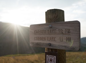
2.1 mi / 622 ft gainCorona Lake is an easy, short hike if you're pressed for time. It's scenic, secluded, and will put you in a great spot to hike to Devils Thumb the next day. There are two ways to reach Devils Thumb. This is considered the "easier" route because of the "lack of elevation gain." The sun and wind re...Read more -
Nederland, Colorado
3 Crater Lakes via South Boulder Creek
5.06.92 mi / 1804 ft gainAfter turning on to Co. 16 (Tolland Rd.) from 119 at Rollinsville, drive about 8 miles down the dirt road along South Boulder Creek. The road will dead end at Moffat Tunnel where you'll find ample parking in a gravel lot with restrooms. You'll begin your hike along sweeping meadows until you ent...Read more -
Nederland, Colorado
Upper Forest Lakes Trail
7.86 mi / 1778 ft gainUpper Forest Lakes Trail is an out-and-back trail that takes you by a river located near Rollinsville, Colorado.Read more -
Buena Vista, Colorado
Hike Huron Peak
5.06.5 miIf you have a 4WD vehicle, drive 2 miles from Winfield along a dirt road to the trailhead. If you don't have a suitable vehicle, you can park before the road gets rough and hike the rest of the road to the trailhead.Starting at 10560 feet of elevation, this 6.5 mile roundtrip hike begins its 3500...Read more -
Nederland, Colorado
Explore the Historic Railroad Route up Rollins Pass
5.0Rollin's Pass Road is a dirt road that follows an old railroad route from the historic town of Tolland, over the Continental Divide, and into Fraser. The road no longer allows you to drive over the summit, due to a partial tunnel collapse, but the road still takes you to within a short hike of th...Read more -
Evergreen, Colorado
Three Sisters
4.31.45 mi / 377 ft gainThe short 1.2 mile long trail, is a family-friendly, dog-friendly trail near Evergreen. The parking lot is incredibly easy to find and there is great signage to make sure you're going the right way. From the parking lot you can follow the Three Sisters trail signs until you reach the beginning of...Read more -
Evergreen, Colorado
Boulder The Eggs on the Hidden Fawn Trail
1.3 mi / 171 ft gainLooking for a place near Denver to perfect your bouldering skills? Or are you wanting to get the whole family out, but not looking for an extreme/technical hike? Which ever question best describes you, Alderfer/Three Sisters Park is the perfect place to go.This Jefferson County Open Space Park ha...Read more -
Evergreen, Colorado
Evergreen Mountain Loop
4.75.89 mi / 0 ft gainThe way up Evergreen Mountain is actually a few different trails stitched together throughout Alderfer/Three Sisters Park. The trail connects to both parking lots in the park, so if one is full you can just start from the other one, giving you lots of options for a quick day-hike. If you start ...Read more -
Sedalia, Colorado
Camp at Goose Creek
3.08 mi / 1300 ft gainGoose Creek is a fantastic spot to hike or camp. There is a dirt road leading to the trailhead, and it winds through the mountains and offers a great view of the valley. The dirt road is relatively easy and well-maintained. The burn scar from the Hayman fire is still really evident, so there are ...Read more -
Evergreen, Colorado
Hike the South Loop at Elk Meadow Park
3.04.4 miElk Meadow Park near Evergreen, CO spans 1,140 acres of open meadow and pine forests and has over 16 miles of managed trails by Jeffco Open Space. This park will give the visitor a diverse taste of ecosystems and terrain and is perfect for trail runners, families, or those seeking a quick excursi...Read more -
Buena Vista, Colorado
Hike Mt. Harvard
14 mi / 4600 ft gainStart your hike at the North Cottonwood Creek Trailhead. The trail begins at the end of the parking lot. You'll cross a bridge and meander along the creek, eventually reaching another bridge crossing at about 1.5 miles.After this bridge, you'll reach a trail junction. Be sure to go right (towards...Read more

