Blue River, Colorado
Looking for the best hiking in Blue River? We've got you covered with the top trails, trips, hiking, backpacking, camping and more around Blue River. The detailed guides, photos, and reviews are all submitted by the Outbound community.
Top Hiking Spots in and near Blue River
-
Idaho Springs, Colorado
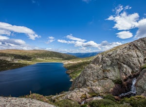
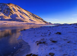
Camp and Fish at Loch Lomond
5.0The trail to Loch Lomond is very rocky. I suggest a high clearance 4x4 vehicle (I did see a small SUV and a Subaru..Not sure how they did it!!!). There are a few campsites at the lake and several along the way. I set up camp by the lake but had to move because the wind was so intense. I recommend...Read more -
Basalt, Colorado
Backpack & Fish at Lake Charles
11 mi / 1700 ft gainI decided to make an Outbound listing for this because the AllTrails listing is incredibly inaccurate. Hopefully you're reading this one! Your adventure starts at the trailhead of Fulford Cave / Fulford Cave Campground in Yeoman Park. Yeoman Park is just past Sylvan Lake State Park and is consid...Read more -
Idaho Springs, Colorado
Hiking James Peak (13,294')
8.3 mi / 3000 ft gainJames Peak is one of 76 13,000'+ peaks in Colorado's front range. On your way up to the peak you will pass St. Mary's Glacier. It is not an actual glacier yet a permeant snow field that is popular among skiers and snowboarders year round. St. Mary's Glaicer is a very popular destination (though m...Read more -
Buena Vista, Colorado
Mt. Belford and Mt. Oxford
4.510.34 mi / 5856 ft gainYou'll being your ascent at the Missouri Gulch Trailhead, which is located a few miles up Chaffee County Road 390, at around 9,600 feet. The trail is very clear and very well maintained, but is steeper than most trails (even quite a few of the 14er trails I've done) right from the get-go. Remembe...Read more -
Buena Vista, Colorado
Hike Missouri Mountain
5.010.5 mi / 4500 ft gainGetting there: The trail begins at Missouri Gulch TH. If you are a car camper or are trying to snag a sunrise summit, there are many many drive off sites in trees and near water before and after the trailhead. The road to get to the trailhead is not paved, but is well maintained - a super high cl...Read more -
Idaho Springs, Colorado
Hike St. Mary's Glacier
4.32 mi / 467 ft gainJust West of Idaho Springs on I-70 take the St. Mary's Alice Exit. Take a right and stay on the main road and follow the signs for about 8 miles (watch on the right side of the road for a surprise pink pig). There are two parking lots for the trailhead. The larger one is South of the trail and a ...Read more -
Idaho Springs, Colorado
Snowshoe Jim Creek Trail
5 mi / 965 ft gainStarting at 9,220 feet of elevation, this 5 mile out-and-back snowshoe begins its 965 foot elevation gain meandering through a quiet forest. The trail will take you through the woods for a few miles, and you can turn around whenever you like. If you're up for a challenge and have a lot of time, y...Read more -
Buena Vista, Colorado
Summit La Plata Peak
5.09.25 mi / 4500 ft gainThe Northwest Ridge is the most easily accessible and popular route, and for good reasons. The trailhead is on the side of Hwy 82, otherwise known as Independence Pass, about 14.5 miles from the Hwy 24 junction, or about 10 miles from Twin Lakes to the east. The trailhead is hard to miss, and you...Read more -
Pitkin County, Colorado
Sunset Hike to Twining Peak
4 mi / 1700 ft gainTwining Peak is a ranked 13er located 2 miles north of Independence Pass. The hike involves around 1700 feet of elevation and is mostly off-trail with some class 2 scrambling (class 3 can be had if you look hard enough). Independence Pass is a prominent and popular pass on Highway 82 between Twin...Read more -
Buena Vista, Colorado
Hike Davis Meadow
5.08.6 mi / 800 ft gainThis is a great hike that is very close to Buena Vista, CO. This trail is on the east side of town and is accessible in the spring. The hardest part of the hike is locating the trail-head. It is located in the northern part of Four Mile Canyon and is in San Isabel National forest. Starting in Bue...Read more -
Independence, Ohio
Hike Mountain Boy Ridge from the Top of Independence Pass
5.06 miThe trailhead is to the Independence Pass viewing deck is located at the Summit parking area, which is about 20 miles from Aspen and 24 miles west of Highway 24 on the Leadville side. At the parking area you will notice a paved walkway that takes you to the viewdeck, which is a easy five minute w...Read more -
Independence, Ohio
Hike Lost Man Pass via Independence Lake
5.04.5 mi / 1200 ft gainPark at the pull out just west of independence pass. From there, begin on the Linkin's Lake Trail. The trail is generally easy to follow (although it can be muddy as it is a wet area) and climbs 900 feet in the 1.8 miles to independence lake. From Independence lake it is about 0.5 miles and 400 f...Read more -
Conifer, Colorado
Elk Falls Loop
3.512.76 mi / 1893 ft gainBegin on Staunton Ranch Trail for 3.3 miles. Switch to Bugling Elk Trail for the next 1.1 miles, then to Lion's Back Trail for the last mile to the overlook. From here, you can create the loop by backtracking to the Chimney Rock Trail, which then connects with the Elk Falls Trail. To head back to...Read more -
Conifer, Colorado
Davis Ponds Trail
4.02.31 mi / 295 ft gainDavis Ponds Trail is a loop trail that takes you by a lake located near Conifer, Colorado.Read more -
Conifer, Colorado
Upper Maxwell Falls Trail
1.11 mi / 135 ft gainUpper Maxwell Falls Trail is an out-and-back trail, which is the shortest and most direct route to Maxwell Falls located near Conifer, Colorado. If you're looking for a little longer trail, check out this Maxwell Falls adventure for a roughly 4-mile loop hike.Read more -
Aspen, Colorado
Hike Lost Man Loop
5.08.8 mi / 1290 ft gainThis 8.8 mile "loop" is not a true loop and the trail ends 4 miles apart along Independence Pass, so a car shuttle is recommended. I would recommend starting at the west trailhead (closer to Aspen) but will describe both trailheads so you can set up another car or shuttle at the other one.1) West...Read more

