
3 Crater Lakes via South Boulder Creek
Nederland, Colorado
Details
Distance
6.92 miles
Elevation Gain
1804 ft
Route Type
Out-and-Back
Description
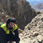
Added by Drew Wallace
Backpack to three alpine lakes and an alpine lagoon in Roosevelt National Forest.
After turning on to Co. 16 (Tolland Rd.) from 119 at Rollinsville, drive about 8 miles down the dirt road along South Boulder Creek. The road will dead end at Moffat Tunnel where you'll find ample parking in a gravel lot with restrooms.
You'll begin your hike along sweeping meadows until you enter Roosevelt National Forest where you'll hike along the South Boulder Creek. Enjoy a casual incline as the bustling stream cools the air and hums with an atmospheric trickle along the moderately wooded and heavily rock filled trails. As the degree of incline intensifies, keep your eyes peeled for rock piles marking the trail—there's a couple of places the trail switchbacks on massive boulders making it easy to lose.
Your first destination once out of the switchbacks is a lake on your left. The trail disperses but picks up in several places. Push in further to find the second lake on your right and several camping spots. Split the two lakes and traverse the left side of the second lake to find the waterfall trail that takes you up to the alpine lake and lagoon—just look for the stream and follow it.
This is the most difficult part of the hike, but also the most rewarding. A lot of people don't take this trail and opt for the straighter, more vertical trail up where the two lower lakes are closest, but they miss the waterfalls and wildflowers, so look for the waterfall trail and take it.
Once up there you'll be rewarded with killer views and a beautiful alpine lagoon. Take some time here to enjoy it but be sure to push in even further yet to discover the third alpine lake. At this point the trail in nonexistent, but I've found the best route to take is to traverse right—going left will lead you to marshy water holes and potentially wet boots.
Download Outbound mobile app
Find adventures and camping on the go, share photos, use GPX tracks, and download maps for offline use.
Get the appFeatures
3 Crater Lakes via South Boulder Creek Reviews


Went with my wife and some friends, to start our Colorado hiking experience. The wife and I had been a bit out of shape, but this was definitely a good one to start with! So bummed out that we didn’t bring a tent to camp out on the first lake! Truly amazing lake at the very top!
5.0

There were quite a few people there on the weekend so groups were a little too close for me and the road to get there got pretty bumpy. Took it slow and had no problems with the car. The hike itself was beautiful and worth the trip.
5.0
Going to the first lake is a well marked easy to follow trail. It’s something like 3 miles on my gps. This will slightly depend on where you go once you get to the first lakes. The trail gets steeper toward the first two lakes. You will pass the first one on your left as you go up and will be able to see it through the trees. If you keep going, you’ll hit the second lake. There are plenty of places to chill here, eat, fish, or even swim. If you want to go to the top lake you will pass between the first two to a much less taken care of trail. The trail will split right and left. The left trail goes almost straight up the mountain and requires bolder scrambling. The path to the right takes a longer rout but isn’t quite as hard. I definitely recommend this further lake. It is by far the best lake out of them all. Overall great hike. You can stop at the first or go on to the final lake. The final like is about a mile up, but is a bit shorter if you take the left path.
5.0
Wow. I'm writing this on my sore legs but I'm writing this wish some serious enjoyment. The drive in, the initial climb, the views along the way, and the incredible finish. This hike has everything you could want in a hike or a camping trip. We went in shorts and I had a cutoff on but the weather was incredible, even after the sun fell below the mountains. Make sure to bring some energy with you, I had a few energy bars that did me right, but my roommate was hurting a bit more. Also, we walked on top of about 3-4 feet of snow, falling in a couple times, so make sure you have waterproof boots that are tied up tight. Amazing day, amazing night. HIKE THIS PATH!
5.0
Leave No Trace
Always practice Leave No Trace ethics on your adventures and follow local regulations. Please explore responsibly!
Nearby

Upper Forest Lakes Trail

Heart and Rogers Pass Lakes

Explore the Historic Railroad Route up Rollins Pass

Hike Rollins Pass to Devils Thumb

King Lake via Hessie Trailhead

Snowshoe Lost Lake
Discover
Community
Mobile Apps

© 2026 The Outbound Collective - Terms of Use - Privacy Policy