Blue River, Colorado
Looking for the best hiking in Blue River? We've got you covered with the top trails, trips, hiking, backpacking, camping and more around Blue River. The detailed guides, photos, and reviews are all submitted by the Outbound community.
Top Hiking Spots in and near Blue River
-
Pine, Colorado
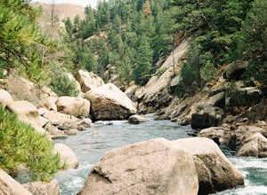
Fish Cheeseman Canyon
5.0Cheesman Canyon is considered one of the top fisheries in the world, and this stretch of the South Platte River is easily accessed at the Cheesman trailhead off CR 126 just Southwest of Deckers. There are tons of great fishing opportunities along this stretch of the river, but it does tend to ge...Read more -
Aspen, Colorado
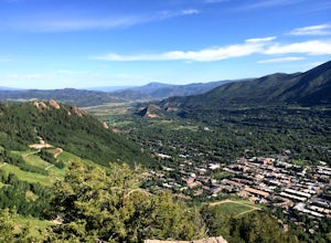
Ute Trail to Ute Rock
4.71.75 mi / 1122 ft gainThis shady trail of switchbacks ascends steadily (over a thousand feet in under a mile) to a rock outcropping at 9,185 feet. Yes, you can expect your heart to be pounding and to be huffing and puffing as you climb Ute Trail. But the view of Aspen that rewards you is spectacular. The trail is pre...Read more -
Nederland, Colorado
Hike to Arapaho Pass and Lake Dorothy
4.37.5 mi / 2080 ft gainBegin by parking at the 4th of July trailhead. This can be reached by conituing past the Eldora ski area and up a rough but passable (for all vehicles) gravel road to the trailhead. The trail is easy to find, and will continue to rise for the next 1.15 miles.At just over a mile there is a fork fo...Read more -
Nederland, Colorado
Hike South Araphaho Peak
5.08 mi / 2533 ft gainStart your hike at the 4th of July Trailhead, just outside of Eldora, CO. From the trailhead at the north end of the parking lot, steadily climb through the trees until a junction at 1 mile. Take the right fork towards Arapaho pass.You'll start to climb above treeline, with spectacular views of t...Read more -
Nederland, Colorado
Upper Diamond Lake via Fourth of July Trailhead
4.88.12 mi / 2037 ft gainThe trail begins at the 4th of July trailhead, which is located near the Eldora ski area and can be crowded during the summer and weekends. The road is rough in places but passable by any car when dry. From the parking area begin hiking the Arapaho pass trail, which will gently gain elevation thr...Read more -
Nederland, Colorado
Backpack to Caribou Lake
4.08.2 miThis is one of the most beautiful hikes I have ever done in Colorado. It is a great trip for photographers, fisherman or anyone who enjoys mountain views, forests filled with wildlife and peaceful meadows. Distances: Arapaho Pass: 3.2 miles, Caribou Lake: 4.2 miles, Caribou Pass: 6.4 miles, Meado...Read more -
Nederland, Colorado
Hike the Arapaho Traverse
8.3 mi / 3500 ft gainBegin at the Fourth of July Trailhead. Day parking is free and overnight parking is $5. Fourth of July is a popular trailhead and to ensure parking, you should arrive early in the morning (6am-ish... cause, I mean, you gotta 7 hour day in front of you). Follow the Fourth of July trail from the ...Read more -
Nederland, Colorado
Hike to Diamond Lake in the Indian Peaks Wilderness
5.05.7 mi / 1361 ft gainDiamond Lake is located in the Indian Peaks Wilderness. This is a super popular destination, so make sure you arrive early to get a parking spot (and be sure to follow all parking rules, they do give out tickets at this trailhead and others nearby). The drive to the trailhead is about 4 miles dow...Read more -
Lake George, Colorado
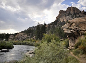
Camp and Fish at Eleven Mile Canyon
4.4Located below the dam of the Eleven Mile Reservoir, Eleven Mile Canyon is a scenic spot for camping, fishing, hiking and climbing. There are four different campgrounds to choose from (Cove, Riverside, Spillway and Springer), though only one campground remains open during the off season. Getting t...Read more -
Nederland, Colorado
Hike to Columbine Lake
5.07 mi / 1200 ft gainThe hike is about seven miles, give or take, however it feels longer. The elevation gain is little over 1000 feet. The drive here is about 45 minutes from both Granby and Winter Park, and is definitely worth it. You follow a trail dusted with wildflowers for the majority of the hike, and occasio...Read more -
Morrison, Colorado
Hike Mount Falcon
4.03.7 miJust a short drive from Denver up US-285 sits Mount Falcon Park, a 2,248 acre open space park managed by Jefferson County. With over 12 miles of hiking trails and stunning views of Denver and the Front Range, this park is perfect for getting in a quick adventure when you don’t feel like driving t...Read more -
Buena Vista, Colorado
Summit Mt. Yale
5.08.48 mi / 4232 ft gainThis amazing adventure starts at 9,900 feet and goes up 4,300 feet over the course of an 8.5-mile round trip. You will want to start at the Denny Creek Trailhead. If you are coming from Buena Vista or staying at the Collegiate Peaks Campground you will pass Denny Gulch and then Denny Creek. The ...Read more -
Golden, Colorado
Summit Windy Peak via the Burro Trail
4.06.35 mi / 1825 ft gainThe Burro Trail starts at the Bridge Creek Trailhead Parking Lot and leads off to the left. While this trail is incredibly well marked it wouldn't hurt to grab a map at the visitors center before you start! From the parking lot you'll travel along the trail for 0.7 miles until you reach your firs...Read more -
Golden, Colorado
Hike to Forgotten Valley
4.33.6 mi / 852 ft gainThere are over 35 miles of hiking trails in the park. The twelve trails in Golden Gate Canyon State Park are named after an animal and marked with the animal’s footprint.For a 2.6 round trip hike, start at the Burro Trailhead in Golden Gate Canyon State Park. You’ll immediately cross over a lit...Read more -
Aspen, Colorado
Camp on the Backside of Buttermilk Mountain
1.04 mi / 2000 ft gainPark at the Buttermilk Ski Area parking lot and begin your hike up the mountain at the bottom of the Summit Express chair lift. Follow the 4x4 dirt road the entire way up Buttermilk. There are other small hiking trails that you can follow too, and with the entire mountain being a ski area, it's s...Read more -
Aspen, Colorado
Explore Aspen's Foliage Along Government Trail
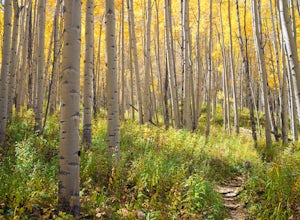
5.010 mi / 2193 ft gainThe Government Trail is beautiful and relaxing during spring and summer, but my favorite time to hike it is during fall because it goes through countless numbers of Aspen groves, which have turned a majestic yellow. After a moderate ascent for the first couple of miles, the trail become flat and ...Read more

