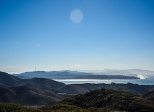
Yountville, California
Yountville, California, offers some of the best trails and outdoor activities. The top pick is the Napa Valley Vine Trail, a must-visit for its scenic beauty. This 47-mile hiking and biking path provides stunning views of vineyards and wineries. The trail difficulty is moderate, making it accessible for most fitness levels. Along the trail, you'll see beautiful natural features such as the Napa River and various rock formations. Another must-visit outdoor adventure is kayaking on the Napa River. Enjoy the scenic views of the river and its surrounding areas. If you're into bird-watching, keep an eye out for the diverse bird species that inhabit the area. Yountville is also home to the Veterans Home of California, a historic site with beautiful gardens perfect for leisurely strolls. With these outdoor activities, Yountville is a top destination for those seeking outdoor adventures.
Top Spots in and near Yountville
-
Mill Valley, California
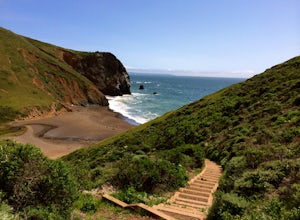
Tennessee Beach via Tennessee Valley Trail
4.63.64 miThe Tennessee Valley trail is leisurely 3.6 mile roundtrip hike that turns around at Tennessee Valley Cove. Along the way, you’ll hike past shrublands, wetlands, and a lake before you get to a cool little secluded beach that many people picnic at. This is probably the easiest to access, and most...Read more -
Stinson Beach, California
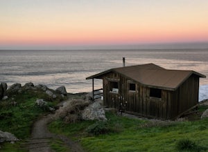
Steep Ravine Cabins
5.0Although these cabins are bare bones, lacking both water and electricity, they couldn't put you in a better spot for views of the Pacific Ocean. From your cabin, you can enjoy amazing sunsets, possibly whale watching, and access to trails like the cabin's namesake, Steep Ravine Trail. The cabins...Read more -
Stinson Beach, California
Steep Ravine Environmental Campground
5.0Gain access through a private locked gate, and descend about 1 mile down to the bluff's edge. There is only parking for 1 car per site and also several cabins that can be rented. A camp host is on site and there are bathrooms and water spigots throughout the campground. Each site has a fire ring...Read more -
Bodega Bay, California
Bodega Head Nature Trail
4.71.67 mi / 121 ft gainSitting west of the San Andrea fault, the Bodega Head is a massive chunk of granite from the Salinian Block, a geological terrane that contains Point Reyes and the Farallon Islands, and shares its origins with the Sierra Nevada mountains, the Head itself having been carried hundreds of miles to t...Read more -
Sausalito, California
Catch the Sunset at Swedes Beach
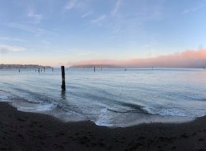
This is a small tucked away beach in Sausalito, CA. Being in the bay, it has very calm waters and is easy to swim in, though the water will be very cold. There are pilings in the water that are remnants of the old piers. It is a great beach to watch the sunset at. There is very limited street...Read more -
Muir Beach, California
Bonfire at Muir Beach
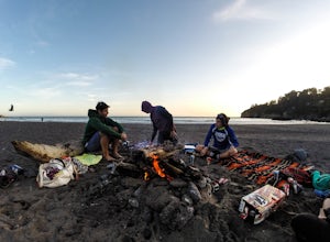
5.0Take in a scenic sunset and enjoy the warmth of a bonfire on the beach! Muir Beach changes the number of fire pits it has seasonally. May through November, the beach offers 6 fire pits, and in the colder months (December through April), there are 3 fire pits on the beach toward the south end of t...Read more -
Muir Beach, California
Pirate's Cove
5.03.43 mi / 856 ft gainPirate's Cove is an out-and-back trail where you may see wildflowers located near Mill Valley, California.Read more -
Muir Beach, California
Muir Beach Overlook
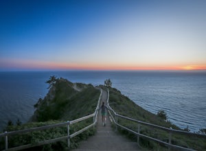
4.9The Muir Beach Overlook is one of the most convenient spots to take in an amazing view of the entire coastline, and one of the best places to catch a dramatic sunset. It’s conveniently located one mile north of Muir Beach and parking is easy. It’s a 5 minute walk down the trail to the Overlook. O...Read more -
Muir Beach, California
Owl Trail
5.01.2 mi / 300 ft gainThe Owl Trail runs between Slide Ranch and the Muir Beach Overlook and is a great way to take in the breathtaking views, flora and fauna of the Northern California coast. The easiest way to access the trail is to park at the Muir Beach Overlook and to take the trail down to Slide Ranch and then...Read more -
Oakland, California
Sibley Volcanic Trail Labyrinths
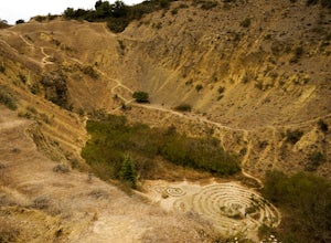
3.52 mi / 144 ft gainFrom Skyline Blvd, pull into the staging area for Sibley Volcanic Regional Preserve, you'll see the sign. Parking here is usually easy to find. You'll find an unstaffed visitor center with a restroom, park maps and informational displays featuring the history and geology of the park. Sibley is a...Read more -
Bodega Bay, California
Camp at Wright's Beach Campground
/ 32 ft gainThis campground is defined by the scenery: rugged headlands, craggy coastlines, natural arches, and quiet coves.Wright's Beach Campground features primitive camping - basic tent sites with picnic tables, fire rings, and amazing ocean views. This is a great location for Bay Area campers who want t...Read more -
Sonoma County, California
Kortum Trail
9.27 mi / 968 ft gainThe Kortum Trail in the Sonoma Coast State Park connects Goat Rock with Wrights Beach, winding along the top of the sea cliffs and affording incredible views of the California Coast and its numerous sea rocks and arches. To get there take the Pacific Coast Highway / Highway 1 to either Wright's...Read more -
Mill Valley, California
Headlands Ride to Point Bonita Lighthouse
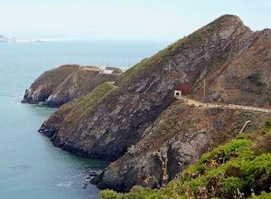
4.3The Headlands are a quick ride over the Golden Gate. On the ride, you'll see wildflowers, rugged coastline, and the Point Bonita Lighthouse. Once you cross the bridge, take Conzelman Rd up ~700 feet to Hawk Hill. From here, continue on to the lighthouse. On the return trip, head back on Conzelman...Read more -
Sausalito, California
Slacker Hill
5.01.02 mi / 344 ft gainAlthough the Headlands can be crowded, particularly at the parking-lot chaos of the Vista Point and pull-offs along Conzelman Road, the three routes leading to the summit of Slacker Hill remain relatively quiet, even during busy weekends. Each can be tied into larger loops throughout the Headland...Read more -
Sausalito, California
Ninja Loop
9.37 mi / 1831 ft gainThis loop can start from several different locations, including Rodeo Beach and the Golden Gate Bridge parking lot. Starting from the GGB will add 2 more miles onto this run. I like to start at the Coastal Trailhead parking lot off of McCullough and Conzelman Roads (just a notch down from Hawk Hi...Read more -
Sausalito, California
Marin Headlands Trail Loop
10.5 mi / 1990 ft gainThis trail starts at the Coastal Trail in Marin Headlands Park, where there's a small parking lot and outhouse bathroom off the circle when coming from Conzelman Road.Take the Coastal Trail until you intersect with Bunker Road (you can even turn right and spit off the trail just before intersecti...Read more

