Yountville, California
Yountville, California, offers some of the best trails and outdoor activities. The top pick is the Napa Valley Vine Trail, a must-visit for its scenic beauty. This 47-mile hiking and biking path provides stunning views of vineyards and wineries. The trail difficulty is moderate, making it accessible for most fitness levels. Along the trail, you'll see beautiful natural features such as the Napa River and various rock formations. Another must-visit outdoor adventure is kayaking on the Napa River. Enjoy the scenic views of the river and its surrounding areas. If you're into bird-watching, keep an eye out for the diverse bird species that inhabit the area. Yountville is also home to the Veterans Home of California, a historic site with beautiful gardens perfect for leisurely strolls. With these outdoor activities, Yountville is a top destination for those seeking outdoor adventures.
Top Spots in and near Yountville
-
Mill Valley, California
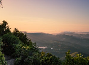
Temelpa Trail
4.52.94 mi / 1929 ft gainThe Mt. Tam Hill Climb via Temelpa Trail is an iconic, "best-of" climb in the trail running community, drawing some of the world's greatest athletes to experience its breathtaking views and technical downhill. Surprisingly though, outside of locals and the running community, the trail remains lar...Read more -
Guerneville, California
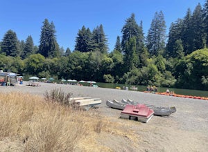
Johnson's Beach
Johnson's Beach is a public beach located on the Russian River in Guerneville, California.Read more -
Berkeley, California
Seaview and Big Springs Loop
4.54.28 mi / 1007 ft gainThe trail is dog and horse friendly, and many trail loops make Tilden Regional Park fun for families and those of any skill level. The Seaview and Big Springs Trail loop is typically used by avid hikers, trail runners, or mountain bikers. The first half of the trail is exposed to the sun and rock...Read more -
Occidental, California
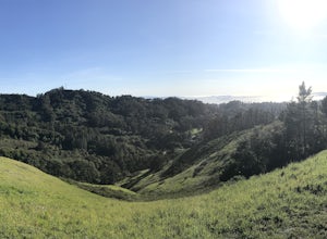
Watershed View Trail
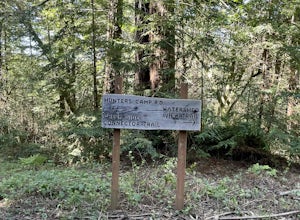
4.01.54 mi / 174 ft gainThe Watershed View Trail is located off of Coleman Valley Road and shares a trailhead with the Hunters Camp and Creekside Loop. This trail is a 1.5-mile out-and-back, which makes for a great trail to get the family out on to get some energy out. Be prepared for a muddy trail if there has been rec...Read more -
Occidental, California
Hunters Camp and Creekside Loop
5.36 mi / 853 ft gainHunters Camp and Creekside Loop is an almost 6-mile loop off of Coleman Valley Road in Occidental, California. This trail can get pretty muddy during the rainy season, but as an added bonus, it makes the waterfall along the Creekside Trail that much better. Dogs are not permitted on this trail.Read more -
Point Reyes Station, California
Sky Trail Loop
5.09.55 mi / 1818 ft gainSky Trail in Point Reyes National Seashore is a dramatic, mostly single-track trail that runs along the main spine of the Inverness Ridge and across highest mountains in Point Reyes, looming above the Olema Valley and Highway 1 which mark the San Andreas Fault rift zone and the dividing line betw...Read more -
Point Reyes Station, California
Sky Campground via Sky Trail
2.66 mi / 495 ft gainEntering Point Reyes National Seashore from Bear Valley Road the Sky Trailhead is a 4.9 mile drive. Camping in Sky Camp requires a Camping Permit. Once at the Sky Trailhead parking lot. The Sky Trailhead will be on the left side pulling in. The hike is not very strenuous and not all that lo...Read more -
Inverness, California
Tomales Point Trail
4.79.47 mi / 1165 ft gainThis hike will take you through the Tule Elk Preserve in Point Reyes Nation Seashore, and offers fantastic views of Bodega and Tomales Bay, as well as the Pacific Ocean. Start at the Tomales Point Trailhead near the Historic Pierce Point Ranch. Follow the trail for roughly three miles. This trai...Read more -
Monte Rio, California
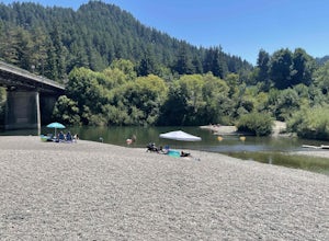
Monte Rio Community Beach
Monte Rio Community Beach is located in the Sonoma County town of Monte Rio. The beach nestles up to the Russian River offering a great chance for families to kick back and relax by the water or bring your kayak or stand-up paddle board for fun on the water. Dog-Friendly: Monte Rio Community Be...Read more -
Berkeley, California
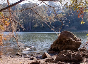
Lake Anza in Tilden Park
5.0Lake Anza makes for a great warm weather swimming hole. The parking area is close to the beach along with the trail, which will take you around the lake. The beach gets plenty of sun and is fairly wind protected, which makes for a relaxing day. Bring some picnic food out to the lake and snag your...Read more -
Stinson Beach, California
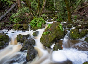
Cataract Falls
4.22.81 mi / 1184 ft gainThe Bay Area is home to many beautiful waterfalls, but Cataract Falls located about an hour north of San Francisco is one of the most stunning. Be sure to head out on this hike after a recent rain. Cataract Falls is a picturesque waterfall located in the Mt. Tamalpais Watershed near Stinson Be...Read more -
Berkeley, California
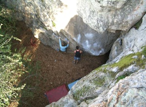
Bouldering at Indian Rock
4.8Indian Rock is one of the most popular outdoor bouldering spots in Berkeley. With over 80 problems, there's plenty of routes for beginners to the most advanced climbers. After parking in the surrounding neighborhood, it's an easy walk into the park. Aside from enjoying the challenge of new routes...Read more -
Inverness, California
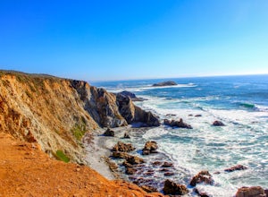
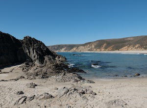
McClures Beach
1.44 mi / 243 ft gainThis beach is really easy to get to. Just follow Pierce Point Road until you see the sign to the beach. It's an easy hike down from the parking lot. There is very little shade, so make sure to bring some sunscreen. Be extremely cautious with getting into the water. There is likely underwater cu...Read more -
Mill Valley, California
Dipsea Trail
4.613.03 mi / 3701 ft gainThe Dipsea Race is the 2nd oldest foot race in the US. The race is named after the Dipsea Inn at the end of the trail at Stinson Beach. The good news is that you can enjoy this scenic trail and its sweeping ocean views at your leisure. The bad news is that the race is only one-way. If you choose,...Read more -
Guerneville, California
East Ridge - Pool Ridge Loop
4.53.37 mi / 810 ft gainThis park most resembles Muir Woods, and if you're looking to get out of the tourist trap, head to Armstrong Redwoods and make a day of it. This 3-mile hike takes off from the sign pointing to East Ridge Trail. As you begin a slight climb up the trail, you'll be under the cover of the redwoods, s...Read more -
Berkeley, California
Hidden Waterfall in Codornices Park
4.00.5 miPark along the street in front of Codornices Park in Berkeley. Follow the stream to the left of the playground. Take the path up the hill to the right (don't head over the bridge on the left). Keep walking up multiple concrete stairs. After the first flight of stairs you'll see a path on the left...Read more

