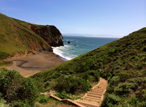
San Geronimo, California
San Geronimo, California is a must-visit for outdoor adventures with some of the top hiking trails. The Gary Giacomini Open Space Preserve is a popular spot, featuring a 4-mile loop trail that offers scenic views of the surrounding landscapes, including lush forests, valleys, and creeks. The trail is moderately difficult, making it suitable for most hikers. For a more challenging hike, the Pine Mountain Loop is a 9-mile trail that leads to a panoramic view of the Marin County. Additionally, the San Geronimo Valley Community Park offers a range of outdoor activities such as soccer, basketball, and a playground for children. For a unique attraction, visit the Spirit Rock Meditation Center, a peaceful retreat nestled among rolling hills and live oak trees. Truly, San Geronimo offers some of the best trails and outdoor activities for a rewarding day out.
Top Spots in and near San Geronimo
-
Mill Valley, California
Canopy, Panoramic, Redwood Trail, Sun, Dipsea Trail Loop
4.74.31 mi / 1145 ft gainWhile there are other, less crowded redwood groves in the Bay Area, Muir Woods National Monument is easily one of the best. It is a beautifully maintained site, with wooden footpaths meandering between towering redwoods that are between 600 – 800 years old. It’s home to some true giants, with its...Read more -
Point Reyes Station, California
Sky Trail Loop
5.09.55 mi / 1818 ft gainSky Trail in Point Reyes National Seashore is a dramatic, mostly single-track trail that runs along the main spine of the Inverness Ridge and across highest mountains in Point Reyes, looming above the Olema Valley and Highway 1 which mark the San Andreas Fault rift zone and the dividing line betw...Read more -
Point Reyes Station, California
Sky Campground via Sky Trail
2.66 mi / 495 ft gainEntering Point Reyes National Seashore from Bear Valley Road the Sky Trailhead is a 4.9 mile drive. Camping in Sky Camp requires a Camping Permit. Once at the Sky Trailhead parking lot. The Sky Trailhead will be on the left side pulling in. The hike is not very strenuous and not all that lo...Read more -
Point Reyes Station, California
Coast Campground via Laguna Trailhead
4.34.02 mi / 633 ft gainThis campground is the closest you can get to staying overnight on Pt. Reyes coastline if you're backpacking in. Once you get there, enjoy the view! The easiest way to get to the camp is from the slightly uphill hike along the Laguna Trail and the Firelane Trail. The trailhead for the Laguna Tra...Read more -
Point Reyes Station, California
Hike the Laguna Trail & Coast Trail Loop
5.05.2 mi / 300 ft gainLeave your car on a side of the road. When navigating there, put "HI Hostel Point Reyes" in your navigation - you park literally on the other side of the road, opposite to the hostel. Go to the west and soon you'll find the start of Coast Trail with a tsunami warning sign. During first 1.8 mile y...Read more -
Muir Beach, California
Muir Beach Overlook
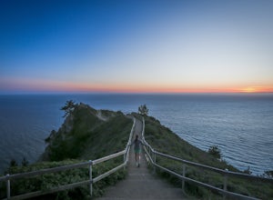
4.9The Muir Beach Overlook is one of the most convenient spots to take in an amazing view of the entire coastline, and one of the best places to catch a dramatic sunset. It’s conveniently located one mile north of Muir Beach and parking is easy. It’s a 5 minute walk down the trail to the Overlook. O...Read more -
Muir Beach, California
Owl Trail
5.01.2 mi / 300 ft gainThe Owl Trail runs between Slide Ranch and the Muir Beach Overlook and is a great way to take in the breathtaking views, flora and fauna of the Northern California coast. The easiest way to access the trail is to park at the Muir Beach Overlook and to take the trail down to Slide Ranch and then...Read more -
Corte Madera, California
Ring Mountain Loop
4.02.65 mi / 597 ft gainRing Mountain Open Space is an easy but uphill trail that take you to the top where you can explore more trails. Take the 101 exit for Paradise Dr in Corte Madera, follow the road, and park on the side of the road once you pass Westward Dr. Even though there are many places to start the trail fo...Read more -
Muir Beach, California
Bonfire at Muir Beach
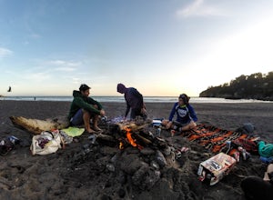
5.0Take in a scenic sunset and enjoy the warmth of a bonfire on the beach! Muir Beach changes the number of fire pits it has seasonally. May through November, the beach offers 6 fire pits, and in the colder months (December through April), there are 3 fire pits on the beach toward the south end of t...Read more -
Muir Beach, California
Pirate's Cove
5.03.43 mi / 856 ft gainPirate's Cove is an out-and-back trail where you may see wildflowers located near Mill Valley, California.Read more -
Inverness, California
Explore the S.S. Point Reyes Shipwreck
3.9Explore the shipwreck of the S.S. Point Reyes, perched on a sand bar off the shoreline of Tomales Bay. It is located in the small town of Inverness, just behind the grocery store. If you are driving North on Sir Francis Drake Blvd it will be on your right side. Parking is easy and you will see a ...Read more -
Inverness, California
Walk along Limantour Beach
4.8The entire drive to Pt. Reyes is picturesque, but once you make it to Limantour, you and your dog can both get out and enjoy it! This area, between Drake's Bay and an estuary, allows you to spend time relaxing or head out for a run (keep the dog on leash). If you're lucky you might either get a c...Read more -
Tiburon, California
Bouldering at Ring Mountain
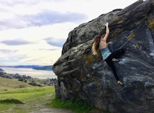
0.5 mi / 400 ft gainItching to climb outdoors near San Francisco? With only a quick drive from the city, Ring Mountain is a beautiful nature preserve overlooking the city of San Francisco offering two main rock formations, Turtle Rock (Pictured) and Split Rock. Split Rock is the slabby rock south of the parking ar...Read more -
Mill Valley, California
Oakwood Trail, Marin Headlands
5.02.56 mi / 538 ft gainLooking to escape the hustle of San Francisco, but don't want to commit to an entire day on the trail? When setting out for this morning hike, be prepared for about 1.5 hour hiking adventure (longer if you stop for extra photos) and a 20 minute commute from San Francisco. This hike is recomend...Read more -
Mill Valley, California
Coyote Ridge Loop
5.06.15 mi / 1001 ft gainStarting just before the Tennessee Valley parking lot, head out from the Miwok Trailhead. This Mill Valley hike offers incredible views of the San Francisco Bay, the Pacific Ocean (fog permitting of course!), and on occasion, wildlife. Unfortunately, this trail is not dog-friendly. Keep in mind...Read more -
Mill Valley, California
Tennessee Beach via Tennessee Valley Trail
4.63.64 miThe Tennessee Valley trail is leisurely 3.6 mile roundtrip hike that turns around at Tennessee Valley Cove. Along the way, you’ll hike past shrublands, wetlands, and a lake before you get to a cool little secluded beach that many people picnic at. This is probably the easiest to access, and most...Read more


