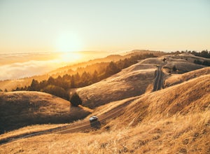
San Geronimo, California
Looking for the best hiking in San Geronimo? We've got you covered with the top trails, trips, hiking, backpacking, camping and more around San Geronimo. The detailed guides, photos, and reviews are all submitted by the Outbound community.
Top Hiking Spots in and near San Geronimo
-
San Geronimo, California
Roys Redwood Preserve Loop
5.02.37 mi / 430 ft gainRoy's Redwoods Preserve is an easily missed pocket of Redwoods off Nicasio Valley Road in Marin County. Don't miss it: heading North on Sir Francis Drake Blvd turn right onto Nicasio Valley Rd--the gate for this little park is about a half mile up on the right. From the main entrance you enter a ...Read more -
Lagunitas, California
Bolinas Ridge Loop
10.27 mi / 1568 ft gainNestled in the Samuel P. Taylor State Park this ten miler was a perfect escape from the chaos of the city. Hikers are able to pay a $10.00 park entry fee that includes plenty of parking spaces and restrooms before you hit the trail. The hike starts along the Cross Marin Trail, a path popular to ...Read more -
Fairfax, California
Carson Falls
4.03.75 mi / 863 ft gainAre you tired of crowds on your hikes? First, shame on you for getting up so late and moving so slowly. Did you really need Philz before you got on the trail? Ok, now that you’ve been thoroughly chastised, let’s start planning a hike to the less-frequented Carson Falls. Like any of the falls in ...Read more -
San Rafael, California
Terra Linda Sleepy Hollow Ridge Trail
5.05.85 mi / 1089 ft gainThis San Rafael neighborhood trail is quite popular, but there is plenty of room for everyone and the parking is easy. After you park at the trailhead, you walk (or bike) up a relatively short and steep path that takes you to the beginning of the trail. This hike takes you along a scenic ridge ...Read more -
Stinson Beach, California
Cataract Falls
4.22.81 mi / 1184 ft gainThe Bay Area is home to many beautiful waterfalls, but Cataract Falls located about an hour north of San Francisco is one of the most stunning. Be sure to head out on this hike after a recent rain. Cataract Falls is a picturesque waterfall located in the Mt. Tamalpais Watershed near Stinson Be...Read more -
Novato, California
Buck Gulch Falls Trail
5.01.26 mi / 203 ft gainBuck Gulch Falls (also known as Fairway Falls) is an easy, scenic hike that takes you through a beautiful forest on your way to a 15-foot waterfall. This little neighborhood treasure is tucked away in Novato, CA at the end of Fairway Drive and there is ample parking near the trailhead. If you v...Read more -
Fairfax, California
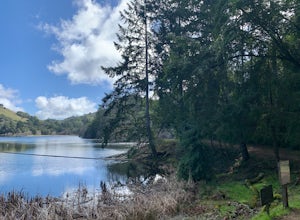
Lake Lagunitas
4.01.6 mi / 176 ft gainLocated near Fairfax, California, this trail is relatively flat and provides peaceful views of the lake as you pass over small creeks and groves of redwoods. It's good for all skill levels and is accessible year-round. It's a great trail for families and beginner mountain bikers.It can be a littl...Read more -
Novato, California
Schwindt, Indian Valley, and Waterfall Trail Loop
3.51 mi / 594 ft gainSchwindt, Indian Valley, and Waterfall Trail Loop is a loop trail that takes you by a waterfall located near Novato, California.Read more -
Ross, California
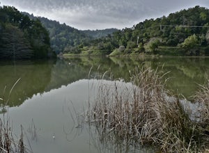
Phoenix Lake Loop
4.52.85 mi / 518 ft gainEnjoy the peacefulness of making it out to the lake for a quick hike without worrying too much about challenging climbs or difficult terrain. Take the wide fire road from the car uphill and then jump on the Phoenix Lake Trail. From here, you’ll combine this trail with the Gertrude Orr and Bill Wi...Read more -
Nicasio, California
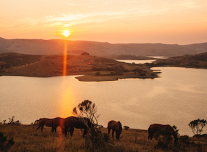
Hike and Fish at Nicasio Reservoir
5.03 mi / 300 ft gainNicasio is a quaint town just inland of the more popular coastal town of Point Reyes. It's most known for it's wine country, rolling hills, and the home of Skywalker Ranch, George Lucas's getaway home. Most visitors of this area either pass right on through for Point Reyes or use it's scenic road...Read more -
Bolinas, California
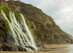
Alamere Falls via Palomarin Trailhead
4.513.54 mi / 1614 ft gainAlamere Falls is the tallest waterfall in the bay area. It is known as a tide fall because it empties directly into the Pacific Ocean. This is extremely unique because there are only 34 tide falls in the world and two in California, the other being McWay Falls in Big Sur. Enjoy stunning views of...Read more -
Bolinas, California
Point Reyes' Wildcat Camp via Coast Trail
5.011.19 mi / 1926 ft gainIn order to make this trip possible, go to recreation.gov and make a reservation for Wildcat Camp (available year-round). On your way to the trailhead, make sure to stop by the Bear Valley Visitor Center to grab your camping permit. For more information, visit: http://www.nps.gov/pore/planyourvis...Read more -
Bolinas, California
Bass Lake via Palomarin Trailhead
4.26.11 miFollow the Coast Trail from Palomarin Trailhead to Bass Lake. It's a fairly easy ~2.5-3 miles to the Lake. As soon as you pass the lake, on the left you will see a narrow unmarked dirt trail. Take this trail and you'll get to a nice clearing with easy lake access (this will be a great spot for lu...Read more -
Bolinas, California
Glen Camp Loop via the Palomarin Trailhead
4.715.72 mi / 3091 ft gainDay 1 Before heading to the trailhead, make sure to stop by the Bear Valley Visitor Center to pick up your permit. To stay overnight in Point Reyes, you must stay at one of the trail camps. Camping anywhere else in the park is not allowed. Permits for the trail camps can be booked up to 6 mo...Read more -
Bolinas, California
Backpack to Coast Camp in Point Reyes via Palomarin Trailhead
20.5 mi / 2705 ft gainSpanning from just north of the small town of Bolinas (about an hour north of San Francisco) across Inverness ridge and to the top of Tomales Point, Point Reyes National Seashore is as stunning park featuring breathtaking ocean views and solitude among the grassy hillsides and forested ridges. Th...Read more -
Mill Valley, California
Summit of Mt. Tamalpais Loop
5.01.15 mi / 394 ft gainMt. Tam is a large park with plenty of amazing viewpoints, but the East routes and the East Peak are best for sunsets. Once you're at the top, it's an amazing spot to view a large number of Marin trails, which can help you can get a head start on planning your next adventure. At 2,570 feet, this ...Read more


