California
Looking for the best fitness in California? We've got you covered with the top trails, trips, hiking, backpacking, camping and more around California. The detailed guides, photos, and reviews are all submitted by the Outbound community.
Top Fitness Spots in and near California
-
Ventura, California
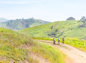
Bike the Sulphur Mountain Loop
28.6 mi / 2884 ft gainThe Sulphur Mountain Loop is a 28 mile cycling and mountain biking loop that begins in Ventura Canyon at the Sulphur Mountain Trailhead and loops through Ojai Valley. Beginning at the Sulphur Mountain Road trailhead off Highway 33, follow the road up and over Sulphur Mountain and down until it co...Read more -
Mariposa County, California
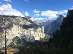
Hike to Union Point via Four Mile Trail
6 mi / 2332 ft gainFour Mile Trail is steep, but hikers efforts are more than rewarded. Union Point sits above Yosemite Valley at 6,332 feet - offering sweeping views of El Capitan and the valley entrance to the left, and North Dome / Half Dome & Clouds Rest to the right. You can also see Yosemite Falls straigh...Read more -
South Lake Tahoe, California
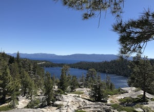
Camp at Bayview Campground
5.0Bayview is a first come, first serve campground in South Lake Tahoe, halfway between Emerald Bay and Cascade Lake. You can catch an amazing sunrise over Emerald Bay! Large pine trees provide ample shade, and each site is equipped with a picnic table, grill, and bear boxes. Bring plenty of water -...Read more -
Ventura, California
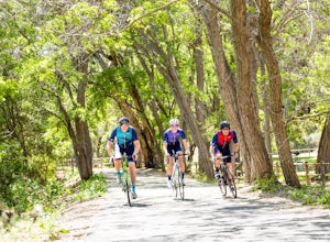
Bike the Ventura River and Ojai Bike Trails
32.6 mi / 1030 ft gainThe Ventura River and Ojai Valley Trail, effectively the same trail, is a gorgeous 32 mile trail that runs from Seaside Park in Ventura to downtown Ojai. It runs along and across the Ventura River and through the Ventura Canyon, with views up and down numerous side canyons and ravines. The trail ...Read more -
Malibu, California
Hike the Backbone East from Latigo Canyon
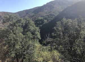
3.8 mi / 780 ft gainStarting in a dusty, generally empty parking lot, at about 2,000' ASL, you'll go immediately due north, up a few more feet before you drop down into another canyon covered in live oaks (and poison oak), thistles, ferns, and wildflowers. There's only one trail. It's windy, it's not hilly, it just ...Read more -
Shingletown, California
Hike the Chaos Crags Trail
3.8 mi / 915 ft gainManzanita Lake campground is located about 1/2 mile past the Northwest entrance of Lassen Volcanic National Park. The trailhead is located just before the campground sites about 0.1 mile off of the main road and marked with a sign (including a map) and a few parking spaces. The trail starts o...Read more -
Santa Monica, California
Spend a Day at the Santa Monica Pier
4.2*Unlimited photography options with the ferris wheel, beach, ocean, and sunsets *Abundant people watching opportunities *Plenty of ways to get a workout in including swimming, volleyball courts, running, or riding a bike There is a bike and walking path that runs along the coast. One of my favo...Read more -
Moraga, California
Bollinger Creek Loop Trail
1.43 mi / 213 ft gainLas Trampas Regional Wilderness offers an extensive trail system for hikers, horseback riders and mountain bikers. The trail is open year round and dogs are allowed. The Las Trampas and Bollinger faults spread apart to reveal a wonderful wilderness area with ancient remnants of beaches. The entir...Read more -
Laguna Beach, California
Hike the West Ridge Trail
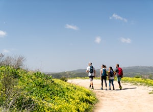
5.01.5 mi / 150 ft gainBeginning at Alta Laguna Park at Top of the World, the West Ridge Trail is a popular starting (and ending) point for adventures into the Laguna Coast Wilderness, leading to trails and areas like Car Wreck, Big Bend, and Willow Canyon. You can also do it in reverse from the north. The ridge itself...Read more -
Paso Robles, California
Hike the Shoreline Trail
1.05.5 mi / 1100 ft gainThe Shoreline Trail on Lake Nacimiento near Paso Robles, CA is a 5.6 mile trail used for hiking and trail running and located near Lake Nacimiento Resort. To get there, from Highway 101 take the 24th street exit in Paso Robles west till it turns into Lake Nacimiento Drive. Lake Nacimiento Drive w...Read more -
Tulelake, California
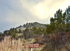
Hike the Schonchin Butte Trail in Lava Beds National Monument
5.01.5 mi / 475 ft gainFrom the entrance booth of Lava Beds National Monument drive south. There will be a left hand turn labeled Schonchin Butte, take it. Drive down a dirt road about a mile to reach Schonchin Butte trailhead parking. It is less than a mile hike to the fire lookout with elevation gain of 475 feet. The...Read more -
Arnold, California
Climb Peep Sight Peak in the Carson-Iceberg Wilderness
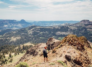
7 mi / 1800 ft gainPeep Sight Peak in the Carson-Iceberg Wilderness off Highway 4 provides solitude and wonderful views of the surrounding Sierra Nevada including the Mokelumnee and Emigrant Wildernesses. Even on summer weekends you'll likely have the peak and surrounding area all to yourself. Peep Sight Peak can b...Read more -
San Francisco, California
Hidden Garden Steps
4.30.1 mi / 39 ft gainThese tiles steps are ironically iconic, as they are called the "Hidden" Garden Steps. They are one of 3 tiled staircases that San Francisco is famous for. The others are the 16th Ave Tiled Steps and the Lincoln Park Steps. Tip: When calling an uber, try to get dropped off at the top of the ste...Read more -
Twentynine Palms, California
Hike the Mastadon Peak Loop
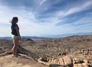
5.02.3 mi / 331 ft gainThe trail is typically used for hiking, nature trips, and trail running. There are lots of opportunities to see desert plants and flowers. On clear days, you can see the Salton Sea. There is an old mine to explore from the outside, as the entrance has been sealed. If you plan on going to the top...Read more -
Jamul, California
Hike the Hollenbeck Canyon Trail
4.6 mi / 626 ft gainThe trail is wide and well maintained. The first mile of the trail is well shaded by oak trees. You'll see stunning rocky peaks and rolling green hills as the trail continues. There are three creek crossings to be aware of. Cleveland National Forest is dog friendly, but bring a leash! Hunting is ...Read more -
Los Angeles, California
Baxter Steps
4.50.16 mi / 108 ft gainThis set of stairs near Dodger Stadium is Los Angeles is a great way to get a workout and stretch your legs. Unfortunately it is not dog-friendly. Keep in mind the best time to go here is during the week, so you can avoid crowds. Be sure to bring extra water with you as it can get very hot!Read more

