Escondido, California
Looking for the best hiking in Escondido? We've got you covered with the top trails, trips, hiking, backpacking, camping and more around Escondido. The detailed guides, photos, and reviews are all submitted by the Outbound community.
Top Hiking Spots in and near Escondido
-
Jamul, California
Hike the Hollenbeck Canyon Trail
4.6 mi / 626 ft gainThe trail is wide and well maintained. The first mile of the trail is well shaded by oak trees. You'll see stunning rocky peaks and rolling green hills as the trail continues. There are three creek crossings to be aware of. Cleveland National Forest is dog friendly, but bring a leash! Hunting is ...Read more -
Jamul, California
Hiking Otay Mountain
5.015.3 mi / 2903 ft gainThe trek begins on the Otay Mountain Truck Trail at Pio Pico Resort & Campground. You can either park and hike the entire trail, or drive up to a point a couple miles and park before the road becomes steep and rough. The distance on here is if you hiked the whole way. If you have a 4-wheel dr...Read more -
San Clemente, California
San Clemente State Beach
4.54.58 mi / 26 ft gainSan Clemente State Beach is an out-and-back trail that takes past scenic surroundings located near San Clemente, California.Read more -
San Diego County, California
Hike Garnet Peak Trail
3.02.6 mi / 500 ft gainWhile there are a few trail options, the designated Garnet Peak Trail begins off of Sunrise Highway at Mile Marker 27.8. There is a small pull-off on the east side of the road with a sign denoting the trail. An Adventure Pass is required for parking in this area of Cleveland National Forest.The f...Read more -
San Diego County, California
Hike Sheep Canyon
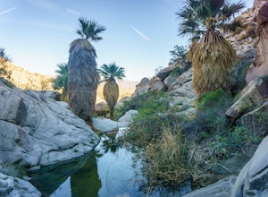
5.03 mi / 1000 ft gainSheep Canyon is probably the most remote palm canyon in Anza-Borrego Desert State Park in California. While Palm Canyon is easily accessed from the State Park campground, Sheep Canyon is on a dirt road that requires stream crossings and potentially a high-clearance 4WD vehicle. The canyon is nam...Read more -
Julian, California
Blair Valley Trail
11.4 mi / 873 ft gainBlair Valley Trail is a loop trail where you may see wildflowers located near Julian, California.Read more -
San Diego County, California
Big Laguna Lake Loop
5.05.9 mi / 400 ft gainBig Laguna Lake Loop is a loop trail that takes you by a lake located near Pine Valley, California.Read more -
Lake Elsinore, California
Hike Bear Canyon Trail to Sitton Peak
6.4 mi / 2200 ft gainA MUST hike for any orange country resident! The hike starts of off Ortega HWY 74 at the Bear Canyon Trail head on the same side of the road as the Ortega oaks candy store. Its recommended you park in the lot across the street from the trail head (tip:there is a working water spicket in the parki...Read more -
Lake Elsinore, California
Sitton Peak
9.36 mi / 2011 ft gainIt's amazing what you can find in your own backyard if you really do you research. In Orange County there are so many awesome hiking options that are often overlooked. The Bear Canyon to Sitton Peak Trail in the San Mateo Wilderness is one of those. Sitton tops out at 3,273 feet and it's a 5 mil...Read more -
San Diego, California
Hike to the beach at Border Field State Park
2 mi / 26 ft gainThe beach at Border Field State Park is southernmost beach in California. This beach begins (on US Maps) at the Mexican border and continues north to the mouth of the Tijuana River. The State Park shares its land with the Tijuana River National Estuarine Research Reserve which are both operated b...Read more -
Borrego Springs, California
Hike through Borrego Palm Canyon
5.03.25 mi / 450 ft gainBorrego Palm Canyon Trail is located just north of the park visitor center, making it a convenient place to begin your exploration of the Anza-Borrego Desert. To reach the trailhead, drive through Borrego Palm Canyon Campground, the largest developed campground in the park, where an $8 day use fe...Read more -
Borrego Springs, California
Camping in Anza-Borrego State Park
5.0With over 600,000 acres, Anza-Borrego Desert State Park is the largest state park in the contiguous United States. 500 miles of dirt roads, 12 wilderness areas and miles of hiking trails provide visitors with an unparalleled opportunity to experience the wonders of the Colorado Desert. The park i...Read more -
Borrego Springs, California
Hike to Maidenhair Falls via Hellhole Canyon in Anza Borrego Desert State Park
5.1 mi / 974 ft gainThis 5.1 mile hike begins near the visitor center of Anza Borrego Desert State Park and gains 974 feet of elevation while climbing up a canyon to a small waterfall. It is an interesting hike as you can see the plant life change as you get closer to the waterfall. There are parts where the trail g...Read more -
San Juan Capistrano, California
Hike the Pinhead Peak Trail at Ronald W. Caspers Wilderness Park
4.02 mi / 220 ft gainRonald W. Caspers Wilderness Park is the perfect place to getaway from the hubbub of LA. Enjoy the scenic drive north on Ortega Highway before reaching the entrance gate to the park. Parking Fees are currently $3 on Weekdays and $5 on Weekends. Camping Fees vary depending on your group size. The...Read more -
Trabuco Canyon, California
Bell Canyon Trail
3.86 mi / 102 ft gainBell Canyon Trail is an out-and-back trail where you may see wildflowers located near San Juan Capistrano, California.Read more -
San Diego County, California
Multi-pitch Climbing at Corte Madera
5.0This is one of San Diego's finest multi-pitch climbing crags. South-facing and standing 500 feet tall, Corte Madera has a history of both traditional and sport routes. The traditional routes will offer adventure with some en-route bushwhacking. The newer sport routes climb the clean faces of this...Read more

