Escondido, California
Looking for the best hiking in Escondido? We've got you covered with the top trails, trips, hiking, backpacking, camping and more around Escondido. The detailed guides, photos, and reviews are all submitted by the Outbound community.
Top Hiking Spots in and near Escondido
-
Solana Beach, California
Annie’s Canyon Trailhead
4.72 mi / 100 ft gainIf you're looking for a super short hike, this 10 minute flat walk couldn't be more ideal. Start at 840 N Rios Avenue, Solana beach and walk east towards the FWY 5 where you will see Annie’s Canyon on your right. There is only one way to go up the canyons and it gets pretty tight in places, but y...Read more -
Poway, California
Hike around Goodan Ranch
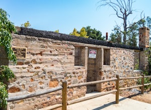
5.03 miStarting at the Sycamore Canyon Trail head, you will see the sign and gate that leads to Goodan Ranch. Head down the gravel road for 1.1 miles, until you reach a 3-way directional split. Heading straight for another .5 miles will take you directly to the ruins of the old Goodan house. Here you wi...Read more -
Del Mar, California
Sunset Seat in Del Mar
3.8In a place in our country where you can take an epic sunset picture nearly everyday, its hard say there is one location tin San Diego that is better than another. I'll let you in my new favorite secret spot to take amazing sunset pictures with a cool piece of art work at the location. Visit the t...Read more -
San Diego, California
Guy Fleming Trail
5.00.76 mi / 95 ft gainThis trail is located in Torrey Pines State Natural Reserve, a beautiful area about 20-30 minutes north of San Diego. To access the reserve, park in the lot off of North Torrey Pines Road (pay $10 to park). If you don't want to walk up the huge hill at the beginning (it is steep and long), I beli...Read more -
San Diego, California
Beach Trail
5.01.43 mi / 259 ft gainI'm stoked for those of you to find this adventure! Torrey Pines is home to a species of tree that is one of the most rare native pines in the United States. Below I have directions on how to get to the trailhead as well as the parking lot to park for the hike. There is a charge to get into the...Read more -
San Diego, California
Torrey Pines Beach Trail Loop
4.72.15 mi / 374 ft gainThe beach trail brings you from the parking lot across the lodge from the bluff down to the beach. You can choose to visit the Red Butte, the Razor Point, and the Yucca Point trails along the way. Of the other trails, this trail seems to provide a complete walkthrough of geological features; it a...Read more -
San Diego, California
Razor Point, Beach Trail, & Broken Hill Trail Loop
5.03.21 mi / 440 ft gainThe parking area for all of Torrey Pines State Natural Reserve is located right off North Torrey Pines Road (where the location is for this hike), about 20-30 minutes north of San Diego. It's $10 to park, and there was also a smaller parking lot at the top of the hill if you want to avoid the ini...Read more -
San Diego, California
Razor Point Trail
1.32 mi / 240 ft gainRazor Point Trail is an out-and-back trail that takes you past scenic surroundings located near La Jolla, California.Read more -
Ramona, California
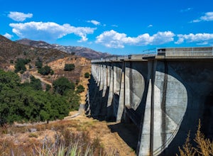
Explore the Sutherland Dam
2.01 miOnce your on Sutherland Dam Rd, follow it until your right next to the dam. Park on the side of the road where you see a small turn-out. Walk down to the side of the dam and drop down onto the concrete flooring of the dam. Walk on-top where allowed, and check out the views of the lake and the mo...Read more -
Oceanside, California
Bike or Skate the Strand
4.01 mi / 0 ft gainOceanside's iconic Strand is a 1 mile long ocean-front road that is perfect for cycling, walking, and running. At various points it is one way or pedestrian only, and is a must-do for any visitors to Oceanside.From the north The Strand begins at Breakwater Way and heads south underneath The Ocean...Read more -
Lakeside, California
Hike the Oakoasis Open Space Preserve
2.5 mi / 300 ft gainStarting at the trail-head, head down towards the oak-lined ravine marking the beginning of the hike. With trees already growing back from the 2003 fire, these sections of the trail are nice and shady, and quite relaxing. About 1 mile in you will start to see the San Vicente Reservoir to your lef...Read more -
San Diego, California
Black's Beach via the Gliderport
4.30.7 mi / 269 ft gainPark at the Torrey Pines Gliderport, which is conveniently empty before sunrise. The hike down to Black's Beach features a steep hike down a winding path of natural and manmade steps along the cliff face, but stay left and cruise the bluff for endless opportunities to observe, reflect and explor...Read more -
Lakeside, California
Hike El Cajon Mountain
4.512 mi / 4100 ft gainThis challenging trek is a great way to get in shape for that spring or summer trip to the Sierras. You may have heard others tell you how tough the hike is and they're not kidding. You'll be gaining 4100 feet over the 12 miles to the peak and back. If you have the time and the energy, you should...Read more -
Palomar Mountain, California
Hike Thunder Spring and Chimney Flat Loop
3.04 mi / 900 ft gainPalomar Mountain is the hidden gem of San Diego. Well, not so hidden per se- but most don't know that the little climb up the mountain can transport you from the prevalent brush-filled terrain of SD to a lush, diverse forest.The great thing about Palomar is that every day you visit could be compl...Read more -
Palomar Mountain, California
Hike to French Valley
5.03.8 mi / 450 ft gainWhen it comes to Palomar Mountain State Park, most people stick to Doane Lake and Upper Doane Valley. Yet on the far right of the parking lot at Doane Pond, there is actually a trailhead that will guide you to a completely different section of the park. The Lower Doane Valley trail is, in my opti...Read more -
San Diego, California
Black's Beach via the Ho Chi Minh Trail
4.30.61 mi / 259 ft gainFinding the actual trail is 80% of the adventure. Once you turn down La Jolla Farms Road you will follow it for about 3/4 of a mile and there won't be anything too apparent that you are there, except a few cars parked along the street. Make sure to plug in the directions from the map so you know ...Read more

