Antioch, California
Antioch, California is a great place to explore the outdoors! With plenty of trails and activities, it's the perfect spot for a day trip or weekend getaway. From the scenic Contra Loma Regional Park to the must-visit Black Diamond Mines Regional Preserve, visitors can enjoy top adventures. The Delta de Anza Regional Trail is also a great option for those looking to take in the beauty of the area. With plenty of activities and attractions to discover, Antioch, California is a great destination.
Top Spots in and near Antioch
-
Palo Alto, California
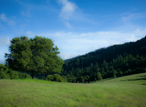
Hike the Arastradero Preserve Loop
3.04.5 mi / 600 ft gainGetting There: From Hwy 280, take the Page Mill Road exit and head West on Page Mill Road, away from Downtown Palo Alto (if you're taking 101, exit on Oregon Expressway). Then turn right on Arastradero Road. There will be a small sign indicating the dirt parking lot on the eastern side of the str...Read more -
Pacifica, California
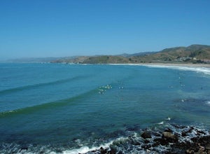
Surf at Pacifica State Beach
4.5If you're looking for a place to surf and Ocean Beach isn't quite your speed or Santa Cruz is too far, head to Pacifica, specifically Linda Mar. Linda Mar is usually more wind protected and user-friendly than ocean beach. Break out your longboard or hybrid board and head to this beach. There is e...Read more -
Carmichael, California
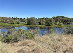
Levee Path/American River Bike Trail: Williams Pond Rec Area to Watt Ave
5.93 mi / 112 ft gainLevee Path/American River Bike Trail: Williams Pond Rec Area to Watt Ave is a loop trail that is good for all skill levels located near Carmichael, California.Read more -
Woodside, California
Hike through Wunderlich County Park
5.04.5 mi / 1400 ft gainLocated in the iconic Silicon Valley town of Woodside, Wunderlich County Park offers a number of hiking trails as well as some horseback riding trails through the wilderness. Once in the parking lot, you will see a number of stables, riding ring, as well as a beautiful historic stable that was o...Read more -
Redwood City, California
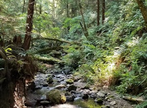
Hike Whittemore Gulch at Purisima Creek Redwoods OSP
4.09.3 mi / 2109 ft gainThis trail starts out going downhill towards the ocean for the first half, which makes for a tough end to the hike as you trek back up the ridge. However, there are nice ocean and hilltop views that are worth the climb. On this trail, you'll pass 60+ banana slugs if conditions are right. They ar...Read more -
Redwood City, California
Hike Purisima Creek Redwoods OSP
4.67 miThere are two places to park for this specific loop- the main parking area on Highway 35 (Skyline Boulevard) and a smaller parking lot on the western end of the park. I would recommend parking at whichever is closest. Find directions to both on Openspace.org. From the main parking lot, the trail ...Read more -
Redwood City, California
Mountain Bike at Purisima Creek
This beautiful mountain bike ride can be started at the Purisima Creek Road Trailhead or on Skyline Boulevard. There are many trails in the Purisisma Creek Redwoods, but Whittemore Gulch is by far the most beautiful and fun single track to descend on. If you are starting from Skyline Boulevard, i...Read more -
Santa Clara County, California
Black Mountain via Rhus Ridge Trail
9.75 mi / 2992 ft gainJust outside of Los Altos is a very long ridge of mountains, one of which is Black Mountain. This is a very dry hike, with no tree canopy, so it can get very hot! Be aware that this can make the hike feel a lot more difficult with the sun beating down on you. Follow Rhus Ridge Trail to Black Mo...Read more -
Los Altos, California
Park Day at Foothills Park
1.7Disclaimer: Foothills Park requires proof of residence in Palo Alto or being accompanied by a resident of the city. Learn more here.Foothills Park is 2.7 miles west of 280 after exiting Page Mill. After exiting you take a short scenic drive up the hill and come to the park entrance on your right...Read more -
Saint Helena, California
Hike Bald Mountain, Sugarloaf Ridge SP
5.06 mi / 1540 ft gainPark at the top of Adobe Canyon Road in the gravel parking lot to the left of the ranger kiosk. There is a $7.00 parking fee.There are many options for routes to the top; the easiest of which is mostly paved (although still steep in parts). To take this route, head north out of the trailhead park...Read more -
Petaluma, California
Hike Helen Putnam Regional Park
4.06 mi / 550 ft gainA 216-acre park, Helen Putnam offers 9 trails that are relatively short but can be combined however you wish. Go 2 miles or 10 miles. Loop in and out, up or around. I take a different route every time I hike here.For a good 6-mile hike, begin at the southwest corner, where the parking lot and res...Read more -
Half Moon Bay, California
Goat Yoga at Lemos Farm
5.0This is a great way to destress and have fun! Goat yoga is like normal yoga, but with goats. Goats tend to like higher ground and flat surfaces. So, when you are in table top position, they are highly likely to jump onto your back! These goats are still young, and so do not weigh as much as f...Read more -
Rancho San Antonio Open Space Preserve, California
Hike Deer Hollow Farm Trail
4.02.7 mi / 259 ft gainRancho San Antonio Open Space Preserve has many beginner to intermediate hiking trails. Deer Hollow Farm Trail Loop is a hiking trail for beginners, families, or anyone wanting to go on a short hike with nice views of the bay. The trail passes by a farm and deer can often be seen wandering aroun...Read more -
Half Moon Bay, California
Devil's Slide Bunker
4.3The Devil's Slide Bunker is perched out on a point the defiantly juts out into the ocean. The Bunker is covered in constantly changing graffiti, which provides a stunning contrast to the gorgeous seaside. Hop on Highway 1 South. Just south of Pacifica there is a tunnel. Once you go through the t...Read more -
Portola Valley, California
Hike the Windy Hill Loop
4.37.2 mi / 1400 ft gainThis 7.2-mile loop starts by heading out of the parking lot and onto the Spring Ridge Trail. Head Southeast On Spring Ridge Trail until you connect with Hamms Gulch Trail. When you jump on Hamms Gulch, head southwest for ~3.4 miles as you circle the far end of the OSP. At this point, you will con...Read more -
Half Moon Bay, California
Gray Whale Cove Loop
5.01.22 mi / 518 ft gainStarting at the parking lot adjacent to Gray Whale Cove State Beach, proceed to the start sign indicating "Grey Whale Cove Trail". GWCT is a fun brisk hike with slight elevation gain that should be easy enough to take a small group or even children to. Take note of the tight spaces you may encou...Read more


