Tonto Basin, Arizona
Looking for the best running in Tonto Basin? We've got you covered with the top trails, trips, hiking, backpacking, camping and more around Tonto Basin. The detailed guides, photos, and reviews are all submitted by the Outbound community.
Top Running Spots in and near Tonto Basin
-
Apache Junction, Arizona
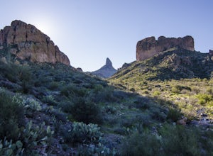
Hike the Dutchman's Second Canyon Loop
5.016 miTo get to the trail head, drive past Lost Dutchman State Park on the 88 and then take the dirt road (on your right) with arrows leading you to First Water Trail Head. There is an outhouse at the trailhead, so I suggest visiting it before you begin this hike. I also started this hike about an ho...Read more -
Apache Junction, Arizona
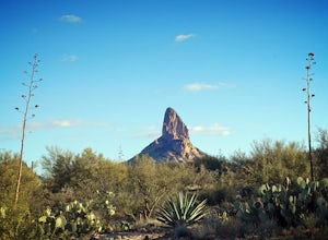
Hike Black Mesa Loop
4.59 miFrom First Water Trailhead, a short walk east brings you to the junction of the Dutchman trail and the Second Water trail. If you follow the Dutchman trail to the right you'll be heading southeast for a while, catching glimpses of Weaver's Needle in the distance. You can complete the loop going...Read more -
Apache Junction, Arizona
Treasure Loop via Jacob's Crosscut Trail
3.78 mi / 620 ft gainStarting Treasure Loop from Jacob's Crosscut offers a slight variation on Treasure Loop as well as ~1.5 miles if you're looking for a little extra distance. This trail is dog friendly on-leash and is used by hikers and runners.Read more -
Apache Junction, Arizona
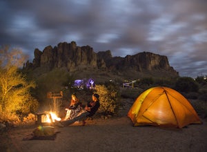
Camp at Lost Dutchman State Park
4.8Lost Dutchman State Park is located near the Superstition Mountains in central Phoenix, about 40 miles from Phoenix. There is a $7 day use fee to enter the park, which is waived if you’re camping ($15/night). The park offers 134 campsites, each with a picnic table, barbeque grill, and fire pit, a...Read more -
Fort McDowell, Arizona
Hike the Lower Salt River Nature Trail
2.52.4 miThis scenic loop offers views of Four Peaks, the Salt River & Verde River, and a desert landscape with plenty of wildlife. Keep an eye out for eagles, wild horses, and other wildlife while you're on the trail. This trail starts from the Phon D Sutton Recreation site, which is located at the...Read more -
Scottsdale, Arizona
Tom's Thumb
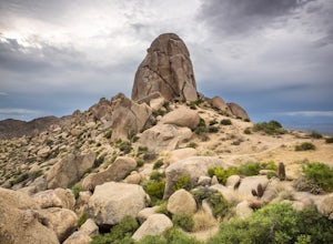
4.33.98 mi / 1236 ft gainThe infamous “thumb” can be seen from most places in the valley – a white burst of rock jutting skyward out of the desert ridgeline. The new Tom’s Thumb Trailhead in 2012 has nice restrooms and offers tons of information about the surrounding rock climbing areas, day hikes and desert knowledg...Read more -
Scottsdale, Arizona
Sunrise Trail to Sunrise Peak
4.83.73 mi / 1037 ft gainSunrise Peak, also known as Sunrise Trail, is located at the residential foothills of the McDowell Mountains in Scottsdale, Arizona. The trail will start next to a residential neighborhood, but after about a quarter mile you'll be immersed in the pristine Sonoran Desert. The trail will lead you t...Read more -
Scottsdale, Arizona
Upper Ranch and Brown's Ranch Road Trail
3.98 mi / 154 ft gainUpper Ranch and Brown's Ranch Road Trail is a loop trail where you may see wildflowers located near Scottsdale, Arizona.Read more -
Scottsdale, Arizona
Hike Bell's Pass
7.3 mi / 1700 ft gainStarting at 1800 ft elevation, the trail begins at Gateway Loop. This part of the trail will start off pretty flat and be more crowded than Bell's Pass depending on the day and time you are hiking. If you enjoy running this would be the time to do it before you reach Bell's Pass and the incline i...Read more -
Cave Creek, Arizona
Hike the Go John Trail
5.05.6 mi / 804 ft gainAs you park at the trailhead, you have the option to take this trail in either direction. I recommend that you travel north, which will immediately provide 0.75 miles of elevation gain. You will then reach a pass with panoramic views of the Tonto National Forest. A bench in this area provides the...Read more -
Phoenix, Arizona
Apache Wash Loop Trail
5.79 mi / 541 ft gainThis hike begins at the Apache Wash Trailhead where you will find restrooms and a covered rest area. This loop is simple to follow and offers various shortcuts along with an access to an optional summit climb. The loop begins from the north-east end of the parking lot near the restrooms. Turn l...Read more -
Phoenix, Arizona
Echo Canyon Trail on Camelback Mountain
4.52.46 mi / 1214 ft gainIf you live near or around Phoenix, you know that Camelback Mountain is pretty hard to miss. Due to the mountain's height, this hike isn't exactly what you would call easy. There are two sides of the mountain you can hike, Echo Canyon and Cholla Trail. Echo Canyon is shorter, but still an extreme...Read more -
Phoenix, Arizona
Shadow Mountain Loop
2.07 mi / 600 ft gainShadow Mountain Loop is a loop trail that takes you past scenic surroundings located near Phoenix, Arizona.Read more -
Phoenix, Arizona
Hole in the Rock
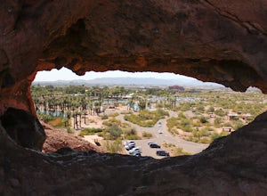
3.60.27 mi / 200 ft gainPapago Park is located right next to the Phoenix Zoo. The park is known for its rock formations and short hiking / running trails. The main attraction, the Hole in the Rock, at the top of the short trail, is a great place to take pictures as it is one of the highest points in the area and it off...Read more -
Phoenix, Arizona
Mojave Trail #200
4.51.88 mi / 430 ft gainThe entrance for the Piestewa Peak area is located at 2701 E. Squaw Peak Drive. The Mojave Picnic Area & Trailhead is the first parking area on the right. This is a very popular trail when the outside temps drop a bit so get there early for sunset hikes to ease parking. The trail begins on t...Read more -
Phoenix, Arizona
Hike the West Park Loop Trail in Papago Park
4.44 miThis trail begins from the parking lot on the west side of Galvin Parkway. To the east of the parking lot is a single track, dirt trail that heads north towards the big buttes. It continues counterclockwise around the big butte and heads south around the smaller butte. It continues west around th...Read more

