Tombstone, Arizona
Top Spots in and near Tombstone
-
Tombstone, Arizona
Explore the streets of Tombstone
5.0Fan of Western movies? Most people are aware of Hollywood movies like Tombstone and Wyatt Earp along with the infamous real life Gunfight at the O.K. Corral. But instead of walking where Kevin Costner or Kurt Russell stood, walk the boardwalks along the dusty main drag where the real Doc Holiday...Read more -
Cochise, Arizona
Hike the Cochise Stronghold Trail
4.012 mi / 1200 ft gainTake Rt. 10 east toward Benson and onto Cochise. Follow the sign to Pearce then to Sunsite. Take Ironwood Rd., Forest Rd. 84, for about 12 miles to the Stronghold Campground. Cochise Stronghold is about 1 hour from Tucson and well worth the drive. This is an out and back hike which makes for a lo...Read more -
Sonoita, Arizona
Hike to Hutch's Pool
5.07.8 mi / 647 ft gainStart at the Sabino Canyon trailhead - you can either walk up the dirt road (which adds about 4 miles) or take the $10 tram from the Visitor Center and hop off at the last stop #9. From there you hike 2.5 miles into Sabino Canyon into the basin (beautiful views of the canyon all the way there). O...Read more -
Willcox, Arizona
Camp at Chiricahua National Monument's Bonita Canyon
5.0Looking for an authentic hiking and camping weekend? Then the Bonita Canyon Campground in Chiricahua National Monument is your ticket. The Chiricahua National Monument is a uniquely beautiful place. There are wonderful hiking trails, some of the best in Arizona. The rock formations are the attrac...Read more -
Bowie, Arizona
Hike to the Ruins of Fort Bowie
5.03 mi / 500 ft gainFort Bowie is an abandoned military outpost and the site of many bloody battles between the government and Native Americans. The fort and visitor center can only be reached on foot, which guarantees a quiet, uncrowded experience through this lovely canyon.Begin at the trailhead on Apache Pass Roa...Read more -
Willcox, Arizona
Hike the Sugarloaf Mountain Trail in Chiricahua National Monument
1.8 mi / 470 ft gainThis short hike is spectacular at sunset. Park in the parking just beyond Echo Canyon right off of the park's scenic eight mile drive. Follow the well marked trail along the edge of Sugarloaf Mountain for beautiful views of the surrounding rock formations and valley below. At the top you will rea...Read more -
Willcox, Arizona
Heart of Rocks Loop from Echo Canyon Trailhead
7.06 mi / 1404 ft gainHeart of Rocks Loop from Echo Canyon Trailhead is an out-and-back trail with a small loop around where you may see wildflowers located near Willcox, Arizona in Chiricahua National Monument. This trail is not dog friendly. .Read more -
Willcox, Arizona
Hike Echo Canyon Trail in Chiricahua National Monument
4.53.5 miThis is a moderate trail, with a good amount of up and down. But you won’t mind one bit, because you’ll be so awestruck with the scenery. The distinct unique green coated rock formations of Chiricahua National Monument are on full display for this trail. Note that the parking fills very quickl...Read more -
Willcox, Arizona
Big Loop in Chiricahua National Monument
5.07.97 mi / 1562 ft gain27 million years ago, a large volcanic eruption in the Chiricahua Mountains left behind volcanic ash which eroded into the hoodoos and balancing rocks at Chiricahua National Monument aka The Wonderland of Rocks. The rock formations are very similar to Bryce National Park and the best part...you w...Read more -
Willcox, Arizona
Massai Point Overlook
5.00.43 mi / 56 ft gainMassai Point Overlook is a loop trail that provides a good opportunity to view wildlife located near San Simon, Arizona.Read more -
Rio Rico, Arizona
Camp at Patagonia Lake State Park
5.0Patagonia Lake State Park is located about 70 miles southeast of Tucson on State Route 82, 7 miles south of Patagonia, Arizona. Coming from the north, the drive to Patagonia Lake State Park is very scenic; the road winds through rolling hills and countryside with the looming Santa Rita Mountains ...Read more -
Tucson, Arizona
Hike to Javelina Rock
5.07 mi / 400 ft gainDrive through the gate of Saguaro National Park and continue straight onto Cactus Forest Drive. The 8 Mile loop takes you around to Javelina Rock parking area. Take time to enjoy this drive, it offers great views of the park and opportunities to spot coyotes and other wildlife.About 7 miles into ...Read more
Top Activities
Camping and Lodging in Tombstone
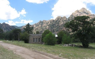
Cochise County, Arizona
Shaw House
Overview
Shaw House is a stone masonry cabin located in East Cochise Stronghold in the Dragoon Mountains of the Coronado National Forest....
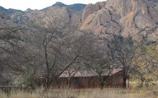
Cochise, Arizona
Half Moon Ranch
Overview
Half Moon Ranch is a ranch style house located in East Cochise Stronghold in the Dragoon Mountains of the Coronado National Fore...
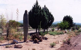
Benson, Arizona
Benson KOA Journey
Indulge your Wild West fantasies near the Benson KOA, in a quiet, high desert valley just 1 mile off I-10 Exit 304. Benson is the gateway...
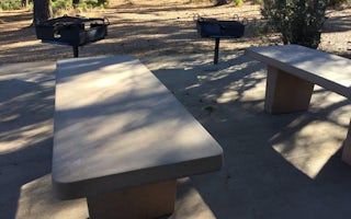
Hereford, Arizona
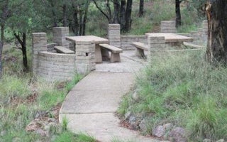
Reef Townsite Group Area
Overview
This high-mountain group campground and day use area is located on a site that was once occupied by the old mining town of Reef....
Elgin, Arizona
Rock Bluff Group Site
Overview
Rock Bluff Group Site is just a short distance from Parker Canyon Lake in a remote and scenic region of the Coronado National Fo...
Sonoita, Arizona
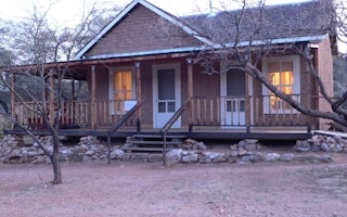
Kentucky Camp Cabin And Headquarters Building
Overview
Kentucky Camp Cabin and Headquarters is located in the Santa Rita Mountains near Sonoita, Arizona in the Coronado National Fores...


