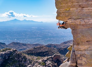
Saguaro National Park, Arizona
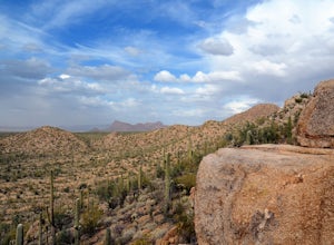
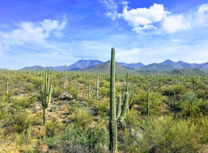
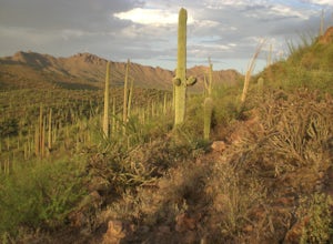
Looking for the best photography in Saguaro National Park? We've got you covered with the top trails, trips, hiking, backpacking, camping and more around Saguaro National Park. The detailed guides, photos, and reviews are all submitted by the Outbound community.
Top Photography Spots in and near Saguaro National Park
-
Tucson, Arizona
Hike the Valley View Overlook Trail in Saguaro National Park
5.00.8 miThe Valley View Overlook Trail is located in the Tucson Mountain District (which west of Tucson) of Saguaro National Park. The access to this trail is about 3 miles north from the Red Hills Visitor Center. From the visitor center travel 1.5 miles north on N. Kinney Road, then take a right on Hoh...Read more -
Tucson, Arizona
Hike Signal Hill Trail
0.6 mi / 46 ft gainA popular trail in the Tucson Mountain District of Saguaro National Park, Signal Hill is a highlight of the park with a small summit to a boulder field with many petroglyphs and views for several miles. The petroglyphs date to the 13th and 14th centuries and were created by the Hohokam people. ...Read more -
Tucson, Arizona
Hike the Hugh Norris Trail, Saguaro National Park
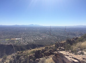
4.09.5 mi / 2000 ft gainNamed for a Native American police chief, the Hugh Norris trail takes you from lush (by desert standards) Saguaro and cholla forests to the top of rugged Wasson Peak. On top of the peak, you'll have sweeping views of the city of Tucson, as well as the surrounding mountain ranges. Depending on y...Read more -
Tucson, Arizona
Hike the Brown Mountain Trail
4.04.2 mi / 500 ft gainI really enjoyed this hike. I recommend doing the hike as an out and back from the Kinney Road parking area. Also, the best time to hike is just before sunset. The hike is just over 4 miles total out and back with only about 500 feet of elevation gain. It has a climb at the beginning then rolls a...Read more -
Tucson, Arizona
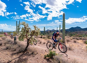
Mountain Bike the Desperado Loop
3.6 mi / 231 ft gainThe Desperado Loop in the Sweetwater Preserve is a great introductory mountain biking loop that is perfect for beginners, yet the Loop can also be tied into the larger Sweetwater Trail System for more advanced riders. Beginning from the parking lot, the Desperado Trail loop quickly rises to a rid...Read more -
Tucson, Arizona
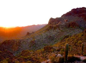
Catch The Sunset on Gates Pass
4.0Get on E Speedway Blvd, and follow it West until it turns into W Gates Pass rd. Follow this for 3 miles and the parking lot will be at the top of the pass. There are a few viewing platforms that offer shade from the desert heat. There are numerous trails that you can follow to get whatever view y...Read more -
Tucson, Arizona
Hike to the Bowen Stone House via Bowen Trail
2.4 mi / 300 ft gainThe Tucson Mountains are home to Saguaro National Park and the Tucson Mountain Park, the latter of which is a massive 20,000 acre park that is home to huge forests of giant saguaro cacti, a wide diversity of desert wildlife, and several long-abandoned farms and ranches like the Bowen Homestead, c...Read more -
Tucson, Arizona
Catch a Sunset on "A" Mountain
4.00.3 mi / 250 ft gainIn 1910 a group of University of Arizona students took local basalt rock and constructed a 160' block "A" on the east face of Sentinel Peak overlooking Tucson, giving the prominent peak its most commonly known name. Now the area is part of the 272 acre Sentinel Peak Park, and features a great net...Read more -
Tucson, Arizona
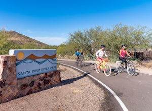
Bike The Loop at The Santa Cruz River Park
22 mi / 500 ft gainThe Loop is an in-development series of shared-use, hard-surface paths meant to connect all of Tucson by following the Santa Cruz River and its major tributaries. The Santa Cruz River Park contains 22 miles of The Loop (with another 40 in development) that runs along the western shore of the Sant...Read more -
Tucson, Arizona
Canyon Loop Trail in Catalina State Park
2.26 mi / 180 ft gainThe Canyon Loop trail is an easy hike through the foothills that begins and ends at the Trailhead parking lot. (End of the road when you enter Catalina State Park from Oracle Rd - entrance fee required) The loop is relatively flat, although starts with a short uphill burst before leveling off. ...Read more -
Tucson, Arizona
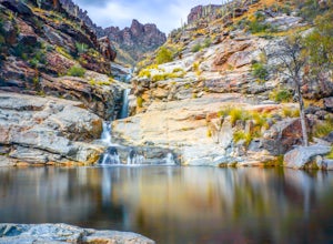
Seven Falls via Bear Canyon
5.08.3 mi / 917 ft gainAt the main parking lot of Sabino Canyon, there are a few different trams you can take to nearby trailheads. You have the option to either hop on a tram that will take you to the 7 Falls trailhead for $4 a person, or walk the 2 miles yourself. Once at the trailhead, signs will lead you into Bear ...Read more -
Catalina Foothills, Arizona
Hike the Sabino Canyon Trail
4.7This popular trail is a paved road that crosses 9 stone bridges over Sabino Creek. The creek itself is pretty dry most of the year, but after a rain it's a wonderful place to cool off and escape from the merciless desert heat. Hikers, cyclists and equestrians alike share and enjoy the trail. Ther...Read more -
Catalina Foothills, Arizona
Hike Blackette's Ridge
5.05.84 mi / 1500 ft gainStarting from the Sabino Canyon Recreation Area you'll want to follow signs for the Bear Canyon Trail. Don't worry about how busy it seems - most of the people you see are probably only going as far as the dam or picnic areas. There is a good chance that you'll have the top all to yourself especi...Read more -
3693 South Old Spanish Trail, Arizona
Drive the Cactus Forest Loop in Saguaro's Rincon Mountain District
5.08 mi / 550 ft gainSaguaro National Park is split into two different "districts" found east and west of Tucson. In the East-Rincon Mountain District you can find over 130 miles of hiking trails. However, for folks who don't have much time in the park, are with friends and family who aren't hikers, or are literally ...Read more -
3693 South Old Spanish Trail, Arizona
Drive the Scenic Loop in Saguaro National Park East (Cactus Forest)
4.58 miThe Cactus Forest scenic drive is one of two scenic drives in Saguaro National Park (the other is in the West district location). The drive in Saguaro National Park East is a paved eight-mile one way loop that runs through the heart of an extensive saguaro forest. If you’re lucky enough to visi...Read more -
Mount Lemmon, Arizona
Rock Climb the Hitchcock Pinnacle
Hitchcock Pinnacle on Mount Lemmon may be the most recognizable landmark in the Santa Catalina Mountains due to its prominence over Catalina Highway and Windy Point. Ample parking is available as are bathrooms. The Pinnacle itself features several trad, sport, and top rope routes including a seri...Read more

