Mormon Lake, Arizona
Looking for the best hiking in Mormon Lake? We've got you covered with the top trails, trips, hiking, backpacking, camping and more around Mormon Lake. The detailed guides, photos, and reviews are all submitted by the Outbound community.
Top Hiking Spots in and near Mormon Lake
-
Sedona, Arizona
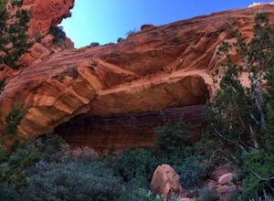
Hike to the Birthing Cave
5.02 mi / 291 ft gainThe hike is an easy one, flat and not too long. In the spring you'll see lots of flowers. Note, the popularity of this Sedona cave has grown in the past year, so you will most likely encounter other hikers and mountain bikers. You start from the Long Canyon Trailhead, and I recommend going earl...Read more -
Sedona, Arizona
Mescal Mountain Loop
4.59 mi / 453 ft gainThe Mescal Mountain Loop Hike circles Mescal Mesa uses three different trails. Park at the Mescal Trail parking area on Long Canyon Road. The Mescal Trail is 2.4 miles long and winds up to the base of the mesa where it travels along beautiful open slick rock. It is an easy hike but the trail is ...Read more -
Sedona, Arizona
Devil's Bridge via Mescal Trail
3.95 mi / 548 ft gainThe Devil's Bridge trail head itself is accessible via a road meant for 4x4s, which your average car cannot handle. The best way around this is to park at the Mescal Trail on Long Canyon Road. From Dry Creek Road, turn right on to Long Canyon Road, where you will see trail maps and a small parkin...Read more -
Flagstaff, Arizona
Hike Fatman's Loop
5.02.5 mi / 690 ft gainSitting on the eastern slope of Mt Elden is a super fun multi-use trail called Fatman's Loop. It's a perfect spot for hiking, trail running, day strolling, or walking the pup. All the while, treating you to glimpses of the eastern suburbs of Flagstaff, beautiful wild flowers, and cool rock format...Read more -
Sedona, Arizona
Hike the Oak Creek Trail
4.51.1 mi / 26 ft gainGreat, short hike in Red Rock Crossing. Make sure to check out the hundreds of cairns at Buddha Beach. Beautiful views of Cathedral Rock. Lots of places to relax and have lunch, with picnic tables near the parking lot. Lots of parking, good amount of shade down near the creek. Good for all sk...Read more -
Flagstaff, Arizona
Frisbee Golf at McPherson's
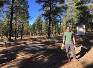
1 miMcPherson's is a public disk golf course five minutes north of downtown Flagstaff. The course is seasonally open from May - November. There are no tee times, and it is free to play. A somewhat tightly wooded 18-hole course with multiple pin placements makes this fun for beginners and a challenge...Read more -
Sedona, Arizona
Hike the Baldwin Trail
3.3 mi / 105 ft gainAs with most areas in Sedona, you will need to have purchased a Red Rock Pass to park at the trailhead, which is located just south of Verde Valley Road. The trailhead, starting at an elevation of 3,950 feet, is well marked and the trail is defined. You have an option to either hike clockwise or ...Read more -
Sedona, Arizona
Hike the Boynton Canyon Trail
5.06 miThis is my favorite trail in all of Sedona. The trail head is at the end of Boynton Canyon rd near the entrance of Enchanted Spa and Resort. The trail goes along the property of Enchanted Spa for about 1 mile. This is the rockiest part of the trail as you pass by a large cliff.Soon after leaving ...Read more -
Sedona, Arizona
Fay Canyon Trail
3.82.56 mi / 666 ft gainLocated on the outskirts of Sedona's main attractions, Fay Canyon is a hidden gem. The Fay Canyon Trail is an easy, scenic hike that takes you through this lesser-known Sedona canyon. You won't see majestic open views like those of Bell Rock, but you will find gorgeous views, without the crowds. ...Read more -
Sedona, Arizona
Fay Canyon Arch
4.51.5 mi / 361 ft gain...The hike through Fay Canyon goes 1.25 miles to Box Canyon and is rated easy to moderate. To see Fay Canyon Arch though is a much shorter hike. From Boynton Pass Rd, park at Fay Canyon parking lot. The parking lot offers restrooms and a few picnic tables to relax at. The start of the trail is d...Read more -
Sedona, Arizona
Hiking Kisva Trail in Red Rocks State Park
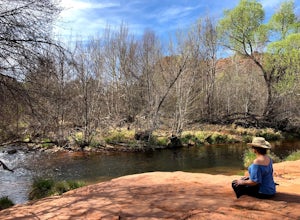
4.01.3 mi / 62 ft gainThis easy hike features a lovely creek and the beautiful red rocks of Sedona! This is a flat, shady, 1.3 mi hike and follows Oak Creek for a portion. Beautiful spots to stop and have a picnic or just relax and watch the birds. Lots of signage, and great to do with kids of all ages. If you’r...Read more -
Flagstaff, Arizona
Camp at Red Rock
4.8Starting from Downtown Flagstaff we headed west. After making a left turn on Woody Mountain Road, we continued for 22 miles. Woody Mountain Road then becomes Forest Road 231. Continue on FS 231 until you find a killer spot to pitch it! Make sure to be wary of elk herds crossing the roads.We made ...Read more -
Flagstaff, Arizona
Hike the Two-Spot Loop Trail
2.5 mi / 100 ft gainThis loop trail has two different starting points. You can start at the south end of Rogers Lake (which is what I did) or the north end. I hike in a clockwise direction. This is recommended if you are hiking in the late afternoon as I did. The sun will be at your back during the section that has ...Read more -
Sedona, Arizona
Doe Mountain Trail
1.49 mi / 446 ft gainDoe Mountain Trail is a loop trail where you may see beautiful wildflowers located near Sedona, Arizona.Read more -
Sedona, Arizona
Hike Doe Mountain
5.01.4 mi / 400 ft gainThe trail begins almost immediately with some gradual switchbacks that climb up the mesa at a moderate incline. As you climb you will come to a trail junction with the Aerie trail about .3 in. At this junction just make sure to stay on the trail marked towards Doe Mountain and not on the Aerie tr...Read more -
Yavapai County, Arizona
Bell Trail
7.12 mi / 591 ft gainBell Trail is an out-and-back trail that takes you by a river located near Rimrock, Arizona.Read more

