Coconino County, Arizona
Looking for the best running in Coconino County? We've got you covered with the top trails, trips, hiking, backpacking, camping and more around Coconino County. The detailed guides, photos, and reviews are all submitted by the Outbound community.
Top Running Spots in and near Coconino County
-
Flagstaff, Arizona
SP Crater
1.96 mi / 341 ft gainOff of the 89, just north of Flagstaff AZ, there is an unmarked dirt road just before a gas station. It leads out to privately owned land that's open to the public. Some friends and I went out there to get away from our day jobs. As we headed down the road, the land opened up in vast expanses of ...Read more -
Flagstaff, Arizona
Trail Run in Lockett Meadow
4.8Getting There North of Flagstaff on the 89A, take a left turn directly after a sign for Sunset Crater. This road winds up a well-developed path; when it ends, turn right. After the road banks left, take a right at the next fork and continue on the dirt road up a single lane path until you enter t...Read more -
Flagstaff, Arizona
Hike the Aspen Nature Loop at Humphrey's Peak
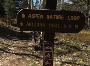
5.01.8 mi / 300 ft gainThis is a great hike that has amazing views at all times of the year. This trail might be closed for skiing season, but I am not sure. I went in October, just before Halloween and the weather was perfect. The leaves were changing and there was a nice brisk breeze. The short loop makes it accessib...Read more -
Flagstaff, Arizona
Bike along the San Francisco Peaks on Waterline Road
4.020 mi / 3000 ft gainWaterline Road is a closed service road that follows along the southern and eastern slopes of the San Francisco Peaks of Flagstaff, AZ. You will pass through several miles of charred ponderosa pine as well as expansive groves of aspen trees as you make your way to the Inner Basin.The road follows...Read more -
Flagstaff, Arizona
Hike and Camp at Arizona's A1 Mountain
4.76.6 miles west of downtown Flagstaff off the I-40 West is the A1 Mountain Road. Continue over the cattle guards and enter into the A1 Mountain Area—perfect for hiking, camping, and trail running.The main road is well established for a dirt road, and many of the hiking trails branch off from it. T...Read more -
Grand Canyon Village, Arizona
Run Rim-to-Rim-to-Rim in the Grand Canyon
5.040.79 mi / 11000 ft gainThis run is an extreme adventure and requires lots of planning and training. The risk for injury or heat related illness is high, so take precautions and don't run alone. Group sizes of 12-30 require a $175 permit from the NPS. These trails are popular with runners, hikers, and backpackers; pl...Read more -
Grand Canyon Village, Arizona
Camp at Mather Campground, Grand Canyon NP
4.5Mather campground provides forest camping at its best while visiting the beautiful South Rim of the Grand Canyon. Spacious RV, tent, group and even horse sites are available in this well kept facility. The area also provides clean restrooms, water, dump station and showers (additional cost) if yo...Read more -
Sedona, Arizona
Climbing at Oak Creek Canyon
5.0Getting There About 18 miles south of Flagstaff on the 89A, turn into the Cave Springs parking lot and look for the trail just right of the first bridge. Hike up the chossy hill until you reach a giant sandstone slot canyon in the northwest. Climbing This canyon contained the crags, known as the ...Read more

