Camp Verde, Arizona
Top Spots in and near Camp Verde
-
Sedona, Arizona
Devil's Bridge Trail
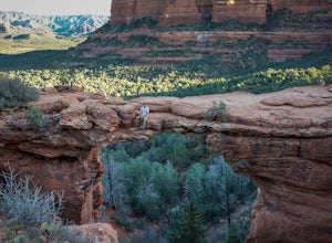
4.63.94 mi / 400 ft gainThe Devil's Bridge is the largest natural sandstone arch in Coconino National Forest and an iconic landmark. If you're visiting the Sedona area, hiking this trail is a must do. The hike: From the trailhead, the hike gradually slopes upward as it winds its way through the trees. The trail is eas...Read more -
Sedona, Arizona
Devil's Bridge via Chuck Wagon Trail
5.05.75 mi / 738 ft gainDevil's Bridge via Chuck Wagon Trail is an out-and-back trail near Sedona, Arizona. This trail will take you to the largest natural sandstone arch in the Sedona area. Note: this trail permits dogs on-leash, but the steepness and footing can make it challenging and therefore not recommended for ...Read more -
Sedona, Arizona
Hike to Bear Mountain
5.06 mi / 2000 ft gainBear Mountain is one of the more difficult hikes in Sedona but has very easy access. There is a parking area between Doe Mountain and Bear Mountain. The trailhead is across the street and the initial approach is very flat. The red rock bluff you first see on the approach is only part of B...Read more -
Sedona, Arizona
Doe Mountain Trail
1.49 mi / 446 ft gainDoe Mountain Trail is a loop trail where you may see beautiful wildflowers located near Sedona, Arizona.Read more -
Sedona, Arizona
Hike Doe Mountain
5.01.4 mi / 400 ft gainThe trail begins almost immediately with some gradual switchbacks that climb up the mesa at a moderate incline. As you climb you will come to a trail junction with the Aerie trail about .3 in. At this junction just make sure to stay on the trail marked towards Doe Mountain and not on the Aerie tr...Read more -
Sedona, Arizona
Wilson Mountain Trail
11.78 mi / 3051 ft gainWilson Mountain Trail is an out-and-back trail that takes you by a river located near Sedona, Arizona.Read more -
Sedona, Arizona
Hike to the Wilson Mountain Summit - South Overlook
4.59.5 mi / 2600 ft gainEver wanted to see Sedona from a bird’s eye view? Sure, you could spring for a helicopter tour. Or…you could hike Wilson Mountain Summit! No other location in Sedona will offer you a view that is so expansive and so breathtaking (and one where you are actually looking DOWN on the helicopters givi...Read more -
Sedona, Arizona
Fay Canyon Trail
3.82.56 mi / 666 ft gainLocated on the outskirts of Sedona's main attractions, Fay Canyon is a hidden gem. The Fay Canyon Trail is an easy, scenic hike that takes you through this lesser-known Sedona canyon. You won't see majestic open views like those of Bell Rock, but you will find gorgeous views, without the crowds. ...Read more -
Sedona, Arizona
Fay Canyon Arch
4.51.5 mi / 361 ft gain...The hike through Fay Canyon goes 1.25 miles to Box Canyon and is rated easy to moderate. To see Fay Canyon Arch though is a much shorter hike. From Boynton Pass Rd, park at Fay Canyon parking lot. The parking lot offers restrooms and a few picnic tables to relax at. The start of the trail is d...Read more -
Sedona, Arizona
Mescal Mountain Loop
4.59 mi / 453 ft gainThe Mescal Mountain Loop Hike circles Mescal Mesa uses three different trails. Park at the Mescal Trail parking area on Long Canyon Road. The Mescal Trail is 2.4 miles long and winds up to the base of the mesa where it travels along beautiful open slick rock. It is an easy hike but the trail is ...Read more -
Sedona, Arizona
Devil's Bridge via Mescal Trail
3.95 mi / 548 ft gainThe Devil's Bridge trail head itself is accessible via a road meant for 4x4s, which your average car cannot handle. The best way around this is to park at the Mescal Trail on Long Canyon Road. From Dry Creek Road, turn right on to Long Canyon Road, where you will see trail maps and a small parkin...Read more -
Sedona, Arizona
Fly Fish Oak Creek
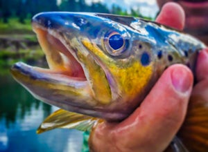
4.0Oak Creek is spring fed from the upper reaches of Oak Creek Canyon. It flows into the Verde River and the upper sections provide for some excellent trout fishing. The trout is stocked from Page Springs Hatchery, below this area the water becomes to warm for trout to survive. While in the area, yo...Read more -
Sedona, Arizona
Hike to the Birthing Cave
5.02 mi / 291 ft gainThe hike is an easy one, flat and not too long. In the spring you'll see lots of flowers. Note, the popularity of this Sedona cave has grown in the past year, so you will most likely encounter other hikers and mountain bikers. You start from the Long Canyon Trailhead, and I recommend going earl...Read more -
Sedona, Arizona
Hike the Boynton Canyon Trail
5.06 miThis is my favorite trail in all of Sedona. The trail head is at the end of Boynton Canyon rd near the entrance of Enchanted Spa and Resort. The trail goes along the property of Enchanted Spa for about 1 mile. This is the rockiest part of the trail as you pass by a large cliff.Soon after leaving ...Read more -
Sedona, Arizona
Hike Munds Mountain
6 mi / 1400 ft gainMunds Mt. is the highpoint due east of the town of Sedona, but due to its forested summit and trailhead accessibility limited to 4WD vehicles, it gets far less interest than hikes like Cathedral Rock, Wilson Mountain, or Fay Canyon yet has fantastic views of the town of Sedona and the surrounding...Read more -
Sedona, Arizona
Brins Mesa - Soldier Pass Loop
5.07.6 mi / 1040 ft gainThis loop starts from Vultee Arch Rd. Important to note that doing this loop from here requires a high clearance 4x4. In this direction, the trail starts off flat and crosses a dry creek bed several times. The trail is relatively easy to follow. This section passes through junipers that offer som...Read more

