Apache Junction, Arizona
Top Spots in and near Apache Junction
-
Gold Canyon, Arizona
Weavers Needle Loop
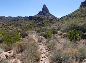
5.012.37 mi / 2608 ft gainThis is a difficult hike! Plan on a lot of time and an early start. I did this hike in a clockwise direction (Peralta Trail) which really doesn't matter much but I recommend the direction to get the steepest part of the hike done first. Most people just do an out and back hike to Freemont Saddle ...Read more -
Gold Canyon, Arizona
Bluff Springs Loop
4.014.55 mi / 2523 ft gainFrom the Peralta Trailhead, start hiking on Bluff Springs Trail. This trail will wind over a few hills past incredible views, and then take you down into a wash. In the wash you will intersect with the Terrapin Trail. Turn left onto the Terrapin Trail, and it will take you out of the wash and pa...Read more -
Queen Creek, Arizona
Hike the Dynamite and Goldmine Loop
5.04.7 mi / 773 ft gainThis trail is a moderately-rated hike. It is used for a variety of activities including hiking, mountain biking, running, and walking. To access the trail, it is important to note that there is a $7 cash parking fee, so be prepared! The beginning of the trail is the most challenging part as it ...Read more -
Scottsdale, Arizona
Sunrise Trail to Sunrise Peak
4.83.73 mi / 1037 ft gainSunrise Peak, also known as Sunrise Trail, is located at the residential foothills of the McDowell Mountains in Scottsdale, Arizona. The trail will start next to a residential neighborhood, but after about a quarter mile you'll be immersed in the pristine Sonoran Desert. The trail will lead you t...Read more -
Pinal County, Arizona
Photograph Elephant Arch
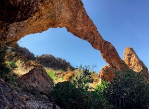
4.00.4 mi / 250 ft gain...For this very short stroll to Elephant Arch, I'd like to clarify that it's more of a sightseeing and/or photo opportunity trip than a hiking trip. It's so close that it can be seen from the side of the road. So just forewarning! Nonetheless, if you love natural wonders then it's a landmark you...Read more -
Fountain Hills, Arizona
Hike the Dixie Mine Trail
2.05.5 mi / 591 ft gainThe MineDixie mine was established in 1877, when mining scouts noticed the large amount of quartz in the area. The Dixie Mine was sold many times throughout the 20th Century and was ruled no longer efficient in 1977 when it was sold to the McDowell Mountain Regional Park. The PetroglyphsThe area ...Read more -
Rogers Trough Trailhead, Arizona
Hike Rogers Canyon Trail
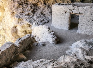
5.08 mi / 1108 ft gainThe Superstition Wilderness is a vast rugged landscape where you can find the cultural remains of ancient Hohokam, Salado, Apache, and Yavapais tribes. Rogers Canyon Trail takes you to one of the most impressive and best preserved archaeological sites this region has to offer. These Salado ruin...Read more -
Scottsdale, Arizona
Bike the Pemberton Loop in McDowell Mountain Park
15.4 miThis is a 15.4 mile loop that has 879 feet of elevation gain and descent. We took this trail clockwise. The trail is very well marked and maintained. It starts out flat from the parking lot. Once you have made it across the road it begins to climb. You continue with a gradual climb until you've g...Read more -
Tempe, Arizona
Catch a Sunset from Tempe Town Lake and the Mill Avenue Bridge
4.5Last year I went to Phoenix for a few days for work. I googled lots of places to shoot pictures around Phoenix, but the majority of them were in neighboring areas, and I only had an hour or two after work and couldn't drive an hour to a better photography spot. One place that kept coming up was...Read more -
Phoenix, Arizona
Hole in the Rock
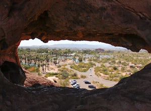
3.60.27 mi / 200 ft gainPapago Park is located right next to the Phoenix Zoo. The park is known for its rock formations and short hiking / running trails. The main attraction, the Hole in the Rock, at the top of the short trail, is a great place to take pictures as it is one of the highest points in the area and it off...Read more -
Tonto Basin, Arizona
Hike to Brown's Peak
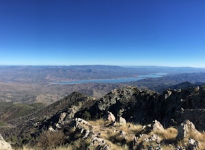
5.06 mi / 1957 ft gainStarting at the trailhead you will begin hiking through oak trees and forest. At numerous times throughout the hike Roosevelt Lake can be seen to the northwest. Approximately 3 miles into your hike you will reach a small campsite in the saddle of the mountain. This is your turnaround point if you...Read more -
Phoenix, Arizona
Hike the West Park Loop Trail in Papago Park
4.44 miThis trail begins from the parking lot on the west side of Galvin Parkway. To the east of the parking lot is a single track, dirt trail that heads north towards the big buttes. It continues counterclockwise around the big butte and heads south around the smaller butte. It continues west around th...Read more -
Superior, Arizona
Hike Picketpost Mountain
4.74.4 mi / 2200 ft gainFrom the parking lot you will start out on the Arizona Trail until you reach the turn off to begin your accent up the mountain. This part of the trail isn't well maintained, and is a scramble, so be ready to use those hands. The trail is marked with cairns though and there is enough traffic tha...Read more -
Paradise Valley, Arizona
Camelback Mountain via Cholla Trail
4.52.68 mi / 1158 ft gainThis challenging hike up the east side of Camelback Mountain has beautiful views of Phoenix and Scottsdale, and is not often crowded. You will begin on switchbacks heading up the mountain, with trail markers to guide you at first. The hike increases in difficulty about 1 mile in, when you reach ...Read more -
Scottsdale, Arizona
Gateway Loop
4.54.32 mi / 764 ft gainThe Gateway Trailhead is one access point into the McDowell Sonoran Conservancy in Scottsdale and is my favorite “Gateway” into the treasure trove of great trails and vistas in the McDowell Mountains. The Gateway Trailhead provides great accessibility for a quick hike or trail run at the end of t...Read more -
Scottsdale, Arizona
Hike Bell's Pass
7.3 mi / 1700 ft gainStarting at 1800 ft elevation, the trail begins at Gateway Loop. This part of the trail will start off pretty flat and be more crowded than Bell's Pass depending on the day and time you are hiking. If you enjoy running this would be the time to do it before you reach Bell's Pass and the incline i...Read more

