Sycamore Canyon Trail in Turnbull Canyon
Whittier, California
2.0
3.47 mi
/ 627 ft gain
The Sycamore Canyon Park Trailhead can be found at the end of the dirt parking lot off Workman Mill Road. The entrance is off a small road which is pretty easy to miss, but there is a sign off the main road. Soon after you start on the trail, the path opens up onto a larger dirt road for vehicle access, but it is only accessible for city vehicles so there shouldn't be any disturbances. After a ...
Kayak Lake Ballinger
Mountlake Terrace, Washington
4.0
Getting Here:
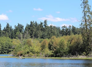
Heading North on I5 from Seattle Center, take exit 178 for 236th Street SW and Lakeveiw Dr. Take a left on Lakeview Dr. and follow along for a half a mile before you see the Lake Ballinger Boat Ramp parking area on the left.
There is a community park and rental facility on the noir the side if the lake. This is a perfect place to visit in the summer to take a dip in the cool water...
Camp at White River in Mount Rainier NP
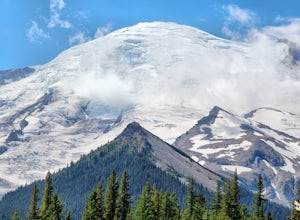
Ashford, WashingtonGetting There From Seattle: Head East on I90 to 405 South, Take the exit for 169 heading towards Enumclaw. I recommend stopping for a bite at the down home, family restaurant called Kitchen in downtown. The food was great with lots of local flavors! Continue on 169 where you will jump on Highway 410. The campground is located five miles up from Highway 410, after you enter the park.
White Rive...
Hike the Pinhead Peak Trail at Ronald W. Caspers Wilderness Park
San Juan Capistrano, California
4.0
2 mi
/ 220 ft gain
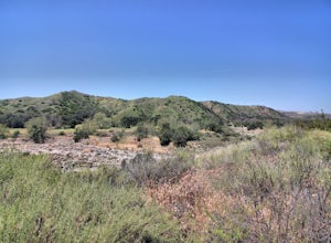
Ronald W. Caspers Wilderness Park is the perfect place to getaway from the hubbub of LA. Enjoy the scenic drive north on Ortega Highway before reaching the entrance gate to the park. Parking Fees are currently $3 on Weekdays and $5 on Weekends. Camping Fees vary depending on your group size.
The trailhead can be found just south of the old windmill on the far side of the park. The trail crosse...
Hike the Heart Rock Trail
Crestline, California
4.5
1.8 mi
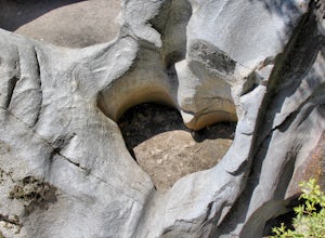
This short but nice hike near Crestline, CA in the San Bernadino Forest is one for the whole family. Although finding the trailhead/parking lot can be a bit confusing, it is definitely worth it.
Driving in from the Inland Empire/LA Area, follow The Rim of the World Trail (SH18) until you see the turnouff for Crestline. Exit on SH138 and continue along that road anonther 4-5 miles. You will con...
Dip into Spence Hot Springs
Jemez Springs, New Mexico
4.0
1.2 mi
/ 193 ft gain
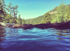
Exit Interstate 550 and head North on Highway 4 heading towards Jemez Springs. The Spence Hot Springs Parking Lot and Trailhead is about 25 miles North off Highway 4. The trail starts on a decline into the canyon for about 800 feet before you cross the bridge over the scenic river. Continue following the trail up a brief, yet steep incline towards the two hot springs. Take a dip and enjoy the J...
Picnic at Point Molate Beach Park
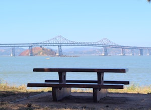
Richmond, CaliforniaThe beach park is very small but has sand along the shore for water access. Along the small cliffs of the beach there are picnic tables and grills for a nice cookout and family picnic. This beach would also be a great place for kayaking or standup paddle boarding as it is fairly secluded and away from major boating activity. Take in the views of the northern bay bridge and Angel Island State Pa...
Camp at Lake Catherine State Park
Fenter Township, ArkansasLake Catherine State Park offers fully-equipped cabins, over 60 tent and RV campsites, and a small marina selling everything you need for a perfect day on the lake. The beautiful tree covered campground offers a swimming beach, picnic sites, playgrounds and hiking trails. The park also offers interpretive programs include guided hikes and boat tours during the summer months.
The park is central...
Hike The Rock Valley & East Quarry Trail, Pinnacle Mountain SP
Little Rock, Arkansas
5.0
2.5 mi
/ 500 ft gain
The Rock Valley Trail and East Quarry Trail trailheads can be found on the Southeast side of the vistors center parking lot (Make sure the take the small walk up the stairs to the nearby overlook before your hike). This portion of the trail is heavily wood and is easy to moderate with little incline in elevation. Continue to follow the green markers along the Rock Valley trail until you reach t...
Hike the Pinnacle Mountain West Summit Trail
Roland, Arkansas
3.0
1.24 mi
/ 738 ft gain
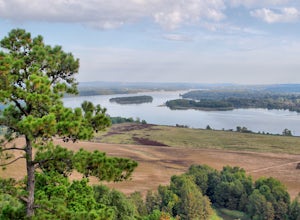
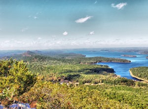
This rocky trail begins at the park picnic grounds and winds its way to the top of Pinnacle Mountain. From the top is a spectacular view of Lake Maumelle, the Arkansas River Valley, the Ouachita Mountains and west Little Rock. This is truly a breathtaking view. To return, you must retrace your steps or hike down the rugged East Summit Trail and return via the base trail for a total hike of 2 1/...
Stand Up Paddle in Castle Rock Bay
Lake Havasu City, Arizona
5.0
The Castle Rock Bay is a bit out of the beaten path, making it a quiet place to relax on Lake Havasu. The parking lot can be found off a dirt road off of Vista Dr. You will see the Castle Rock sign to the left heading towards the lake on Vista Dr. Drive along the dirt road for 150 yards or so before you make it to the designated dirt parking area. You will have to hike another 100 yards pulling...
Camp at Lake Havasu State Park
Lake Havasu City, Arizona
4.0
Lake Havasu is a premier lake dividing California and Arizona along with the Colorado River. Lake Havasu State Park has an abundance of amenities including 47 camp sites, 3 boat ramps, multiple picnic areas and a beach area. The state park sits just north of the famous London Bridge that was purchased by Robert McColluch and moved into the newly established community of Lake Havasu City. There ...
Heybrook Ridge
Sultan, Washington
3.71 mi
/ 856 ft gain
Although short, this new trail is a great warm-up to the many other trails this area has to offer. Starting immediately across the North Fork Skyhomish River at the new trailhead, you will make your way up this moderately steep hike to the Heybrook Ridge. once you reach the top of the trail, you will cross two sets of power lines and an old utility road before making it to the viewpoint. From t...
Falls Creek Falls via Falls Branch Trail
Hot Springs, Arkansas
4.3
1.6 mi
/ 210 ft gain
The 3 trailheads to get to the Falls Branch waterfall can all be accessed within Lake Catherine SP. Follow the main road to the very end of the park, passing the amphitheater just before you reach the trail's parking lot. The three trails you can take to reach the Falls are Falls Branch Trail, Horseshoe Mountain Trail, and Dam Mountain Trail, each with their own scenic routes to the Falls.
Th...
Sandia Peak
Albuquerque, New Mexico
4.5
/ 10378 ft gain
Start at the Sandia Mountain base terminal where you can purchase your tickets to ride the tram (Tip: If you make reservations at the peaks restaurant, High Finance, you can get a discount on your ticket). Enjoy the 15 minute ride to the peak while taking in beautiful city views of Albuquerque as well as the valley directly below the tram. Prepare yourself for the "Dip & Swing" as you cross...
Hike the Pinnacle Mountain East Summit Trail
Roland, Arkansas
4.5
1.4 mi
/ 719 ft gain
The East Summit trail is a 1.5 out and back that reaches a final elevation of 1,011ft. The trailhead is in the southeast corner of the East Summit Parking Lot on Pinnacle Valley Road. Walk about 10 yards down the trail to the junction, take the right fork and follow the RED and WHITE blazes. This is the more rugged 3/4-mile ascent to the summit of Pinnacle Mountain and requires crossing several...
Camp at Petit Jean SP
Morrilton, ArkansasLocated between Ft. Smith and Little Rock, just south of Interstate 40, you will find the state treasure that is Petit Jean State Park. Its central location makes it very easy for any one to visit. The main hub of the State Park is the beautiful Mather Lodge, which has a rooms to rent, a restaurant, gift shop, and the location of the Cedar Falls Trailhead. Along with the lodge, this area has ma...
Camp out at Manzanita Lake Cabins in Lassen Volcanic NP
Shasta County, CaliforniaDeep in the Lassen National Forest is the beautiful and surprisingly one of the least visited National Parks, Lassen Volcanic National Park. On the north entrance of the park, you will find the beautiful Manzanita Lake Cabins and Campground with the gorgeous blue lake in the foreground.
Getting there:
From the Bay Area. Take I5 north towards Redding, after driving through the small town of Co...
Camp at Buckeye Flat in Sequoia National Park
Sequoia National Park, CaliforniaEntering Sequoia National Park at the Ash Mountain Entrance near the small city of Three Rivers, follow Highway 198 (Generals Highway) through the park until you see a sign for Buckeye Flat Campground off to the right. The campground sign is immediately after you see signs for Hospital Rock. Follow the small dirt road overlooking the beautiful Kewah River around a half a mile until you reach th...
Hike the Rim Trail at Mount Nebo SP
Dardanelle, Arkansas
3.0
3.57 mi
/ 226 ft gain
The official trailhead for the Rim Trail can be found on the north side of Country Rd 92, but it seems to be much easier to start the hike right behind the visitors center. There is more parking spaces and you can purchase any last minute items you may have forgotten before you start. To find the official trailhead however, you will pass the Visitors Center on your right from Country Rd. 155 an...
Camp at Moran State Park
Moran State Park, WashingtonMoran State Park is an true gem within the beautiful San Juan Islands. The park takes up a large portion of the East side of Orcas Island, the largest of all the San Juans. There are multiple campgrounds within the park along the shores of Cascade Lake and Mountain Lake. For the most relaxing experience, I recommend the South End sites on Cascade Lake, or any of the sites on Mounatain Lake as t...
Seal Beach
Seal Beach, California
4.7
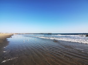
Seal Beach is a small beach community between Long Beach and Huntington Beach. Right off PCH (Pacific Coast Highway), this sandy beach is a great place to chill on a hot summer day. The high winds coming off the water makes it an ideal place to kite board, surf, or simply fly a kite along the shoreline. On a clear day, you can see Catalina Island along the horizon. One of the best aspects of Se...
Camp at Mount Nebo SP
Dardanelle Township, Arkansas
4.0
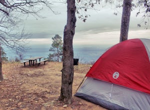
Mount Nebo State Park is just 12 miles southwest of Russellville, AR, home of Arkansas Tech University. With its proximity to the university and other large cities, it makes visiting Mount Nebo an easy trip. The last few miles on Country Road 155 takes you through switch backs up the mountain, and has a 24ft trailer haul limitation due to its very sharp turns. Keep in mind the elevation gain to...
Explore the Old Mill At T.R. Pugh Memorial ParK
North Little Rock, Arkansas
5.0
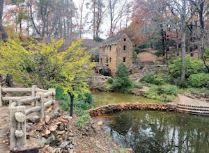
Street parking is located just outside the main park gates. Park hours our sunrise to sunset.The Old Mill was built in 1933 as a historic replica of mills used in the in the 1880's. Some of the features in the mill are actual historic relics dating back over 150 years. The park grounds are beautifully landscaped and a great place for an afternoon photography session. There are also multiple pic...
Community
© 2024 The Outbound Collective - Terms of Use - Privacy Policy


