Banff, Alberta
Looking for the best hiking in Banff? We've got you covered with the top trails, trips, hiking, backpacking, camping and more around Banff. The detailed guides, photos, and reviews are all submitted by the Outbound community.
Top Hiking Spots in and near Banff
-
Improvement District No. 9, Alberta
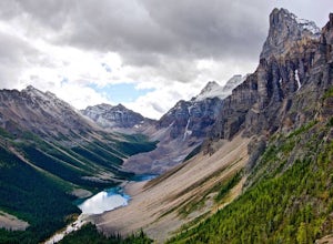
Scramble the Tower of Babel
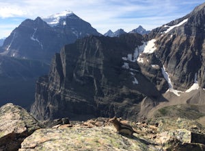
4.01.94 mi / 1726 ft gainStarting at the Moraine Lake parking lot follow the trail East along behind the large pile of boulders along the lake shore. Once you reach the foot of the Tower of Babel scramble up the slope to heading towards the valley between the two peaks. The easiest route is along one of the cliff faces w...Read more -
Improvement District No. 9, Alberta
Sentinel Pass: Larch Valley to Paradise Valley
5.010.45 mi / 2618 ft gainThis popular hike starts out by the one the most iconic lakes in Banff National Park, Moraine Lake. Though the trail from Larch Valley attracts herds of tourists, this is a majestic hike you don’t want to miss. Before your hike, contact the park office at Moraine Lake about possible hiking restr...Read more -
Improvement District No. 9, Alberta
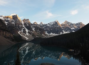
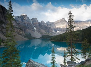
Moraine Lake
4.8Showing up at Moraine Lake before dawn is a must as to avoid the multitude of tours busses. The morning sun is subtle and magical. The lake, being glacially fed, does not reach its crest until mid to late June. When it is full, it reflects a distinct shade of blue. The color is due to the refract...Read more -
Kananaskis, Alberta
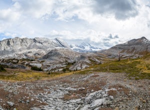
Exploring Burstall Pass
5.0Head to the northwest corner of the parking lot to find the trail. For the first 5.5 km the trail is quite easy, with only modest elevation increase. At 5.5 km you will arrive at what is known as the gravel flats. Depending on the time of year the gravel flats can be either quite dry or a wide, s...Read more -
Kananaskis, Alberta
Hiking Burstall Pass
5.09.3 mi / 1542 ft gainThe trail begins along the berm beside Mud Lake. After a rather uninspiring 3 km (you can mountain bike this part) the trail narrows and enters trees where tangled roots twist across the path and you breathe in the smells of damp earth and moss.Ten minutes later the trail spits you across a spl...Read more -
Kananaskis, Alberta
Backpack the Fortress Cirque
5.012.19 mi / 3507 ft gainNo better way to watch the stars with friends than huddled up in your sleeping bag on top of a 3000m summit. This describes the bivy at The Fortress. Starting at the Chester Lake Trailhead, take the unmarked trail on the right side of the parking lot. These winter cross-country ski trails take y...Read more -
Kananaskis, Alberta
Hike from Headwall Lakes to Chester Lake
5.010.6 mi / 2650.9 ft gainThe hike starts at the Chester Lake trailhead along the Smith Dorian road in Kananaskis. The first few kilometers follow the old logging roads, now used as cross country skiing trails. Find the beginning of the trail at the upper right end of the parking lot, and continue to follow parallel to t...Read more -
Kananaskis, Alberta
Hike to Chester Lake
5.06.2 mi / 984.3 ft gainChester Lake was officially one of my favorite hikes of 2016. It's a short & sweet 5 km's to the lake, with outstanding views in every direction. Fall colors were just starting to peak through and the sky looked amazing. From what I understand, this is one of the more popular hikes in the are...Read more -
Kananaskis, Alberta
Scramble the Fortress
Have you ever done a hike where you just don't want the day to end? Scramble the Fortress and you'll know the feeling. The thing that drew me to the Fortress was its summit elevation of 3000 masl, as well as its blocky, fortress-like profile when viewed from the north. It's so much more than that...Read more -
Bragg Creek, Alberta
Hike Jumpingpound Summit
3.03.1 mi / 1148.3 ft gainThis is a great short hike that will only take about ½ day. Take Hwy. 1 west and take the exit for the Sibbald Creek Trail. Follow this road until you hit the Powderface Trail. (NOTE: this road is closed from December 1 – May 14 annually). Follow this road for approximately 15km’s. Take note tha...Read more -
Lake Louise, Alberta
Plain of Six Glaciers
4.68.96 mi / 1565 ft gainStarting from the parking lot on the east end of Lake Louise, there are a few options you can take to get to the Plain of Six Glaciers. One is to head directly along the lakeshore trail, and in about 7 km (4.2 miles) you will be at the lookout offering the best vantage point of the glacier field....Read more -
Lake Louise, Alberta
Lake Agnes Tea House
4.84.58 mi / 1260 ft gainTowering peaks, glaciated valleys, and crystal clear water draw thousands of visitors a year to the shores of Lake Louise in Banff National Park. A short hike takes you beyond the crowds up to Lake Agnes, a beautiful valley surrounded by jagged peaks and golden Larch trees. At the foot of Lake ...Read more -
Lake Louise, Alberta
Hike Fairview Mountain
7.1 mi / 3280.8 ft gainFairview Mountain is a non-technical objective alpine summit located on the south side of Lake Louise. It's trailhead is accessed from the Lake Louise parking lot. The trail is well established and well marked throughout. You can expect a distance of about 11km return and elevation gain of 1000m,...Read more -
Lake Louise, Alberta
Hike to the Lake Louise Overlook
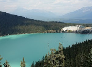
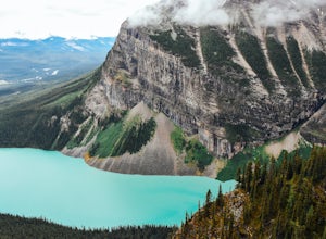
5.02 mi / 500 ft gainThis is a fairly steep, short hike that gives you a great view of Lake Louise. The hike begins right behind the canoe rental shop on the South side of the lake. The trail is very easy to follow and there are quite a few people that hike it. The hike is an hour and half round trip. The hike leads...Read more -
Kananaskis, Alberta
Hike Opal Ridge's South Summit
5.0Opal Ridge is located on the East side of highway 40 in Kananaskis.The trailhead starts at Fortress Gas Station. Park at the North end of the parking lot. The trailhead is easy to spot from here. Follow the creek a couple hundred meters till you reach an open area with power lines. Turn left. Con...Read more -
Lake Louise, Alberta
Hike to Big Beehive
5.06.2 mi / 1710 ft gainThe hike to Big Beehive begins at the base of Lake Louise. From the parking lot, hike along the paved trail on the northeastern shore of Lake Louise. The Fairmont Chateau Hotel will be to your right with the lake to your left. Continue toward the junction for the Lake Agnes Trail. Keep right t...Read more

