Snoqualmie Pass, Washington
Looking for the best photography in Snoqualmie Pass? We've got you covered with the top trails, trips, hiking, backpacking, camping and more around Snoqualmie Pass. The detailed guides, photos, and reviews are all submitted by the Outbound community.
Top Photography Spots in and near Snoqualmie Pass
-
North Bend, Washington
Middle Fork Snoqualmie River Trail
27.57 mi / 3609 ft gainThis beautiful tucked-away trail offers runners, hikers, and backpackers a new view of their favorite neighboring peaks - like Mailbox Peak and Mt. Si - from one of the most scenic river trails in the Seattle area. Often overlooked in favor of more rigorous hikes, the Middle Fork is a gently gra...Read more -
North Bend, Washington
Hike Pratt Balcony
2.2 miThis one can be a bit tricky to find. The trailhead is unmarked and is a bit hidden around a curve of Middle Fork Road so it is easy to miss. At about 9.80 miles from the junction of 468th St. and Middle Fork Road, look for two signs on the right warning of upcoming gravel patches (probably will ...Read more -
Ronald, Washington
Camping at French Cabin Creek Rd.
3.0This area is a very secluded camp area, so unless it's a holiday weekend, be prepared to be alone :) It is a very quiet lake and along the roadside there are plenty of spots to hike, camp, and fish by the lake or the Cle Elum river.So bring your day hiking gear and pole as well and head out in th...Read more -
Ronald, Washington
Spade and Venus Lakes
5.026.47 mi / 2300 ft gainNestled in a high rocky cirque near the upper reaches of Mt Daniel, Spade and Venus Lakes are two of the most remote lakes in the Alpine Lake Wilderness. But to experience this level of pure isolation, you'll need to earn it; the shortest hike in to the lakes is 14 miles, the majority of which i...Read more -
North Bend, Washington
Rainy Lake Trail
4.09 mi / 3205 ft gainThis is an abandoned trail that heads south along Rainy Creek, off of the downstream section of the Middle Fork Snoqualmie Trail, and up to Rainy Lake. The lake is popular among fisherman, since it is home to lots of trout, but be warned -- route-finding skills are a must on this trip. I do my be...Read more -
North Bend, Washington
Hike Mount Washington
4.32.89 mi / 3058 ft gainYou start out at an elevation of about 1200 feet and you gradually make your way up to the top at 4450 feet. You are hiking through forest land the whole time with peaks of a beautiful view to the north every so often. Along the way there are many rock walls which you can climb at, however on our...Read more -
North Bend, Washington
Mailbox Peak Old Trail
4.44.96 mi / 3898 ft gainNote this adventure covers the old route. For the updated route, check out Hike Mailbox Peak New Trail. Take exit 34 from I-90. Head north on 468th Ave SE until the intersection with the SE Middle Fork Road. Turn right onto the Middle Fork Road. Follow SE Middle Fork Road 2.2 miles to the stop ...Read more -
North Bend, Washington
Mailbox Peak New Trail
4.210.53 mi / 4127 ft gain*Disclaimer this article is in regards to the newly built trail.* For the old trail, head to Hike Mailbox Peak. Just off of exit 34, Mailbox Peak offers a birds-eye view of the surrounding area. This hike begins at a mere 800 ft. above sea level and by the time you are done you are nearly touch...Read more -
Skykomish, Washington
Backpack from Dorothy Lake Trailhead to Snoqualmie Lake
18 mi / 1900 ft gainThe trail was not crowded although when we got to Snoqualmie Lake there were only a couple camping spots left. The trail up from Dorothy is not too hard at all. The weather was perfect. After passing Dorothy you have to ford a creek where the bridge has been washed out. We went through it on foot...Read more -
North Bend, Washington
Twin Falls
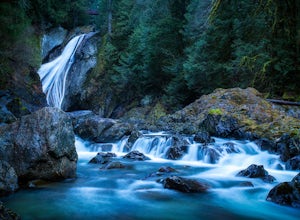
3.32.51 mi / 778 ft gainFor a portion of this 3-mile hike, you'll trek next to the South Fork Snoqualmie River, so take in the peaceful sound of the river running. Along the trail runs a river, where massive boulders create wading pools of icy water for warm summer days. At 1.5 miles, you'll reach a viewpoint bridge, wh...Read more -
North Bend, Washington
Drive Along the Middle Fork Snoqualmie River
5.0Some days you don't need to tackle a grueling summit or long mileage loop, just getting outside the city is enough. Driving forest roads is always an adventure and pays its dividend in seclusion, viewpoints, and peacefulness. The Middle Fork Snoqualmie (FR56) offers a photo enthusiast numerous pi...Read more -
King County, Washington
Teneriffe Falls (Kamikaze Falls)
4.55.64 mi / 1732 ft gainThe lesser known Mt Si Rd trail starts off as a relatively flat road. This continues for two miles until you reach the Teneriffe Falls sign. Upon turning right at this junction, the terrain takes a shift and the incline steepens. This is where most of the elevation is gained. The rest of the way...Read more -
Enumclaw, Washington
Hike to Kelly Butte
3.4 mi / 1100 ft gainAfter a rough drive to the trailhead you’ll have little time to catch your breath as the trail laces up the mountain side, but with Rainier to distract you, it won’t be long until you’re at the top with a view that is more than enough reward for your efforts. Pay very close attention to the drivi...Read more -
Ronald, Washington
Hike Cathedral Rock and Mount Daniel
5.011.5 mi / 2300 ft gainHike easy switchbacks for almost 2 miles until the trail junction at elevation 4400 feet, then veer right onto trail #1345 toward Squaw Lake and Cathedral Rock. Pass by Squaw Lake on your left (a great place to take a short swim on a hot day) and stay on the trail until you reach another junction...Read more -
Skykomish, Washington
Hike to Big Heart Lake
5.014.6 mi / 3300 ft gainThis hike takes you past 5 lakes and a few different waterfalls, so if you don't wish to push on to Big Heart, you won't be disappointed! Start at the West Fork Foss River Trailhead, about 2.6 miles past the Necklace Valley Trailhead. The first mile is relatively flat. Once you reach the bridge t...Read more -
Skykomish, Washington
Hike to Foss River and Lakes
4.04.2 mi / 2400 ft gainChoose from Trout Lake (1.6 miles each way with 500 feet of elevation gain), Copper Lake (4.2 miles each way with 2400 feet of elevation gain), or Big Heart Lake at 7.3 miles each way, with 3300 feet elevation gain). There are plenty of camp sites if you decide to go overnight at any of the lakes...Read more

