Draper, Virginia
Looking for the best hiking in Draper? We've got you covered with the top trails, trips, hiking, backpacking, camping and more around Draper. The detailed guides, photos, and reviews are all submitted by the Outbound community.
Top Hiking Spots in and near Draper
-
Mouth of Wilson, Virginia
Mount Rogers Loop
5.015.6 mi / 1079 ft gainFor an awesome 2-3 day trip, start hiking at the Massie Gap trailhead, which can be reached from Grayson Highlands State Park. Take the Rhododendron Trail up the ridge to connect with the AT, keeping an eye out for wild ponies in the Massie Gap area as they like to hang out here. Some of these po...Read more -
Mouth of Wilson, Virginia
Rhododendron Trail to Rock Croppings
5.01.77 mi / 289 ft gainIn order to go when the Rhododendron are blooming you'll need to aim for the first three weeks of June. Starting from the Massies Gap parking area in the Grayson Highlands State Park, follow the trail through the field and towards the base of a large hill. You will see a fence that runs along t...Read more -
Mouth of Wilson, Virginia
Hike and Fish Cabin Creek Trail
5.01.8 mi / 400 ft gainStarting at the Massie Gap Parking Area follow the paved road down towards the woods. You will see a gravel dirt path off the side of the road to your right that heads back towards the woods. A couple steps down the trail you will see a metal pole with "Cabin Creek Trail" written on it. Follow th...Read more -
Pinnacle, North Carolina
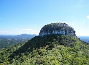
Hike the Jomeokee Trail at Pilot Mountain SP
4.30.8 mi / 100 ft gainThis unique peak, also known as the Big Pinnacle, is in Pilot Mountain State Park. From the main parking area on top of the mountain on Pilot Knob Park Road, you can first view the Big Pinnacle from the overlook attached to the parking lot. The prominent mountain behind the Big Pinnacle is Hang...Read more -
Mouth of Wilson, Virginia
Wilburn Ridge and Massie Gap Loop
5.02.32 mi / 318 ft gainTo reach the trail head, park in the Massie Gap Parking Lot. This is the parking lot for most of the trails in the park, so it can fill up very quickly, but you are able to park along the side of the road. Massie Gap as two parking areas: one intended for overnight hikers and one for day hikers...Read more -
Mouth of Wilson, Virginia
Twin Pinnacles via Big Pinnacles Trail
5.02 mi / 525 ft gainTo reach the Big Pinnacle Trail Head, park at the Massie Gap Day Parking area, and then follow the road west (away from Massie Gap) until you reach the trail head located on the left side of the road. Follow the Big Pinnacles Trail for 0.4 miles until it intersects with the Twin Pinnacles Trail....Read more -
Catawba, Virginia
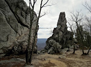
Dragon's Tooth Trail
4.94.44 mi / 1394 ft gainFrom I-81: Exit 140 and take Highway 311 north for 11 miles towards New Castle. Dragon’s Tooth parking lot is on the left, just past Catawba Grocery. LAT 37.3787 LONG -80.1563 Ready to tackle the Dragon? This 4.6 mile, out and back, trail provides one with a true hiking experience. The hike wil...Read more -
Catawba, Virginia
Virginia Triple Crown
5.029.24 mi / 5531 ft gainThe Virginia Triple Crown is a combination of three of the most spectacular and popular hikes in the region. It combines the Dragon’s Tooth, McAfee’s Knob, and Tinker Cliffs hikes into one long multi-day hike along the Appalachian Trail. It makes for an excellent 2 day backpacking trip, with many...Read more -
Walnut Cove, North Carolina
Hike the Sauratown Trail
22 mi / 800 ft gainYou can through-hike or section hike. I did it from Tory's Den to the Corridor Trail Parking Lot in about 10 hours. Check the Sauratown Trail Association's website before traveling. It is a bridle and hiking trail so the hiking is fairly easy. A lot of it travels beside streams. In other places...Read more -
Walnut Cove, North Carolina
Lower Cascade Falls
4.40.75 mi / 105 ft gainA beautiful hike through the forest of Hanging Rock State Park. Trail meanders through pines and hardwoods filled with boulders, mountain laurel, scenic views, and the occasional deer or turkey. The trail begins as gravel and dirt then turns into steps made of wood and stone. Also on the trail is...Read more -
Walnut Cove, North Carolina
Hike and Rock Climb Moore's Knob
4.3Looking for a shorter hike with stunning views, or a place to rappel with a backdrop like no other on the East Coast? Look no further than Moore's Knob, located within Hanging Rock State Park. Just North of Winston-Salem, Moore's Knob is one of the many wonders of the Sauratown Mountains. At 2579...Read more -
Danbury, North Carolina
Hanging Rock
4.42.45 mi / 515 ft gainPark in the main parking lot for Hanging Rock State Park, and the trailhead can easily be found in the upper parking lot (furthest away from the main building), and is clearly marked. The trail starts off by descending, but don't be fooled, it quickly turns into a steady climb that will have you ...Read more -
Danbury, North Carolina
Hanging Rock and Cole Gap Mountain Loop
4.53.95 mi / 623 ft gainBeautiful hike through the forest up to an elevation of 2000+ feet for Hanging Rock. The Hanging Rock Trail is 1.3 miles one way. It includes a moderate incline up a well-kept dirt and gravel trail then, turns into steps made of timber, rock, and boulders (330 steps to be more exact!). Well worth...Read more -
Troutdale, Virginia
Hike the Appalachian Trail from Elk Garden to Buzzard Rock
5.06.6 mi / 1000 ft gainStarting at the Elk Garden Parking Area hike the Appalachian Trail south (do not cross the road, follow the trail from the parking area). Hike along the trail following the white blazes and at 2.4 miles you'll reach a campsite on your left. This is a great place to camp overnight if you decide to...Read more -
Salem, Virginia
McAfee Knob
4.77.79 mi / 1296 ft gainIntro McAfee Knob is one of the most photographed and picturesque locations along the Appalachian Trail. Once you reach McAfee Knob, you'll have almost 270 degree views of the the Roanoke Valley to the East, Catawba Valley and North Mountain to the West, and Tinker Cliffs to the North. Due to t...Read more

