Burke, Vermont
Looking for the best photography in Burke? We've got you covered with the top trails, trips, hiking, backpacking, camping and more around Burke. The detailed guides, photos, and reviews are all submitted by the Outbound community.
Top Photography Spots in and near Burke
-
Jefferson, New Hampshire
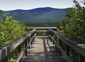
Hiking at Pondicherry Wildlife Refuge
4.5As hiking in the White Mountain area goes, this is a pretty easy one. This is a family friendly hike along a rail trail and well maintained forest trails. The main attraction here isn't the difficultly. The main attraction here is the spectacular views and the abundant wildlife.This trail begi...Read more -
Jefferson, New Hampshire
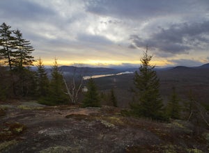
Summit Mount Waumbek via the Starr King Trail
5.07.2 mi / 1500 ft gainThe hike starts out at the Starr King trailhead because you will summit Starr King Mountain (3,907 ft - so close to being a 4000 footer!) before moving on to Waumbek. The 2.6 miles that it takes to get to the first summit are gradual and forgiving. The majority of the total elevation is completed...Read more -
Groton, Vermont
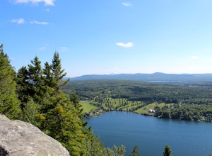
Hike to Owl's Head Trail Overlook
3.03 mi / 200 ft gainStarting at 1746 ft of elevation, this easy 3 mile hike (RT) pays off with a dramatic view of Lake Groton, Kettle Pond and the Green Mountains of Vermont. The trail head begins in New Discovery Park, along the dirt road to Osmore Pond. There is room to pull off the dirt road and park near the t...Read more -
Coaticook, Quebec
Mount Pinacle
1.5 miWe came from Parc de la Gorge on Ch de Baldwin-Barnston road, which leads you to the Parc Harold F Baldwin area. Turn left onto Ch May and park your car in the parking area that is next to a small shop/cafe. There are signs at this point. Walk up the hill a bit until you reach the blue Mt. Pinac...Read more -
Sugar Hill, New Hampshire
Photograph Lupines in Sugar Hill
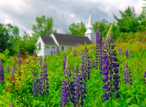
Every year, more or less around the second week of June, the village of Sugar Hill boasts a magnificent show of lupines. There are several concentrations of lupines in fields along the road, but the highlight of a visit to Sugar Hill is the small hillside near St. Matthew's Church. The vistas tow...Read more -
Franconia, New Hampshire
Hike Artists Bluff
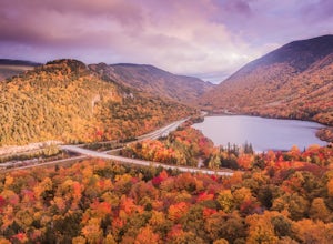
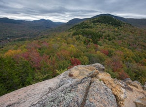
4.31.5 miStarting from the Bald Mountain trailhead, the Artists Bluff trail takes you up a short but steep 1.5 mile path to a beautiful rocky overlook of Franconia Notch State Park. This is the perfect hike to find incredible views of the park and some amazing foliage in autumn. We parked across the stree...Read more -
Jefferson, New Hampshire
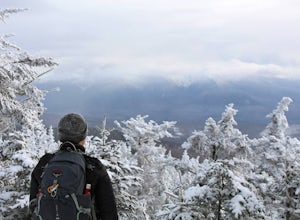
Ski Touring the Pemigewasset Wilderness Traverse
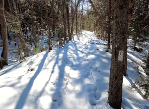
23 mi / 4500 ft gainThe Pemigewasset Wilderness is a 45,000-acre treasure embedded within the spectacular “Whites” of New Hampshire. It’s a remote, less often travelled wilderness than the nearby Presidential Range but no less spectacular. The winter “Pemi Traverse”, a 23 mile tour from Bretton Woods to Lincoln, jum...Read more -
Jefferson, New Hampshire
Hike the Sugarloaf Trail
3.3 mi / 1099 ft gainThe Sugarloaf Trail begins at the Sugarloaf trailhead on Zealand Road off of US 302. There are two trails that begin at this trailhead--be sure to cross the bridge over the Ammonoosuc and look for the "Sugarloaf Trail" sign. The trail begins following the Ammonoosuc River for a short while before...Read more -
Franconia, New Hampshire
Hike to the Summit of Cannon Mountain via Kinsman Ridge trail
5.04 mi / 3000 ft gainDriving north on I-93 in New Hampshire, Cannon Mountain can be seen on the left just a few miles after exit 32. It is a massive cliff that towers over the highway, thousands-of-feet tall. Parking for the trail head is left off of exit 34B. If you look left as you're driving into the paved parking...Read more -
Colebrook, New Hampshire
Hike to the Top of Table Rock
4.31.52 mi / 715 ft gainThough the trail may seem a bit daunting at first (especially for beginners), this out-and-back hike isn't all that difficult. At the trailhead (located almost directly behind the sign "Entering Dixville Notch State Park"), you'll begin by walking through some densely wooded forest. The trail is ...Read more -
Franconia, New Hampshire
Camp at Lafayette Campground, White Mountains
5.08.3 miThe White Mountains offer some of the most prime foliage sightseeing (aka 'leaf peeping') in New England. Tourists flock to the Franconia Notch State Park area and surrounding parts of the White Mountains every October, but camping is generally less common. October can be a cold month in New Hamp...Read more -
Franconia, New Hampshire
Backpack the Franconia Ridge Loop
4.514.5 mi / 3000 ft gainThis is a multi-day backpacking loop in Franconia Notch State Park, New Hampshire (located in the the White Mountains).Leave the car at the Lafayette Place Campground, (about 1700' elevation), then head up 1.4mi to Lonesome Lake. If you start hiking in the evening, as the sun is setting, you can ...Read more -
Franconia, New Hampshire
Lonesome Lake
4.53.05 mi / 1027 ft gainThe Franconia Notch area of New Hampshire has many roadside adventures to go on, bringing in thousands of visitors every year, but my favorite place in the notch is Lonesome Lake. At 3 miles, the hike is easy enough for the whole family, but most people visiting the notch stick to the roadside a...Read more -
Franconia, New Hampshire
Hike Falling Waters Trail
4.03 mi / 1100 ft gainFalling Waters Trail takes you up to the summit of Little Haystack Mountain, and Mount Lincoln and Mount Lafayette if you continue to the Franconia Ridge Trail / Appalachian Trail, then over to Old Bridle Path.Also along Falling Waters Trail are stunning waterfalls. The most popular one is Cloudl...Read more -
Franconia, New Hampshire
Hike to Greenleaf Hut via Old Bridle Path
5.05.5 mi / 3772 ft gainTo hike to the Appalachian Mountain Club's Greenleaf Hut, the best route for a day hike there and back is the Old Bridle Path. This hike is certainly doable in a day if you're interested in just hiking to the Greenleaf Hut. You have a lot of options when hiking this trail. I am going to focus spe...Read more -
Randolph, New Hampshire
Summit Mount Jefferson, Mount Clay, and Mount Washington
4.010.5 mi / 4455 ft gainHike with at least one other and take two cars. First drop one car at the Cog Railway parking lot (Base Station Rd, Bretton Woods, NH). Jump into the second car and drive about 15 minutes to the Caps Ridge Trailhead on Jefferson Notch Road ( N 44° 18' 15"W 71° 21' 42" )The Caps Ridge Trail will l...Read more

