Colebrook, New Hampshire
Top Spots in and near Colebrook
-
Colebrook, New Hampshire
Hike to the Top of Table Rock
4.31.52 mi / 715 ft gainThough the trail may seem a bit daunting at first (especially for beginners), this out-and-back hike isn't all that difficult. At the trailhead (located almost directly behind the sign "Entering Dixville Notch State Park"), you'll begin by walking through some densely wooded forest. The trail is ...Read more -
Coaticook, Quebec
Mount Pinacle
1.5 miWe came from Parc de la Gorge on Ch de Baldwin-Barnston road, which leads you to the Parc Harold F Baldwin area. Turn left onto Ch May and park your car in the parking area that is next to a small shop/cafe. There are signs at this point. Walk up the hill a bit until you reach the blue Mt. Pinac...Read more -
Coaticook, Québec
Hike the Parc de la Gorge de Coaticook Yellow Trail
5.02.18 mi / 164 ft gainHiking trails at Parc de la Gorge de Coaticook are spread into 3 sectors to reveal the park’s attractions.For a day trip I will suggest doing the yellow trail, which is the one we did. It will bring you directly into the heart of the Gorge. It is quite a short hike, 1h30-2h00 and you'll get the c...Read more -
Andover, Maine
Fly Fish Lower Dam at Rapid River, Maine
Getting to Rapid River can be a bit of a trek, as the 10 or so miles leading to it is a maze of logging roads and the cell service is spotty at best. Here is a rundown of the route:Driving Northeast on Rt 26, take a sharp right onto Andover RD (East B Hill Road)After 2.1 miles, turn left onto Bro...Read more -
Pittsburg, New Hampshire
Hike to Fourth Connecticut Lake
2 mi / 350 ft gainThe Fourth Connecticut Lake is a northern glacial tarn, just 2.5 acres in surface area. The mighty Connecticut River is just a small babbling brook as it leaves Fourth Connecticut Lake. It's only about 200 yards from the Canadian border. The 78-acre area is a nature sanctuary preserved by The Nat...Read more -
6385 Vermont 5A, Vermont
Hike to Mount Pisgah
4.04.1 mi / 1597 ft gainThe hike to Mount Pigsah is 4.1 miles out and back, just outside of Westmore, Vermont. The trail is most commonly used from March through October, but some people traffic this trail in the winter with crampons and sturdy hiking boots. This is an incredibly dog friendly trail. Be aware that there...Read more -
Jefferson, New Hampshire
Summit Mount Waumbek via the Starr King Trail
5.07.2 mi / 1500 ft gainThe hike starts out at the Starr King trailhead because you will summit Starr King Mountain (3,907 ft - so close to being a 4000 footer!) before moving on to Waumbek. The 2.6 miles that it takes to get to the first summit are gradual and forgiving. The majority of the total elevation is completed...Read more -
Newry, Maine
Table Rock Trail
4.51.91 mi / 761 ft gainTable Rock Trail is a loop trail that takes you past a cave located near Newry, Maine.Read more -
Maine 26, Maine
Hike Eyebrow Trail to Old Speck Mountain Loop
7.8 mi / 3000 ft gainThe first time I attempted this trail was in mid April, and the slush and mud I encountered was absolutely unbelievable. Snowshoes were useless. Crampons were useless. Boots alone meant dirty, wet, muddy feet. So, I had to bail. But I came back in October and I’m so glad I did because the views o...Read more -
Bald Mountain Road, Maine
Hike Bald Mountain in Rangeley
2.3 mi / 931 ft gainThe trail itself has a gradual incline over the course of the 1.15 miles to get to the top. There are a few steeper sections near the top, but completely manageable even for a beginner. There is another trailhead off of route 4, which would lead to a longer hike, around 4 miles. When coming from ...Read more -
Newry, Maine
Photograph Screw Auger Falls
4.00.2 mi / 6 ft gainAfter parking in the allotted parking area at screw auger, make your way down to the falls to explore! There are several "smaller waterfalls" that the river flows over before making its way to the 27 foot main attraction. Going in April, the falls were at their most powerful. It made taking pictu...Read more -
Jefferson, New Hampshire
Hiking at Pondicherry Wildlife Refuge
4.5As hiking in the White Mountain area goes, this is a pretty easy one. This is a family friendly hike along a rail trail and well maintained forest trails. The main attraction here isn't the difficultly. The main attraction here is the spectacular views and the abundant wildlife.This trail begi...Read more -
Randolph, New Hampshire
Hike the Northern Presidentials
15.6 miThe Presidential Range is a mountain range located in the White Mountains of New Hampshire. They contain the highest peaks of the Whites and are named after Presidents of the U.S. I also want to add that this range is known for having some of the worst weather in America, mainly because of the un...Read more -
Randolph, New Hampshire
Madison Spring Hut to Lake of the Clouds Hut via Gulfside Trail
5.06.76 mi / 2441 ft gainMadison Spring Hut to Lake of the Clouds Hut via Gulfside Trail is a point-to-point trail that provides a good opportunity to view wildlife located near Randolph, New Hampshire.Read more -
Gorham, New Hampshire
Hike the Imp Face Trail
6.1 mi / 2080 ft gainStart a few miles north of the Joe Dodge Lodge and Pinkham Notch. If starting in Gorham, the trailhead is 6-8 miles south and will be on the east side of the road. Starting at about 1000 ft, hike in about 5 miles and 5 miles back to beginning. Two routes back, both about the same distance.Startin...Read more -
Randolph, New Hampshire
Summit Mount Jefferson, Mount Clay, and Mount Washington
4.010.5 mi / 4455 ft gainHike with at least one other and take two cars. First drop one car at the Cog Railway parking lot (Base Station Rd, Bretton Woods, NH). Jump into the second car and drive about 15 minutes to the Caps Ridge Trailhead on Jefferson Notch Road ( N 44° 18' 15"W 71° 21' 42" )The Caps Ridge Trail will l...Read more
Top Activities
Camping and Lodging in Colebrook
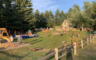
Carroll, New Hampshire
Twin Mountain / Mt. Washington KOA Holiday
Come enjoy Twin Mountain/Mt. Washington KOA, an award-winning campground in the heart of New Hampshire's scenic White Mountains. Explore ...
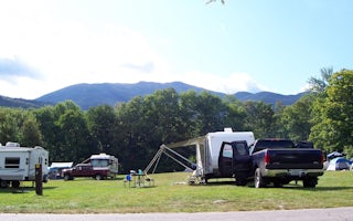
Gorham, New Hampshire
Dolly Copp
Overview
Located 6 miles south of Gorham, New Hampshire at the base of New England's tallest peak, the historic Dolly Copp Campground is ...
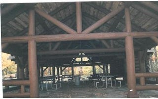
Gorham, New Hampshire
Dolly Copp Picnic Pavilion
Overview
Located along the Peabody River in the heart of the White Mountains, the Dolly Copp Picnic Pavilion is a wonderful location for ...
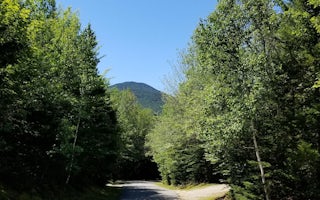
, New Hampshire
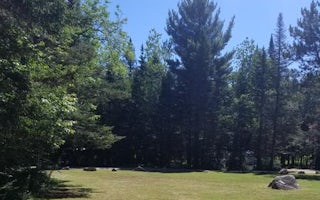
Sugarloaf 1 Campground
Overview
Sugarloaf 1 is a quiet, remote getaway in the northwoods of New Hampshire. Located near the western base of Mount Washington and...
Jefferson, New Hampshire
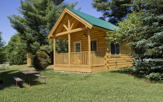
Sugarloaf 2 Campground
Overview
Sugarloaf 2 is a scenic, remote campground in the northwoods of New Hampshire. Located near the western base of Mount Washington...
Lisbon, New Hampshire
Littleton / Franconia Notch KOA Holiday
With tree-shaded and grassy sites, this comfortable campground is a great base for exploring New Hampshire's White Mountains and Vermont'...


