Burke, Vermont
Looking for the best photography in Burke? We've got you covered with the top trails, trips, hiking, backpacking, camping and more around Burke. The detailed guides, photos, and reviews are all submitted by the Outbound community.
Top Photography Spots in and near Burke
-
Randolph, New Hampshire
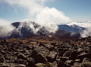
Hike Mount Jefferson
5 mi / 2700 ft gainMount Jefferson stands at 5712 feet, the third tallest mountain of the Presidential's in the White Mountain National Forest. The trail head begins at the Caps Ridge Trail on Jefferson Notch Rd. While 2.5 miles sounds easy, this hike is not for the once in while day hiker. Challenging rock scrambl...Read more -
Lincoln, New Hampshire
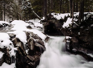
Explore the Basin in Franconia Notch
4.01 mi / 300 ft gainThe Basin is just one stop on the Pemigewasset Recreational Trail that follows along I-93 through Franconia Notch. The parking lot for the Basin is easily accessible from either north or south on I-93, and it has it's own exit sign which can't be missed.Park in the lot and follow the signs toward...Read more -
Lincoln, New Hampshire
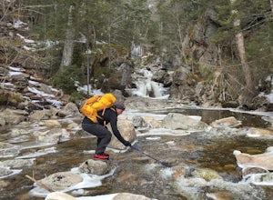
Kinsman Pond via Basin Cascade
7.25 mi / 2215 ft gainOur hike began at the Basin, which is a clearly marked exit directly off 93. If you are coming from the Northbound side, walk under the bridge beneath 93 to get to the beginning of the trail. We enjoyed the Basin for a while before hiking 1.0 mile to the Cascade Brook Trail where we took a right....Read more -
Coaticook, Québec
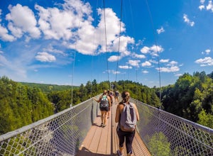
Hike the Parc de la Gorge de Coaticook Yellow Trail
5.02.18 mi / 164 ft gainHiking trails at Parc de la Gorge de Coaticook are spread into 3 sectors to reveal the park’s attractions.For a day trip I will suggest doing the yellow trail, which is the one we did. It will bring you directly into the heart of the Gorge. It is quite a short hike, 1h30-2h00 and you'll get the c...Read more -
Lincoln, New Hampshire
Hike Mt. Liberty and Camp at Liberty Springs Tent Site
7 mi / 2870 ft gainLiberty Springs Trail is a moderately trafficked out and back trail in the heart of Franconia Notch State Park and the White Mountains. The trail is a part of the Appalachian Trail, which allows it to remain very well maintained throughout the year. The trail is listed as difficult and strenuous ...Read more -
Carroll, New Hampshire
Hike Mt. Pierce
5.06.2 mi / 2412 ft gainMount Pierce (elevation 4312 ft.) is part of the Presidential Region in the White Mountain National Forest. Upon reaching the summit, you will be rewarded with 360 degree views of the surrounding mountains. To begin your hike, park at the Crawford Connector Trailhead. You will follow the Crawfo...Read more -
Carroll, New Hampshire
Mount Willard
5.03.07 mi / 958 ft gainThis hike begins at the trailhead behind Crawford Depot. The first 1/4 mile of the trail is relatively level. You will cross two small streams before the trail begins to steepen. For much of the trek up to the top of the mountain you will be following an abandoned carriage road. Along the sid...Read more -
Crawford Notch Road, New Hampshire
Snowshoe Mount Pierce
6.4 mi / 2500 ft gainThe hike begins right across from the AMC Highland Center, which is great because you can utilize their spacious parking lot! Once you locate the trailhead, the elevation begins almost immediately. Begin on the Crawford Connector Trail for 0.4 miles.You will come to a foot bridge over Gibbs Brook...Read more -
Crawford Notch Road, New Hampshire
Hike the Tom, Field, Willey and Avalon Traverse
10.2 mi / 3300 ft gainFor hikers en route to climbing the 67 4,000 footers of Northern New England, or for those looking for a day-long mini-adventure, this four-peaks-in-one traverse is a spectacular must. Mount Tom, Mount Field, and Mount Willey are all above 4,000 feet, and Mount Avalon caps at 3,442 feet. The tota...Read more -
Lincoln, New Hampshire
Hike the Flume Gorge
4.82 mi / 300 ft gainThe Flume Gorge in Franconia State Park is beautiful year round and every season has it's unique benefits. During the summer, the Flume is a highly frequented tourist destination and is usually crowded with groups of kids and families. Technically, the Gorge is closed during the winter and there ...Read more -
Crawford Notch Road, New Hampshire
Snowshoe Mount Jackson
5.2 mi / 2300 ft gainThe hike starts across the street from the AMC Highland Center on route 302, which means there is plenty of parking and when you finish there is a fireplace and snacks to warm up with! It starts at the Webster Jackson trailhead and after 1.4 miles breaks off onto the Jackson trail. At that point ...Read more -
Jackson Webster Trail, New Hampshire
Hike Mount Jackson
4.5 mi / 2109 ft gainThe Jackson Webster trailhead is located on Crawford Notch Road a little ways down from the AMC Highland Center where they have bathrooms, food, a store, info, etc. There's a parking lot at the Center as well as a smaller lot right across from the trailhead. These lots often get filled up but you...Read more -
Waterbury Center, Vermont
Hike Mt. Hunger
5.04.2 mi / 2263 ft gainMt Hunger stands at 3540 ft and face Vermont's tallest mountain, Mt Mansfield. At 45 min drive from Burlington, this is a challenging out and back hike. The views it offers and the waterfalls you will find along the path, makes it a good alternative to the overcrowded trails of Mt Mansfield. Th...Read more -
Gorham, New Hampshire
Snowshoe to Carter Notch Hut
7.8 mi / 2200 ft gainThe nineteen mile brook trail is a winding path up approximately 2200 feet of elevation over the course of 3.9 miles. That distance feels a lot farther when you are breaking trail in 18-24 inches of snow and you are carrying 35 lb packs on your backs. Luckily we started out early and we able to ...Read more -
Stowe, Vermont
Hike to Bingham Falls
4.00.5 miHiking to Bingham Falls is rewarding for many reasons; people not only come to see the falls, but also to swim in the refreshing, icy cold swimming holes as well. The main falls are tucked away along the walls of a deep, rocky gorge that has been formed naturally over time. At the base of these ...Read more -
Lincoln, New Hampshire
Photograph Fall Foliage on the Kancamagus Highway
4.032 mi / 2855 ft gainDriving the Kancamagus Highway is something you can do as a way to cross the White Mountain National Forest quickly from I-93 in the east to Conway, or it can be an entire day's activity. In the fall, it's almost impossible not to stop at every turn-off on the scenic highway as it winds through t...Read more

