Oakley, Utah
Looking for the best photography in Oakley? We've got you covered with the top trails, trips, hiking, backpacking, camping and more around Oakley. The detailed guides, photos, and reviews are all submitted by the Outbound community.
Top Photography Spots in and near Oakley
-
Provo, Utah
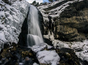
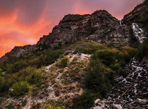
Upper Falls
2.70.54 mi / 423 ft gainComing from Provo, at about 2.5 miles make a right hand turn for Nunn's Park/ Bridal Veil. Go straight through the intersections and pass Bridal Veil Falls (on your right) and continue until you see a park on your right (Upper Falls Park). Park here and cross the bridge over the creek and then fo...Read more -
Pleasant Grove, Utah
Drive-In Sunrise
4.8Pull into the Pine Hollow parking lot, just before the winter closure gate and watch the show. If you get there early enough you can watch Timpanogos go from the tones of soft alpenglow to the harsh vibrance of sunrise. In the winter make sure you remember enough blankets.Read more -
Pleasant Grove, Utah
Rock Climbing American Fork Canyon
4.7American Fork Canyon, UT has a rich history in outdoor activity. Little do most people know that American Fork was the birth place of steep, overhanging, sport climbing. Developed by locals, now legends, in the climbing world like Boone Speed and Jeff Pedersen amongst others. This canyon came ...Read more -
Evanston, Utah
Backpack Mount Beulah via East Fork of the Bear River Trailhead
5.018 mi / 3423 ft gainGetting thereThis trip could be crammed into a really long day or even two days, but give yourself three days to really enjoy the area and not be too pressed for time.Your departure point is the East Fork of the Bear River Trailhead on the north slope of the Uintah Mountains. For most, this will ...Read more -
Provo, Utah
Bridal Veil Falls
4.80.47 mi / 285 ft gainHeading on Provo Canyon Rd the waterfall is just on the right hand side. You will see a sign that says "Bridal Veil" to turn in and park at the falls. At the falls you can hike up a bit to get closer to the waterfall but you will get sprayed quite a bit. Usually a few people there take photos at ...Read more -
Draper, Utah
Lone Peak via the Cherry Creek Logging Trail
14.8 mi / 6378 ft gainYou start this trail at the Orson Smith Park in Draper. It joins with the Bonneville Shoreline Trail briefly before turning off onto the cherry creek logging trail. It switchbacks for a long ways exposed on towards the valley. It is fairly steep in places, but doable. I had tennis shoes with ...Read more -
Draper, Utah
Lone Peak via Jacobs Ladder
4.714.2 mi / 6713 ft gainThe main trail to Lone Peak is via Jacobs Ladder. To get to the start of the trailhead you need to drive on a dirt road for a little bit until you get to a little parking area (start of the road indicated on the map). The trail starts just south of where you park on the dirt road. The Jacobs Lad...Read more -
Sandy, Utah
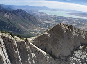
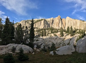
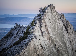
Climbing in the Lone Peak Cirque
4.0Lone Peak reaches 11,253 feet at its summit. It's alpine feel is unique as it stands above the busy city below. While this gem is one of the highlights in the Wasatch range, it must be earned. A long steep approach, best done at night in the summer months, deposits you in the high meadow surround...Read more -
Salt Lake City, Utah
Ensign Peak
4.20.97 mi / 354 ft gainThis hike is a piece of cake with a sizable reward. It starts just up the hill behind the Capitol Building and ascends 350 feet over about 0.5 miles to the top on a very well marked trail. It's great for a family with young ones or maybe a quick post-dinner evening date. Parking is all along a re...Read more -
Pleasant Grove, Utah
Battlecreek Falls
4.71.09 mi / 486 ft gainBattlecreek Falls is a great place to get away after a long day of work—or if you're looking for a great hike but are short on time. It's a great way to get the dog or your family out to enjoy some nature. The falls are about a 15-25 minute walk from the parking lot, the waterfall is enormous an...Read more -
Centerville, Utah
Hike to the Rope Swing on Deuel Creek Trail
5.02.6 mi / 646 ft gainNot only is this hike absolutely gorgeous, but it also has an epic rope swing at the end! To get to the trailhead you'll need a vehicle that can handle rough roads—you have to drive up a bit on the side of the mountain to get to the trailhead. The beginning of the hike is marked with a little bul...Read more -
Centerville, Utah
Hike to the Parrish Creek Pictographs
4.71 mi / 200 ft gainThe petroglyphs are pretty easy to find and it is such a short hike you can do it in about 45 minutes. To get to the trailhead, drive to Centerville, Utah and take 400 N all the way towards the mountain. The road with curve to the right with a small dirt road heading to the left. Take the dirt ro...Read more -
Evanston, Utah
Backpack to Dead Horse Lake
5.021 mi / 1400 ft gainDead Horse Lake is a lightly trafficked and highly scenic route in the High Uintas Wilderness. The trail is easy enough to do overnight but I recommend taking an extra day to explore the area around Dead Horse Lake. From the trailhead you will hike south on the West Fork Blacks Fork trail. The...Read more -
Evanston, Utah
Hike to Tokewanna Peak in the High Uintas
17 mi / 4202 ft gainClimbing all of Utah's 13ers is nota popular trend, yet. Most people seek out Colorado's 14ers for their summit height, but don't let Utah's 13ers be overshadowed by their neighbors to the East. Utah's 13ers are remote. The closest 13er to a road is Tokewanna which comes in around 17-18 miles rou...Read more -
Provo, Utah
Hike to Buckley's Abandoned Mine
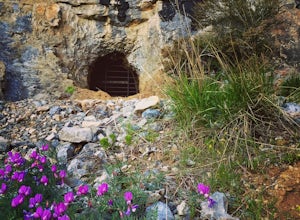
4.63 mi / 200 ft gainOnce you reach the mine it's gated but you can slide in. Follow the main tunnel a hundred or so feet back and climb the 75 foot ladder up to the second level. You can then make your way back out to the cliff face where there is another gate to the outside. That gate is a little trickier to squeez...Read more -
Salt Lake City, Utah
Birding at Farmington Bay
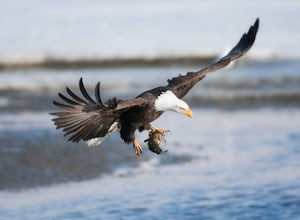
5.0Every winter as the ice thaws, eagles gather at Farmington Bay to feed on huge populations of carp. This can produce a pretty amazing set of circumstances where it's not uncommon to see birds feeding just 50 yards from shore.The prime viewing opportunity happens around "Bald Eagle Day," an event ...Read more

