Heber City, Utah
Looking for the best photography in Heber City? We've got you covered with the top trails, trips, hiking, backpacking, camping and more around Heber City. The detailed guides, photos, and reviews are all submitted by the Outbound community.
Top Photography Spots in and near Heber City
-
Heber City, Utah
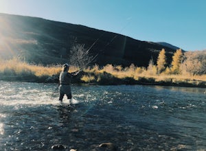
Fly Fish the Middle Provo River
The Middle Provo River runs from Jordanelle Reservoir to Deer Creek Reservoir through the Heber Valley. To get there from Salt Lake City, head southeast on I-80. Take exit 146 and merge onto US-189/US-40 toward Heber. Travel 17.1 miles; turning right onto W 100 South/River Road. 0.3 miles down Ri...Read more -
Wallsburg, Utah
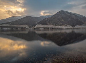
Walk the Deer Creek Dam Trail
4.08.03 mi / 400 ft gainWhile driving East, the turnoff to the trailhead is just left of the dam. There is a size-able parking lot and rest rooms available. The hike itself is a dirt path and easy to follow. Access to the water's edge is restricted until you are 1500 feet past the dam. Though the trail is designed for b...Read more -
Provo, Utah
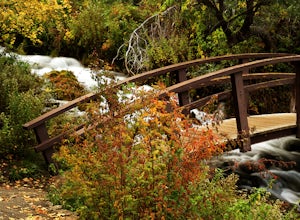
Explore Scenic Cascade Springs
4.7One of the most photogenic spots of the Timpanogos Canyon. If you take the Alpine loop you will see a sign to turn off and go to Cascade Springs. It's about a 15 minute drive from there. The parking lot is right next to the springs. The best time to go is during the fall when the leaves are chang...Read more -
Wasatch County, Utah
Capture the Sunrise above Cascade Springs
Head towards Cascade Springs from either Provo or American Fork Canyons. As you approach Cascade Springs, a couple miles out watch for small turn-outs on the right side of the road. There should be just enough room for you to park in a variety of locations on the way down to the springs. Hop out ...Read more -
Provo, Utah
Hike Big Springs Hollow Loop
4.05 mi / 600 ft gainArriving to Big Springs Hollow is relatively easy. Drive up Provo Canyon and turn right onto South Fork Rd at Vivian Park. As you pass Vivian Park, you'll continue for 3 miles on South Fork Rd until you reach Big Springs Park. Continue up to the Upper level parking and the trailhead will be in...Read more -
Provo, Utah
Hike to Stewart Falls
4.34 miThe canyon is closed during snowfall so this is only accessible between May-Nov usually. It is best during the fall when the leaves have changed color, but let's be honest, it's always great. Head up Provo Canyon and follow the signs to make a left going into Sundance. Follow the road past the sk...Read more -
Provo, Utah
Hike the North Summit of Mount Timpanogos
5.016 miTo reach the north summit of Timpanogos you start out just like you would if you were going to the main summit. There are 2 different trail options to choose from; The Aspen Grove trail near Sundance Ski resort or the Timpanooke trail through American Fork Canyon. I will put the start point on th...Read more -
Provo, Utah
Hike Mount Timpanogos via Aspen Grove
4.014 mi / 5140 ft gainThe Aspen Grove trail is shorter but a bit steeper than the Timpanooke Trail. This usually means that fewer people take this route, and on an extremely popular mountain like Timpanogos, that’s a good thing. The trail is 14 miles round trip with an elevation gain of 5,140 feet. The hike begins at...Read more -
Park City, Utah
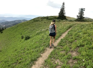
Hike Empire Pass Ridge
3.25 mi / 800 ft gainStarting at an elevation of 8,960 feet at Empire Pass, the trail follows the ridge to the west. It starts off on a gravel road, but quickly turns into a single-track trail once you pass the buried water tank. For the most part, you will stay on the ridge and have great views of Clayton Peak, Deer...Read more -
Park City, Utah
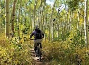
Bike or Hike Park City's Mid Mountain Trail
5.022.8 mi / 4457 ft gainThe Mid-Mountain Trail is unique to Park City. It's an epic trail that connects Deer Valley, to Park City Mountain Resort, and Canyons Village. Traversing at approximately 8,300 feet elevation, the trail is comprised of 13 sections and is a 22.8 mile point-to-point ride from Deer Valley to Canyon...Read more -
Provo, Utah
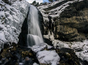
Upper Falls
2.70.54 mi / 423 ft gainComing from Provo, at about 2.5 miles make a right hand turn for Nunn's Park/ Bridal Veil. Go straight through the intersections and pass Bridal Veil Falls (on your right) and continue until you see a park on your right (Upper Falls Park). Park here and cross the bridge over the creek and then fo...Read more -
Park City, Utah
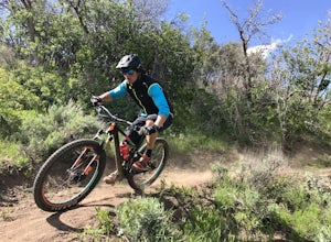
Mountain Bike Deer Valley, Park City
5.07 mi / 1200 ft gainIf you’re a downhill bomber, you came to the right place. The resort has lift-served singletrack of every difficulty with machine-built table tops, berms, tree runs and technical obstacles. If cross country is more your scene, there are miles of forested climbs, beautiful views and enjoyable down...Read more -
Provo, Utah
Camp at Timpooneke Campground
5.0The Timpooneke Campground sits at 7,400 ft. elevation with views of Mount Timpanogos and campsites surrounded by beautiful aspen, fir and spruce trees. The leaves in the fall put on a show you will not want to miss. Within the campground there are 9 equestrian sites, 1 large group site and 20 sta...Read more -
Provo, Utah
Hike to Scout Falls
2.8 mi / 675 ft gainStarting at a little over 7,300 feet, the Timpooneke Trailhead offers a beautiful alpine setting for starting your hike. Several trails originate from the same parking lot so you will want to make sure you get on the correct trail. The parking lot can also get quite full on summer days as people ...Read more -
Provo, Utah
Timpanogos Basin via Timpooneke Trail
5.09.78 mi / 3015 ft gainThe wildflowers are normally at their peak from mid to end of July or the beginning of August. Depending on the amount of snow that year and how wet of a spring we had it could vary a little bit. But anytime during the mid summer you will encounter amazing Indian Paintbrush, Lupine, and other co...Read more -
Provo, Utah
Mount Timpanogos via Timpanogos Trail #053
4.815.72 mi / 4970 ft gainThe Timpooneke trailhead is located in American Fork Canyon, next to the Timpooneke Campground. There is a $6 fee to enter the canyon, unless you have a National Park Pass with which you get in free. On the weekends, it may be difficult to find parking at the Timpooneke Campground, so arrive earl...Read more

