Heber City, Utah
Looking for the best hiking in Heber City? We've got you covered with the top trails, trips, hiking, backpacking, camping and more around Heber City. The detailed guides, photos, and reviews are all submitted by the Outbound community.
Top Hiking Spots in and near Heber City
-
Oakley, Utah
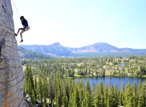
Scale the Cliffs at Ruth Lake
4.8Getting There From Evanston, take the Mirror Lake Highway 150 about 42 miles to the Ruth Lake trailhead and follow the easy hike up from the highway; just look for the signs directing you to Ruth Lake. The Trail/The Climbs Once on the trail, keep an eye out to your left and soon you'll see the cl...Read more -
Oakley, Utah
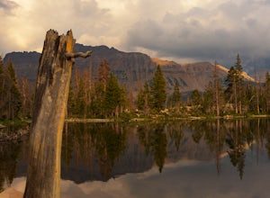
Hike to Ruth Lake in the High Uintas Wilderness
5.02 mi / 300 ft gainThe Uintas are a high elevation, pristine mountain wilderness located in Utah. This range receives over 400 inches of precipitation annually, and you can find water everywhere. There are 400+ miles of streams, waterfalls, and more than 2,000 lakes! One of the prettiest and most accessible of th...Read more -
Salt Lake City, Utah
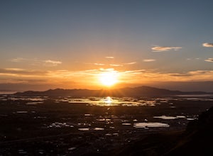
Ensign Peak
4.20.97 mi / 354 ft gainThis hike is a piece of cake with a sizable reward. It starts just up the hill behind the Capitol Building and ascends 350 feet over about 0.5 miles to the top on a very well marked trail. It's great for a family with young ones or maybe a quick post-dinner evening date. Parking is all along a re...Read more -
Bountiful, Utah
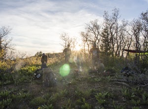
Backpack to Rudy's Flat
4.07 miRudy's Flat is a great overnight hike with plenty of tent or hammock space and multiple established fire rings. This hike offers multiple options for distance depending on your availability and skill level.From the Mueller Park Canyon trailhead (5,234 ft), hikers will experience a gradual ascent ...Read more -
Bountiful, Utah
Trail Run to Elephant Rock
4.47 mi / 1025 ft gainMueller Park is a beautiful, quaint canyon, with some sweeping up canyon views throughout the ascent. The trail is a fun, family friendly single track from the bridge all the way to the rock. You will pass a bald strip (pipeline) that runs North to South which marks about halfway to the rock. At ...Read more -
Payson, Utah
Grotto Falls
4.00.54 mi / 144 ft gainHeading in the canyon you will drive along a winding road for a while until you pass through a gate (Closed during Winter, this is where you will need to pull over and continue down the road on foot) about a mile up you will see a trailhead on the left called "Bennie Creek" and right after you wi...Read more -
Herriman, Utah
Hike to Kennecott Copper Mine
5.04 miFrom Salt Lake City go on UT-201W, then take Bacchus Highway all the way until the intersection with Butterfield Canyon Road. This is where you can park your car and follow the dirt road for roughly 2 miles until you come to a fork. One road from the fork leads to Middle Canyon and the other to t...Read more -
Evanston, Utah
Amethyst Basin via Christmas Meadows
4.512.57 mi / 2303 ft gainDirections: The trail leaves from the Christmas Meadows Trailhead. From Mirror Lake Scenic Byway (US 150) turn on Christmas Meadows Rd. The campground and trailhead are around 3.5 miles down the road dirt road. The road is suitable for low clearance vehicles. Trip Length: 6 miles each way + opt...Read more -
Evanston, Utah
Backpack to Ryder Lake
4.718 mi / 2000 ft gainRyder Lake is accessed via the Stillwater Trail, beginning at the Christmas Meadows Trailhead off of Mirror Lake Highway. The trail heads due south from Christmas Meadows along the Stillwater River. It winds through lodgepole pine forests and skirts alpine meadows, gradually gaining elevation. A...Read more -
Evanston, Utah
Hike to Ostler Peak in the High Uintas
13.7 mi / 3935 ft gainHiking Ostler Peak in the High Uintas Wilderness is a serious challenge for anyone. Typically, this hike is done over 2-3 days, with an overnight at the beautiful Ostler Lake. Strong hikers can do this hike in one day, however, as long as you are prepared and know the route. The route up Ostler ...Read more -
Evanston, Utah
Camp at Christmas Meadows in the Uinta National Forest
Just four miles from the Mirror Lake Scenic Byway, this limited site campground is a great alternative to the larger, busier campgrounds at lower elevations. There are just 11 sites here, a few of which are first-come, first-serve. Amenities include picnic tables, campfire rings, vault toilets, d...Read more -
Evanston, Utah
Kermsuh Lake Trail
5.013.04 mi / 1722 ft gainKermsuh Lake Trail is an out-and-back trail that takes you by a lake located near Oakley, Utah.Read more -
Centerville, Utah
Hike to the Rope Swing on Deuel Creek Trail
5.02.6 mi / 646 ft gainNot only is this hike absolutely gorgeous, but it also has an epic rope swing at the end! To get to the trailhead you'll need a vehicle that can handle rough roads—you have to drive up a bit on the side of the mountain to get to the trailhead. The beginning of the hike is marked with a little bul...Read more -
Centerville, Utah
Hike to the Parrish Creek Pictographs
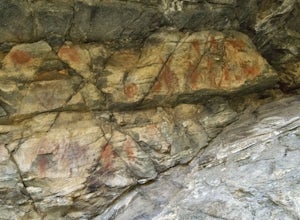
4.71 mi / 200 ft gainThe petroglyphs are pretty easy to find and it is such a short hike you can do it in about 45 minutes. To get to the trailhead, drive to Centerville, Utah and take 400 N all the way towards the mountain. The road with curve to the right with a small dirt road heading to the left. Take the dirt ro...Read more -
Evanston, Utah
Backpack Mount Beulah via East Fork of the Bear River Trailhead
5.018 mi / 3423 ft gainGetting thereThis trip could be crammed into a really long day or even two days, but give yourself three days to really enjoy the area and not be too pressed for time.Your departure point is the East Fork of the Bear River Trailhead on the north slope of the Uintah Mountains. For most, this will ...Read more -
Payson, Utah
Mount Nebo via North Rim Trail
4.58.6 mi / 2897 ft gainMount Nebo is the tallest of all the mountains in the Wasatch, and also one of the easiest to hike, due to the fact that the trail begins at an elevation of ~9300 ft. The parking area for the trailhead is along a short dirt road, which is precisely marked on the location map. The trail itself is...Read more

