Grand Staircase-Escalante National Monument, Utah
Looking for the best photography in Grand Staircase-Escalante National Monument? We've got you covered with the top trails, trips, hiking, backpacking, camping and more around Grand Staircase-Escalante National Monument. The detailed guides, photos, and reviews are all submitted by the Outbound community.
Top Photography Spots in and near Grand Staircase-Escalante National Monument
-
Page, Arizona
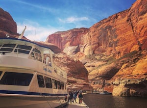
Boat-in to Rainbow Bridge
1.25 miThis amazing trip to one of the largest natural bridges in the world, Rainbow Bridge National Monument, begins at the Lake Powell Marina. Catch your ride at Lake Powell Resort at the Wahweap Marina. This tour the lake for a couple of hours until you reach a narrow canyon. The 50+ foot boat will m...Read more -
Boulder, Utah
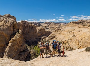
Backpack Death Hollow in Grand Staircase-Escalante
22 mi / 1600 ft gainThe most popular route into Death Hollow is from the Boulder airstrip near the town of Boulder, Utah. The trailhead for the Boulder Mail Trail begins, or ends here depending on which way you are hiking. Leave a car at the Highway 12 bridge over the Escalante River for the thru hike, or get luck...Read more -
Boulder, Utah
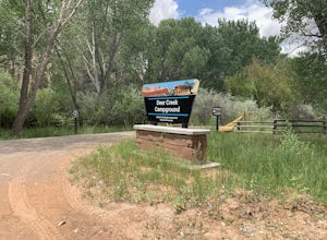
Camp at Deer Creek Campground
5.0Deer Creek campground is off of the Burr Scenic drive and right outside of the lower part of Capitol Reef National Park. This campground is perfect if you are driving from Bryce Canyon to Capitol Reef. There are a total of 7 tent sites in the campground. There are no spots for RVs and no turn aro...Read more -
Garfield County, Utah
Camp at Dave's Hollow Campground
4.2 mi / 800 ft gainWe all know the crowds well at our favorite National Parks, and Bryce Canyon is no exception. When you're looking to get a little further away from the noise, lights, and experience of a National Park campground, you often don't have to go very far off the main road. This adventure is for those w...Read more -
Boulder, Utah
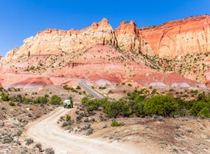
Drive the Burr Trail Scenic Backway
5.066.2 mi / 4124 ft gainThe Burr Trail is a 66 miles mostly-paved road connecting Boulder, Utah / Highway 12 with the Notom-Bullfrog road that passes through some of the most scenic (and largely untouched) painted-rock backcountry in three of our national parks/monuments including Grand Staircase-Escalante, Capitol Reef...Read more -
Kane County, Utah
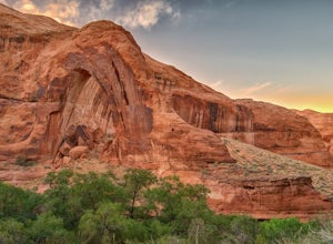
Hike to Broken Bow Arch
4.76.28 mi / 732 ft gainThe trailhead starts at the Willow Gulch Trailhead, located just off of Hole in the Rock Road in the Grand Staircase -Escalante National Monument. The coordinates for the trailhead are 37.324812,-111.023019. To get there head east on highway 12 out of Escalante, Utah until you get to Hole in the ...Read more -
Page, Arizona
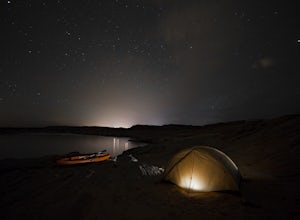
Kayak Camp on Lake Powell
3.7Kayak camping right on the beaches of Lake Powell and then paddling out into the stillness of the morning to hike antelope canyon is one of my all time favorite memories. Just across from the Antelope Point Launch Ramp is a fantastic beach with several flat areas that are perfect for tent campin...Read more -
Kanab, Utah
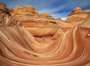
The Wave via Coyote Buttes North
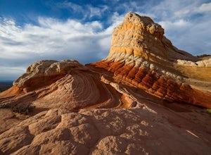
5.05.41 mi / 755 ft gainThe hike to the Wave is 2.5 miles (one-way). When you arrive, take in the sandstone showing incredible striations of red, orange, pink, yellow, and beige. Please note that this adventure is only accessible by obtaining a permit. Only 20 visitors are allowed access per day with 10 permits given on...Read more -
Kanab, Utah
Wire Pass Slot Canyon
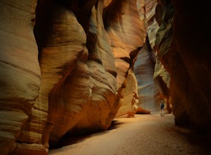
4.63.75 mi / 325 ft gainWire Pass is a hike through a scenic slot canyon that is often overlooked due to its close proximity to the very famous Wave. Unlike the "Wave" a permit is not required to make the hike, only a day use fee at the trailhead. Be sure to check local weather for rainfall and please do not go on this ...Read more -
Kanab, Utah
Hike Buckskin Gulch, Vermillion Cliffs Wilderness
4.615 miBuckskin Gulch is a natural wonder. At 15 miles long it is the longest slot canyon in the world. It sometimes is as narrow as 2ft. Because of the nature of this canyon and Utah topography this canyon is subject to deadly flash flood if it rains anywhere along the headwaters. Be sure to check in w...Read more -
Marble Canyon, Arizona
Hike to the White Pocket
5.04 miWhite Pocket is extremely difficult to access due to the road leading to it. There are sections with very deep, soft sand going uphill! You must have a high clearance 4WD vehicle and air down your tires to have any hope of making it here. Do not take this lightly, a tow bill will cost you a minim...Read more -
Marble Canyon, Arizona
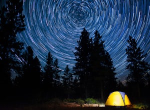
Night Photography at White Pocket
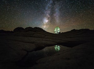
White Pocket is a remote outcropping of sandstone formations in Vermillion Cliffs National Monument similar to the famous "Wave". Unlike The Wave, a permit isn't needed to visit, but you will need a high-clearance 4WD vehicle with good tires; alternatively, you can hire a 4WD tour service in near...Read more -
Kane County, Utah
Hike and Swim through Labyrinth Canyon
3.04 mi / 500 ft gainThis hike is a perfect day activity from boating/houseboating/camping Lake Powell. We were houseboating by Gunsight/Cookie Jar Buttes and boated across the bay to Labyrinth Bay. We jumped out when the canyon became too narrow for the ski boat and swam the slot canyon. Wear your life jacket. I ha...Read more -
Page, Arizona
Hike the Glen Canyon Dam Overlook
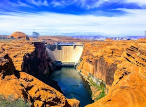
5.00.11 mi / 124 ft gainThe Glen Canyon Dam separates the Colorado River from Lake Powell. The terrain on this hike is uneven and rocky. The overlook is located on Scenic View Drive off of highway 89. Glen Canyon Dam is located in Glen Canyon National Recreation Area.Read more -
Kane County, Utah
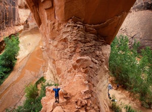
Day Hike Crack-in-the-Wall to Jacob Hamblin Arch in Coyote Gulch
5.011 mi / 2000 ft gainDrive to Hole in the Rock Road outside of Escalante UT. Drive SE down the all-dirt Hole in the Rock Road for 36 miles to a signed turn off on your left. The road can be sandy and bumpy from here, so consider the car you're using. Travel NE for 7 miles to the 40 Mile Ridge TH. From Here, follow a ...Read more -
Kane County, Utah
Coyote Gulch Loop
4.710.59 mi / 4354 ft gainEasy hiking, water availability, and spectacular scenery make this a "must do" hike. Three days are best to see all this canyon has to offer. You can either make this a 3-5 mile hike or a longer 10-15 mile hike. The perfect trip down Coyote Gulch is three days and two nights. Hike in to Jacob Ham...Read more

