Grand Staircase-Escalante National Monument, Utah
Looking for the best fitness in Grand Staircase-Escalante National Monument? We've got you covered with the top trails, trips, hiking, backpacking, camping and more around Grand Staircase-Escalante National Monument. The detailed guides, photos, and reviews are all submitted by the Outbound community.
Top Fitness Spots in and near Grand Staircase-Escalante National Monument
-
Kane County, Utah
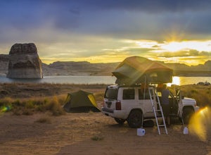
Beach Camp On Lake Powell's Lone Rock Beach
4.6Just twelve miles north of Page, Arizona on Highway 89 across the Utah border, Lone Rock Beach is a great open beach where you can drive right up and make camp anywhere you like. There is a $10 fee to get on the beach and it can get a little busy during the summer, but it seems like you can alway...Read more -
Boulder, Utah
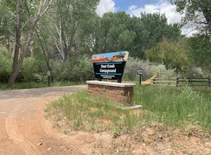
Camp at Deer Creek Campground
5.0Deer Creek campground is off of the Burr Scenic drive and right outside of the lower part of Capitol Reef National Park. This campground is perfect if you are driving from Bryce Canyon to Capitol Reef. There are a total of 7 tent sites in the campground. There are no spots for RVs and no turn aro...Read more -
Boulder, Utah
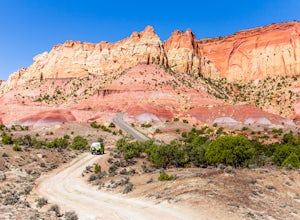
Drive the Burr Trail Scenic Backway
5.066.2 mi / 4124 ft gainThe Burr Trail is a 66 miles mostly-paved road connecting Boulder, Utah / Highway 12 with the Notom-Bullfrog road that passes through some of the most scenic (and largely untouched) painted-rock backcountry in three of our national parks/monuments including Grand Staircase-Escalante, Capitol Reef...Read more -
Kane County, Utah
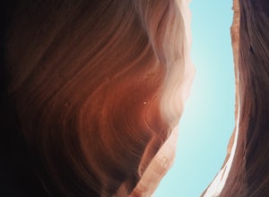
Hike and Swim through Labyrinth Canyon
3.04 mi / 500 ft gainThis hike is a perfect day activity from boating/houseboating/camping Lake Powell. We were houseboating by Gunsight/Cookie Jar Buttes and boated across the bay to Labyrinth Bay. We jumped out when the canyon became too narrow for the ski boat and swam the slot canyon. Wear your life jacket. I ha...Read more -
Page, Arizona
Hike the Page Mesa Trail
13.2 mi / 800 ft gainThe best way to loop is counter-clockwise, to avoid unnecessary uphill distance. The trail features wonderful wildflowers in the spring, and is open year round. The Page Mesa Trail typically takes between 1 and 3 hours to hike. The trail is also a fabulous location for mountain biking and is dog ...Read more -
Page, Arizona
Hike through Upper Waterholes Canyon
4.81.5 mi / 300 ft gainWaterholes Canyon is a gorgeous slot canyon located just south of Page, Arizona that empties into Glen Canyon. The Upper Part of the Canyon is an easy, largely non-technical section that is easily accessed from Highway 89 and a clear parking turnoff on the left side of the road if you're heading ...Read more -
Page, Arizona
Hike Cathedral Canyon
5.01 mi / 50 ft gainCathedral Canyon is located just south of Page, Arizona and west of Coppermine Road and is entirely on Navajo Land, so access is possible only by permission from a local or with a permit from one of the licensed tour companies, of which Chief Tsosi is currently the only one permitted to give perm...Read more

