Grand Staircase-Escalante National Monument, Utah
Looking for the best hiking in Grand Staircase-Escalante National Monument? We've got you covered with the top trails, trips, hiking, backpacking, camping and more around Grand Staircase-Escalante National Monument. The detailed guides, photos, and reviews are all submitted by the Outbound community.
Top Hiking Spots in and near Grand Staircase-Escalante National Monument
-
Kanab, Utah
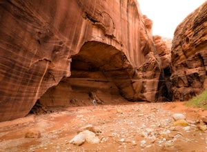
Wire Pass Slot Canyon
4.63.75 mi / 325 ft gainWire Pass is a hike through a scenic slot canyon that is often overlooked due to its close proximity to the very famous Wave. Unlike the "Wave" a permit is not required to make the hike, only a day use fee at the trailhead. Be sure to check local weather for rainfall and please do not go on this ...Read more -
Kanab, Utah
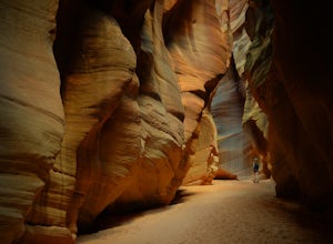
Hike Buckskin Gulch, Vermillion Cliffs Wilderness
4.615 miBuckskin Gulch is a natural wonder. At 15 miles long it is the longest slot canyon in the world. It sometimes is as narrow as 2ft. Because of the nature of this canyon and Utah topography this canyon is subject to deadly flash flood if it rains anywhere along the headwaters. Be sure to check in w...Read more -
Marble Canyon, Arizona
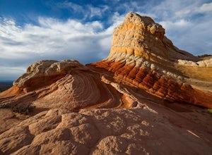
Hike to the White Pocket
5.04 miWhite Pocket is extremely difficult to access due to the road leading to it. There are sections with very deep, soft sand going uphill! You must have a high clearance 4WD vehicle and air down your tires to have any hope of making it here. Do not take this lightly, a tow bill will cost you a minim...Read more -
Kane County, Utah
Hike and Swim through Labyrinth Canyon
3.04 mi / 500 ft gainThis hike is a perfect day activity from boating/houseboating/camping Lake Powell. We were houseboating by Gunsight/Cookie Jar Buttes and boated across the bay to Labyrinth Bay. We jumped out when the canyon became too narrow for the ski boat and swam the slot canyon. Wear your life jacket. I ha...Read more -
Page, Arizona
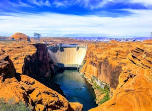
Hike the Glen Canyon Dam Overlook
5.00.11 mi / 124 ft gainThe Glen Canyon Dam separates the Colorado River from Lake Powell. The terrain on this hike is uneven and rocky. The overlook is located on Scenic View Drive off of highway 89. Glen Canyon Dam is located in Glen Canyon National Recreation Area.Read more -
Kane County, Utah
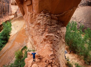
Day Hike Crack-in-the-Wall to Jacob Hamblin Arch in Coyote Gulch
5.011 mi / 2000 ft gainDrive to Hole in the Rock Road outside of Escalante UT. Drive SE down the all-dirt Hole in the Rock Road for 36 miles to a signed turn off on your left. The road can be sandy and bumpy from here, so consider the car you're using. Travel NE for 7 miles to the 40 Mile Ridge TH. From Here, follow a ...Read more -
Kane County, Utah
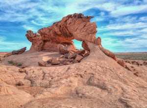
Sunrise Arch
The trailhead starts at Coyote Gulch Trailhead in the Grand Staircase - Escalante National Monument. There is actually no trail to the arches but they are pretty easy to find and even easier with a GPS. The coordinates are Sunrise Arch = 37.382214,-111.04838 and Sunset Arch = 37.38191,-111.048397...Read more -
Page, Arizona
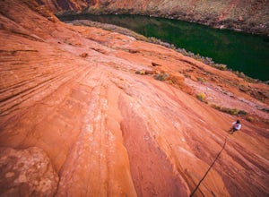
Hiking the Ropes Trail in Page Arizona
5.0The Ropes Trail is an old hiking trail below Glen Canyon Dam that has long since been abandoned by the park service. It is also one of the few trails that leads down the steep walls into the canyon. Let me say that again, it's steep. Getting there Take Highway 89 from Page going north and take th...Read more -
Marble Canyon, Utah
Hike the Buckskin Mountain Passage from Stateline Campground on the Arizona Trail
8 mi / 1400 ft gainDepending how you approach this 800 mile trail, I did the first 4 miles or last 4 miles as an out and back from Stateline Campground on the Utah/Arizona state line and the border of Vermilion Cliffs National Monument. This section of the trail does not pass through Vermilion Cliffs N.M. b...Read more -
Hatch, Utah
Bike Thunder Mountain Trail
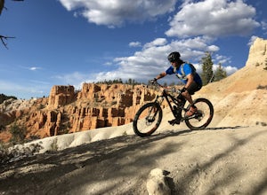
4.08 mi / 1123 ft gainThunder Mountain Trail is one that should be on every mountain bikers bucket list. It's located just outside of Bryce Canyon National Park and passes through hoodoos, classic Bryce Canyon topography and epic views to the west. For the first 2.5 miles, the trail meanders back and forth with littl...Read more -
Page, Arizona
Hike the Page Mesa Trail
13.2 mi / 800 ft gainThe best way to loop is counter-clockwise, to avoid unnecessary uphill distance. The trail features wonderful wildflowers in the spring, and is open year round. The Page Mesa Trail typically takes between 1 and 3 hours to hike. The trail is also a fabulous location for mountain biking and is dog ...Read more -
Page, Arizona
Explore the Horseshoe Bend Crack
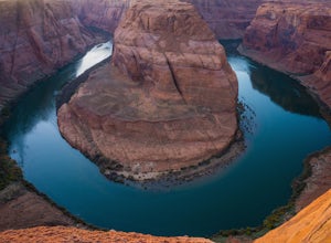
5.01.9 miHorseshoe Bend is an iconic viewpoint, and a must-see for photographers. Check out Tiffany Nguyen's post, Hike to Horseshoe Bend, for more details on that part of the adventure. Because of its popularity and easy access, the Horseshoe Bend viewpoint is thoroughly photographed and can be very cro...Read more -
Williams, Arizona
Horseshoe Bend
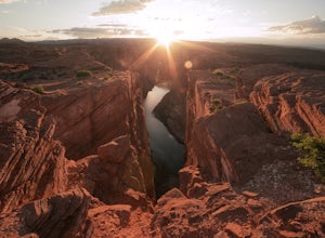
4.71.52 mi / 157 ft gainHorseshoe Bend in Page, Arizona is classic bucket list material and for good reason. Even if they don’t know what it’s called or where it is, everyone has seen this famous spot somewhere. Rest assured; pictures cannot convey the massive scale of this place. From your vantage point 1,000 feet abov...Read more -
Kane County, Utah
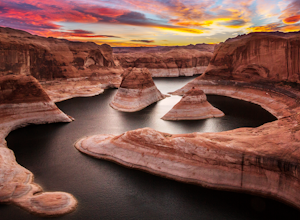
Reflection Canyon
5.015.24 mi / 1368 ft gainBackpacking Reflection Canyon is not for the faint of heart. It's an intense, challenging hike that takes you through slot canyons, climbing up and down shifty sandstones and traversing rugged terrains and ravines. Although the elevation gain is almost nothing, the up and down climbs from one rav...Read more -
Marble Canyon, Arizona
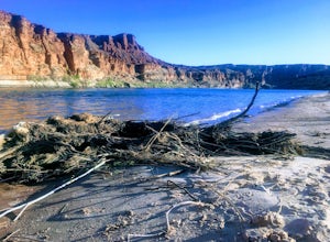
Paria Beach
5.0The area directly below Lee's Ferry campground is known as the Paria Riffle and Beach. The Paria is a small river that feeds into the Colorado River just north of the campground. Just park at the campground parking lot next to the river and walk a short distance to the sandy beach area where you ...Read more -
Page, Arizona
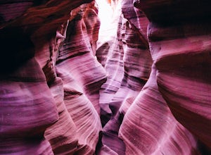
Hike through Upper Waterholes Canyon
4.81.5 mi / 300 ft gainWaterholes Canyon is a gorgeous slot canyon located just south of Page, Arizona that empties into Glen Canyon. The Upper Part of the Canyon is an easy, largely non-technical section that is easily accessed from Highway 89 and a clear parking turnoff on the left side of the road if you're heading ...Read more

