Garfield, Texas
Top Spots in and near Garfield
-
Austin, Texas
Hike Walnut Creek Metro Loop
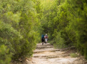
4.08.8 mi / 534 ft gainWalnut Creek Metro Loop is an 8.8 mile loop hike located within Walnut Creek Metro Park in north Austin, Texas. The trail is moderately hiked and relatively easy. It's great for walking/running/cycling. There are many smaller trails that connect portions of the main loop and it's easy to get conf...Read more -
Austin, Texas
Hike Hill of Life Hiking Trail
4.53.1 mi / 328 ft gainThe Hill of Life hiking trail is an out-and-back hiking trail around 3 miles long total. Parking is parallel parking on the street and can be found in the neighborhood where the trailhead is located. The trail begins with a half mile descent down a very rocky and gravel-ridden trail. The descent ...Read more -
Austin, Texas
Sculpture Falls
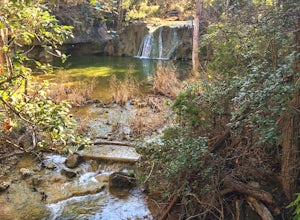
4.12.23 mi / 577 ft gainSculpture Falls is a hidden gem that is part of the 7.9 mile long Barton Creek Greenbelt in Austin. It's considered an urban oasis and is part of the Edwards Aquifer making the water temperatures in the summer about 70 degrees, and is a perfect way to cool off in the Texas heat! To find the trai...Read more -
Bastrop, Texas
Bike the Lost Pines of Bastrop
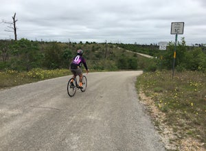
13 mi / 823 ft gainIn the fall of 2011, the most destructive fire in Texas history burned through Bastrop, just 45 minutes east of Austin, TX. This makes for an interesting, and eerie, bike ride. As you ride through the park, you can see the extent of damage the fire caused. It's also amazing to see the vegetation ...Read more -
Austin, Texas
Wild Basin Wilderness Preserve Loop
4.01.8 mi / 262 ft gainWild Basin Wilderness Preserve is managed as part of the Balcones Canyonlands Preserve and consists of 227 acres of beautiful Hill Country woodlands owned jointly by Travis County (164.4 acres) and St. Edwards University (62.6 acres). Wild Basin is open to visitors who can hike the 2.5 miles of t...Read more -
Austin, Texas
Watch the Sunrise at Highway Scenic Overlook
This spot is located right off of the North Capital of Texas Highway (Loop 360) on the west side of Austin. It faces east and is perfect for catching the sunrise over the city or just overall chillin'. It provides easy and accessible parking. It's a popular spot for sunset and sunrise. There are ...Read more -
Austin, Texas
Hike the 360/Pennybacker Bridge Overlook Trail
1.8 mi / 167 ft gainThis is a pretty challenging hike but the view is most definitely worth the effort. There are two sides you can hike up on: the east and west. The west side is more popular as it gives a view of the Austin skyline as well the Pennybacker Bridge. However, the east side is good for sunset viewing. ...Read more -
Austin, Texas
Photograph Pennybacker Bridge (Austin 360 Bridge)
4.30.5 mi / 75 ft gainIf you're looking for excellent views of hill country, the skyline, or just an awesome place to watch the sunset this is the place to be. If you're heading southbound from 183 on 360 just before you reach the bridge there will be a dirt parking lot on your right. There are trailheads on the easts...Read more -
Austin, Texas
Hike the Western Oaks Trail
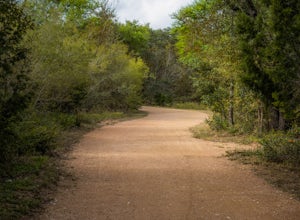
1.74 mi / 49 ft gainThe Western Oaks Trail is a 1.7 mile trail located in the Legend Oaks neighborhood in Southwest Austin, Texas. The trail is looping however there are several interconnecting trails which can shorten or lengthen the duration of the hike. The trail is mostly flat and made of crushed gravel. It is p...Read more -
Austin, Texas
Take a Stroll on the Dick Nichols Park Trail
1.09 mi / 16 ft gainThe Dick Nichols Park Trail is a 1 mile loop neighborhood park trail located in Southwest Austin. The trail is completely flat and is entirely paved. It circles the park and is equally shaded and exposed. It's very kid-friendly and perfect for walking the dog, biking, trail running, hiking, and e...Read more -
Austin, Texas
Bull Creek South to North
3.67 mi / 335 ft gainThe Bull Creek Trail is an Out-and-Back trail along Bull Creek; it's a pretty beginner to intermediate hike. The trail follows along Bull Creek which runs between the hills of the Austin Hill Country. There are several waterfalls which can be found along the creek. The trail has multiple access p...Read more -
Austin, Texas
Hike the Lower Bull Creek Greenbelt Trail
5.02.86 mi / 78 ft gainPark in the lot off of Lakewood Drive (see map) to access the trail. This trail is good for all skill levels and is dog-friendly.Read more -
Austin, Texas
Hike Lost Trail
1.5 mi / 52 ft gainLost Trail is a 1.3 mile loop hike through the Upper Bull Creek Greenbelt in northwest Austin, Texas. The trail features a beautiful waterfall, an abundance of wildlife and wildflowers, several benches, and many beautiful scenes. During the wet season, the creek fills up and flows very nicely. T...Read more -
Austin, Texas
Valburn to Bull Creek Loop
1.6 mi / 170 ft gainThe Valburn to Bull Creek Loop is a 1.6 mile loop hike through the Bull Creek Greenbelt located in Northwest Austin, Texas. The trail follows alongside the creek and is pretty rocky and steep with many changes in elevation. The trail is very scenic and has many wildlife watching opportunities, a...Read more -
Austin, Texas
Hike Valburn South Loop
1.02.3 mi / 334 ft gainThe Valburn South Loop is a 2.3 mile loop trail within the Bull Creek Greenbelt in Northwest Austin, Texas. The trail is known for its grand views of the surrounding Hill Country. The trail is shaded for the most part and is pretty rocky, good shoes are highly recommended. The trail is made up of...Read more -
Austin, Texas
Hike Valburn Switchback Party
1.1 mi / 203 ft gainThe Valburn Switchback Party is a 1.1 mile loop hike located within the Bull Creek Greenbelt of northwest Austin. This trail is part of the Valburn trail system and is mostly shaded. It features several mild inclines and the switchbacks on the trail are decently moderate. It's a great exercising ...Read more

