Dale, Texas
Looking for the best cycling in Dale? We've got you covered with the top trails, trips, hiking, backpacking, camping and more around Dale. The detailed guides, photos, and reviews are all submitted by the Outbound community.
Top Cycling Spots in and near Dale
-
Bastrop, Texas
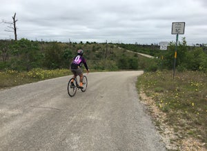
Bike the Lost Pines of Bastrop
13 mi / 823 ft gainIn the fall of 2011, the most destructive fire in Texas history burned through Bastrop, just 45 minutes east of Austin, TX. This makes for an interesting, and eerie, bike ride. As you ride through the park, you can see the extent of damage the fire caused. It's also amazing to see the vegetation ...Read more -
San Marcos, Texas
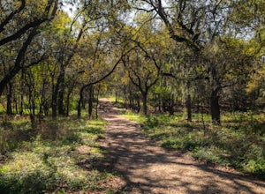
Hike Limbo, Dante, Old West, Beatrice, And Ovid East Loop
5.03 mi / 131 ft gainThe Limbo, Dante, Old West, Beatrice, and Ovid East Loop is a 2.98 mile loop trail that begins in Prospect Park and makes a loop around through the Purgatory Greenspace in San Marcos, Texas. The trail is mostly shaded and a little rocky at certain sections. However, this is a great hiking trail ...Read more -
San Marcos, Texas
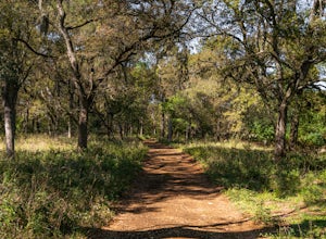
Hike Limbo Loop
1 mi / 55 ft gainThe Limbo Loop is a 1-mile loop hike in San Marcos, Texas found within the Purgatory Creek Green space. The trail is a filled with nature and wildlife. The trail is beautiful during the spring, with an abundance of wildflowers. It is mostly shaded, with few inclines. The trail is family and dog-...Read more -
San Marcos, Texas
Hike Lower Purgatory Creek Greenspace To Dante's Trail Loop
3.5 mi / 173 ft gainThe Lower Purgatory Creek Greenspace to Dante's Trail Loop is a 3.5 mile loop hike located in San Marcos, Texas. The trail is great for hiking, biking and general exercise. It's shaded for the most part. The trail is very rocky and uneven at certain points, but flat and smooth at others. It's a f...Read more -
Austin, Texas
Stephenson Preserve Loop
2.17 mi / 243 ft gainThe Stevenson Preserve Trail is a 1.5 mile loop hike located in South Austin. The outer trail makes a large loop around the entire park, however there are several interconnecting trails within the loop. This trail system is part of the Stephenson Preserve, which is also connected to the Longview ...Read more -
San Marcos, Texas
Hike Dante's Trail And Backend Loop
2.5 mi / 213 ft gainThe Dante's Trail and Backend Loop is a 2.5 mile loop hike located within the Purgatory Creek Greenspace area just south of San Marcos, Texas. This particular section of the Greenspace is made of flattened crushed gravel and is mostly shaded. The trail is very well maintained and several benches ...Read more -
San Marcos, Texas
Hike Purgatory Creek Overlook Via Dante's Trail
2.8 mi / 209 ft gainThe Purgatory Creek Overlook via Dante's Trail is a 2.8 mile out-and-back hike located within the Purgatory Creek Greenspace area just south of San Marcos, Texas. This particular section of the Greenspace is made of flattened crushed gravel and is mostly shaded. The trail is very well maintained ...Read more -
Austin, Texas
Bike through Iconic Graffiti Landmarks in Austin
5.0You don't have to rent a bike but it's the "Austin" thing to do. With plenty of pick up and drop off locations all throughout the city you can start the trip and end it whenever you feel like it! It's recommended to start the trip on South Congress at the bike rental located near Doc's Motorworks...Read more -
Austin, Texas
Hike along Lady Bird Hike & Bike Trail
10 miThe Hike and Bike Trail around Lady Bird Lake provides great views of the city skyline from several different perspectives. It's perfect for exercising or just taking a stroll on. It's about a 10 mile looping trail however there are several points in which you can cross the river and make the loo...Read more -
Austin, Texas
Hike the Violet Crown Trail: 360 to 290 Trailhead
1.8 mi / 239 ft gainThe Violet Crown Trail: 360 Trailhead to 290 trail is a 1.8 mile point-to-point hike that stretches from Loop 360 to Highway 290. Only a portion of the trail follows alongside Barton Creek before heading south towards HWY 290 while the creek veers off to the west. Dogs are more than welcome as lo...Read more -
Austin, Texas
Hike Barton Greenbelt Trail Via Barton Creek Plaza
6.6 mi / 380 ft gainThe Barton Greenbelt Trail via Barton Creek Plaza is a 6.6 mile out-and-back hike located within the Barton Creek Greenbelt. This trail follows along the creek and features a couple prominent waterfalls that also serve as popular swimming holes in the summer months. Depending on the rainfall for ...Read more -
Travis County, Texas
Hike Violet Crown Trail: Zilker to 360 Trailhead
3.03.7 mi / 282 ft gainThe Violet Crown Trail: Zilker to 360 is 3.7 mile out-and-back stretch through the Barton Creek Greenbelt. The trail begins in Zilker Park and follows Barton Creek all the way south to Loop 360. Parking can be found at Zilker Park. Though on weekends and during the summer time, the park is usuall...Read more -
Austin, Texas
Twin Falls and Sculpture Falls via Barton Creek Greenbelt Trail
3.03.23 mi / 141 ft gainThis hike is about 3.2 miles in total and is an out-and-back trail found within the Barton Creek Greenbelt stretch. The trail follows along the Barton Creek and is popularly known for the two major waterfalls it entails: Twin Falls and Sculpture Falls, which are very popular swimming destinations...Read more -
Austin, Texas
Take a Stroll on the Dick Nichols Park Trail
1.09 mi / 16 ft gainThe Dick Nichols Park Trail is a 1 mile loop neighborhood park trail located in Southwest Austin. The trail is completely flat and is entirely paved. It circles the park and is equally shaded and exposed. It's very kid-friendly and perfect for walking the dog, biking, trail running, hiking, and e...Read more -
Austin, Texas
Hike the Western Oaks Trail
1.74 mi / 49 ft gainThe Western Oaks Trail is a 1.7 mile trail located in the Legend Oaks neighborhood in Southwest Austin, Texas. The trail is looping however there are several interconnecting trails which can shorten or lengthen the duration of the hike. The trail is mostly flat and made of crushed gravel. It is p...Read more -
Austin, Texas
Hike the Shoal Creek Trail
5.05.47 mi / 173 ft gainThe Shoal Creek trail is located along the Shoal Creek Greenbelt which stretches the length of central/downtown Austin. It is a 5.4 mile out-and-back trail following along Shoal Creek. Much of the trail runs through residential area. And though it runs parallel to a creek, itis a city trail and n...Read more

