Blanco, Texas
Looking for the best running in Blanco? We've got you covered with the top trails, trips, hiking, backpacking, camping and more around Blanco. The detailed guides, photos, and reviews are all submitted by the Outbound community.
Top Running Spots in and near Blanco
-
Austin, Texas
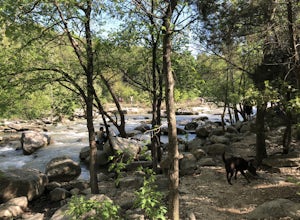
Hike the Little Fern Trail
0.5 mi / 140 ft gainThe Little Fern Trail is a 1.9 mile out-and-back hike that is a part of the River Place Nature Trail. It is perfect for hiking, walking, running, and biking. The trail is open for use year-round and is easy to follow, with lots of small, side waterfalls and lush greenery scattered along. The tree...Read more -
Barton Creek Greenbelt: Trail 11, Texas
Barton Creek Greenbelt Trail via Spyglass Trailhead
5.03.03 mi / 128 ft gainOutside of the fantastic job market, one of the most magical things about Austin is how quickly you can go from city life to being immersed in nature. Nearly every day, I take a quick jaunt down to the Barton Creek Greenbelt with my trusty companion, Sage the Chocolate Lab. We live within walking...Read more -
Austin, Texas
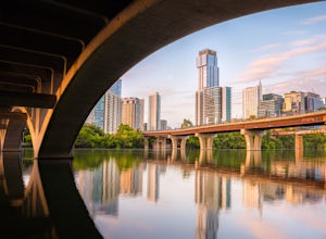
Hike along Lady Bird Hike & Bike Trail
10 miThe Hike and Bike Trail around Lady Bird Lake provides great views of the city skyline from several different perspectives. It's perfect for exercising or just taking a stroll on. It's about a 10 mile looping trail however there are several points in which you can cross the river and make the loo...Read more -
Austin, Texas
Hike the Lower Bull Creek Greenbelt Trail
5.02.86 mi / 78 ft gainPark in the lot off of Lakewood Drive (see map) to access the trail. This trail is good for all skill levels and is dog-friendly.Read more -
Austin, Texas
Hike the Shoal Creek Trail
5.05.47 mi / 173 ft gainThe Shoal Creek trail is located along the Shoal Creek Greenbelt which stretches the length of central/downtown Austin. It is a 5.4 mile out-and-back trail following along Shoal Creek. Much of the trail runs through residential area. And though it runs parallel to a creek, itis a city trail and n...Read more -
Austin, Texas
Hike Valburn South Loop
1.02.3 mi / 334 ft gainThe Valburn South Loop is a 2.3 mile loop trail within the Bull Creek Greenbelt in Northwest Austin, Texas. The trail is known for its grand views of the surrounding Hill Country. The trail is shaded for the most part and is pretty rocky, good shoes are highly recommended. The trail is made up of...Read more -
San Antonio, Texas
Government Canyon Loop
12.73 mi / 1240 ft gainThe Government Loop is a ~12.75 mile trail that is great for intermediate-advanced hikers who want a longer loop. The trail winds through a beautiful forest and is shared with mountain bikers and trail runners. The trail is open year-round and allows dogs.Read more -
Austin, Texas
St. Edwards Park Yellow & Blue Trails
4.71.24 miSt. Edwards Park offers 2 main trails taking you along a creek, up hill trails with gorgeous views from atop a bluff, through exposed meadows filled with prairie grasses and cacti, and to a small swimming hole with a rope swing. The Creek Trail is a much easier, family friendly hike compared to ...Read more -
Austin, Texas
Hike the Bull Creek Loop
4 mi / 100 ft gainPart park, part preserve, St. Edwards Park is not too well known, even among long time Austin residents. It's hidden away on old Spicewood Springs Road, beyond the Loop 360 boundary beyond which most people do not venture. The park consists of two parts, one park and one preserve. The portion of ...Read more -
Austin, Texas
University of Texas Walk
2.99 mi / 197 ft gainThe University of Texas Walk is about a 3-mile loop trail around the University of Texas at Austin. Beginning at the LBJ Presidential Library, the trail loops around all of UT's most prominent landmarks, including the LBJ fountain, the Blanton Museum of Art and of course the renowned school tower...Read more -
Austin, Texas
Hike Lost Trail
1.5 mi / 52 ft gainLost Trail is a 1.3 mile loop hike through the Upper Bull Creek Greenbelt in northwest Austin, Texas. The trail features a beautiful waterfall, an abundance of wildlife and wildflowers, several benches, and many beautiful scenes. During the wet season, the creek fills up and flows very nicely. T...Read more -
Burnet, Texas
Hike the Inks Lake State Park Trail
4.04.7 mi / 347 ft gainThe Inks Lake State Park Trail is a 4.7 mile loop trail located within Inks Lake State Park, just outside of Burnet, Texas. Only a small portion of the trail follows the lake, then it veers off through the rocky and hilly terrain of the Texas Hill Country. The trail is only partially shaded at ti...Read more -
Austin, Texas
Hike Mueller Park Trail
4.02.6 mi / 78 ft gainThe Mueller Park Trails total a distance of 5 miles with a 2.6 mile loop hike that takes you by some waterfalls located in Austin, TX. You can wander around Mueller Lake or the pond in Southwest Greenway, where man-made waterfalls can be viewed, or both! In addition to the waterfalls, the Southwe...Read more -
Cedar Park, Texas
Hike the Brushy Creek Regional Trail
4.56.5 mi / 85 ft gainPark in the big lot off E Little Elm Trail Road (see map) to access the trailhead. Trail is accessible year round and is dog-friendly.Read more -
San Antonio, Texas
Hike through Tom Slick Community Park
5.01.19 mi / 19 ft gainThe trail runs alongside a river and is primarily used for hiking, walking, and trail running. Dogs are welcome on this trail. There is a pond in the middle of the loop trail, and the park has playgrounds for dogs and for kids.Read more -
Austin, Texas
Hike Walnut Creek Metro Loop
4.08.8 mi / 534 ft gainWalnut Creek Metro Loop is an 8.8 mile loop hike located within Walnut Creek Metro Park in north Austin, Texas. The trail is moderately hiked and relatively easy. It's great for walking/running/cycling. There are many smaller trails that connect portions of the main loop and it's easy to get conf...Read more

