Blanco, Texas
Looking for the best running in Blanco? We've got you covered with the top trails, trips, hiking, backpacking, camping and more around Blanco. The detailed guides, photos, and reviews are all submitted by the Outbound community.
Top Running Spots in and near Blanco
-
San Antonio, Texas
Main Loop to Restoration Way Trail
5.63 mi / 958 ft gainMain Loop to Restoration Way Trail is a ~5.6 mile loop hike located in Northwest San Antonio within Friedrich Park. Portions of the trail are paved, however this particular loop is not recommended for those that have mobility limitations because of the more strenuous inclines. This trail is prim...Read more -
San Antonio, Texas
Hike the Main Loop to Vista Loop to Fern Del Trail
2.6 mi / 308 ft gainThe Main Loop to Vista Loop to Fern Del Trail is a 2.4 mile loop trail located in Northwest San Antonio within Friedrich Park. Portions of the trail are paved, however this particular loop is not recommended for those that have mobility limitations because of the more strenuous inclines. This tr...Read more -
San Antonio, Texas
Hike the Hillview Nature Trail
2.9 mi / 285 ft gainThe Hillview Nature Trail is a 2.9 mile loop hike located in Northwest San Antonio within Eisenhower Park. This trail is extremely heavily trafficked. This is a very family friendly park. There is a playground at the entrance of the trail and an educational area. The park is known for its attrac...Read more -
San Antonio, Texas
Yucca And Hillview Nature Trail Loop South
3.41 mi / 230 ft gainYucca and Hillview Nature Trail Loop South is a 3.4 mile loop hike located in Northwest San Antonio within Eisenhower Park. This is a very family friendly park. There is a playground at the entrance of the trail and an educational area. The park is known for its attraction of wildlife and natur...Read more -
San Antonio, Texas
Yucca And Hillview Nature Trail Loop North
2.44 mi / 223 ft gainThe Yucca and Hillview Nature Trail Loop North is a 2.4 mile loop hike located in Northwest San Antonio within Eisenhower Park. This is a very family friendly park. There is a playground at the entrance of the trail and an educational area. The park is known for its attraction of wildlife and n...Read more -
Austin, Texas
Take a Stroll on the Dick Nichols Park Trail
1.09 mi / 16 ft gainThe Dick Nichols Park Trail is a 1 mile loop neighborhood park trail located in Southwest Austin. The trail is completely flat and is entirely paved. It circles the park and is equally shaded and exposed. It's very kid-friendly and perfect for walking the dog, biking, trail running, hiking, and e...Read more -
Austin, Texas
Hike the Western Oaks Trail
1.74 mi / 49 ft gainThe Western Oaks Trail is a 1.7 mile trail located in the Legend Oaks neighborhood in Southwest Austin, Texas. The trail is looping however there are several interconnecting trails which can shorten or lengthen the duration of the hike. The trail is mostly flat and made of crushed gravel. It is p...Read more -
Austin, Texas
Stephenson Preserve Loop
2.17 mi / 243 ft gainThe Stevenson Preserve Trail is a 1.5 mile loop hike located in South Austin. The outer trail makes a large loop around the entire park, however there are several interconnecting trails within the loop. This trail system is part of the Stephenson Preserve, which is also connected to the Longview ...Read more -
Austin, Texas
Hike Mary Moore Searight Park Trail
2.1 mi / 65 ft gainThe outer loop trail at Mary Moore Searight park is 2.1 miles and is interconnected by several smaller trails, which can be used to shorten the length of the hike. The trail is relatively easy with very few inclines and declines. The trail is mostly very thin crushed gravel and great for an easy ...Read more -
San Antonio, Texas
Hike the Mud Creek Loop at McAllister Park
1.5 mi / 181 ft gainI love McAllister Park. Sure it can get a little stinky after the torrential Texas rains sweep through, but on a clear, dry day you can always find a new and LOVELY trail. The Mud Creek Loop (or the Green Loop) is a 1.5 mile dirt trail used by hikers and mountain bikers. The trail itself is rela...Read more -
Travis County, Texas
Hike Violet Crown Trail: Zilker to 360 Trailhead
3.03.7 mi / 282 ft gainThe Violet Crown Trail: Zilker to 360 is 3.7 mile out-and-back stretch through the Barton Creek Greenbelt. The trail begins in Zilker Park and follows Barton Creek all the way south to Loop 360. Parking can be found at Zilker Park. Though on weekends and during the summer time, the park is usuall...Read more -
Austin, Texas
Hike Hill of Life Hiking Trail
4.53.1 mi / 328 ft gainThe Hill of Life hiking trail is an out-and-back hiking trail around 3 miles long total. Parking is parallel parking on the street and can be found in the neighborhood where the trailhead is located. The trail begins with a half mile descent down a very rocky and gravel-ridden trail. The descent ...Read more -
Austin, United States
Riverplace Nature Trail
4.45.41 mi / 768 ft gainThis is a great trail to get some exercise close to downtown Austin, Texas. The trail at Natural Preserve at River Place is well maintained and has stairs and plenty of elevation gain to make your legs a little wobbly by the time you get back to your car. The trail is a 5.5-mile out-and-back hike...Read more -
Austin, Texas
Three Falls Hike
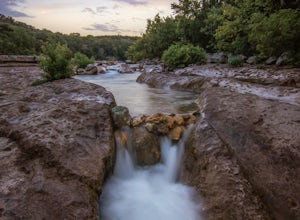
7.35 mi / 600 ft gainThe Three Falls Hike is a 7.35 mile out and back hike located in the Barton Creek Greenbelt in Austin, Texas. The hike is heavily trafficked. The trail takes you past three waterfalls, which during the summer time serve as extremely popular swimming holes. Please note that the flow of the waterf...Read more -
Austin, Texas
Hike the Violet Crown Trail: 360 to 290 Trailhead
1.8 mi / 239 ft gainThe Violet Crown Trail: 360 Trailhead to 290 trail is a 1.8 mile point-to-point hike that stretches from Loop 360 to Highway 290. Only a portion of the trail follows alongside Barton Creek before heading south towards HWY 290 while the creek veers off to the west. Dogs are more than welcome as lo...Read more -
Austin, Texas
Hike Barton Greenbelt Trail Via Barton Creek Plaza
6.6 mi / 380 ft gainThe Barton Greenbelt Trail via Barton Creek Plaza is a 6.6 mile out-and-back hike located within the Barton Creek Greenbelt. This trail follows along the creek and features a couple prominent waterfalls that also serve as popular swimming holes in the summer months. Depending on the rainfall for ...Read more

