Walland, Tennessee
Top Spots in and near Walland
-
Cosby, Tennessee
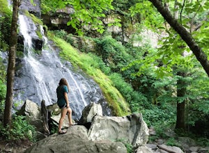
Hike to Hen Wallow Falls in Great Smoky Mountains NP
5.04.57 miStart your adventure by parking in the Cosby Picnic Area Parking Lot near the entrance of the Cosby Campground. (127 Cosby Picnic Area Rd, Cosby, TN 37722.) Then backtrack through the parking lot about 100 yards until you see the sign marking the start of Gabes Mountain Trail. The trek to Hen W...Read more -
Cosby, Tennessee
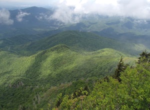
Hike to the Mount Cammerer Lookout Tower
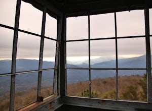
4.510.99 mi / 3040 ft gainMost visitors have a vision of how they'd like to see Great Smoky Mountains National Park, and it typically involves climbing to the top of a mountain like 4,928-foot Mount Cammerer. This is a very strenuous hike involving a breathtaking amount of elevation gain along the rugged Low Gap and Appal...Read more -
Oak Ridge, Tennessee
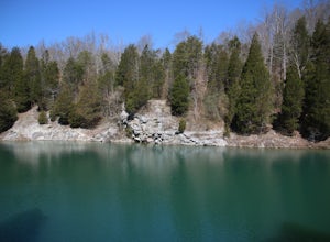
Hike to North Boundary Quarry
5.01 mi / 100 ft gainThe parking at the trailhead is right off of the Oak Ridge turnpike so its very easy to park and there are plenty of spots to park. The trail is very wide and is a great place for taking kids and riding your bike. There are more than one trail that you can take to get to the quarry from the trail...Read more -
Franklin, North Carolina
Wesser Bald Fire Tower
4.72.36 mi / 807 ft gainThe road leading to the trailhead is rough the last mile, but doable in any car. Just make sure to take it easy going up and be careful, especially if there has been any rain or snow. You will have reached the parking area for the hike once you see a large green Appalachian trail sign and a few...Read more -
Tellico Plains, Tennessee
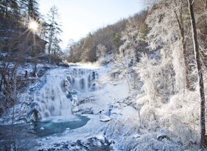
Exploring Bald River Falls
4.8If you're looking to check out a secnic waterfall in East Tennessee, Bald River Falls is sure to be on your list. At 90 feet, you can't miss this roaring beauty during any season. Also, Tellico Plains is an awesome mountain town in itself; check it out before or after your hike.To get to Bald Riv...Read more -
Bureau of Indian Affairs Highway 506, North Carolina
Barrett Knob Fire Tower
5.01.21 mi / 400 ft gainYour hike will start at the base of the Blue Ridge Parkway just a few miles from the start in Cherokee. The trail starts right off of the parkway in a very small easy to miss dirt road. There is a small area to park that then you start your hike up the dirt road right after the gate. The hike to ...Read more -
Rutledge, Tennessee
Buffalo Creek Falls
5.0Buffalo Creek is located near Rutledge, Tennessee and Cherokee lake. It is a wilderness area with a fish hatchery run by TWRA and a few acres of game land. You can drive straight up to the falls then hike around a little bit through the river to see the rest of the river and fishing areas. The be...Read more -
Bryson City, North Carolina
Hike to Alarka Falls
5.01 mi / 100 ft gainTo visit the falls, take US-74 west from Bryson City to exit 64 . Take a left at the exit and drive on Alarka Road for about 10 miles. Follow the road all the way to the end where you will find a turnaround. Don't make the mistake of following the forest service road (it is gated), as it is not ...Read more -
Maynardville, Tennessee
Photograph the Maynardville Fire Tower
3.5The maynardville fire tower is one that anyone can go too since you can drive straight to the base of it. From the base however there are about 100 steep stairs to the top. On the way up you will need to be extra careful because it is very old and was never built for safety. When you get to the t...Read more -
Tellico Plains, Tennessee
Drive the Cherohala Skyway National Scenic Byway
5.0The Cherohala Skway is one of the National Scenic byways in America it spans over 43 curvy miles from Tellico Planes, Tennessee to Robbinsville, North Carolina. On the Skyway there are many overlooks ranging elevations from 2000-5200 feet all have beautiful views and different view points. The pa...Read more -
Andersonville, Tennessee
Norris Dam State Park Campground Trail
14.6 mi / 2310 ft gainNorris Dam State Park Campground Trail is a loop trail that takes you by a lake located near Rocky Top, Tennessee.Read more -
Hartford, Tennessee
Whitewater Rafting the Pigeon River
5.0The Pigeon River is a dam controlled river that winds its way through North Carolina and Eastern Tennessee just outside Great Smoky Mountains National Park. The river provides beautiful views as one paddles along via raft or kayak. Cutting through portions of the Pisgah and Cherokee National For...Read more -
Maggie Valley, United States
Hemphill Bald
Hemphill Bald is a quintessential Smoky Mountains vantage point and this moderate loop trail leading to it takes you through beautiful forest and rolling hills. This area is incredible in all seasons - wildflowers in the spring, colorful leaves in the fall, and with bare trees in the winter, the ...Read more -
Sylva, North Carolina
Hike to Cowee Bald Fire Tower
4.4 mi / 400 ft gainThe Cowee Bald Fire Tower is located in the Nantahala National Forest near Bryson City North Carolina. To get there you can either drive almost all the way to the top about .2 miles from the top but to get there you will need to have a 4WD or a higher clearance vehicle to cross a small stream. Ho...Read more -
Newport, Tennessee
Explore Halls Top Fire Tower
4.01 mi / 200 ft gainHalls Top Fire Tower is a special untouched spot in the Cherokee National Forest. The road that leads you into the CNF is known as Halls Top Road just a few miles off of Interstate I-40. This road will take you 4.4 miles to the next turn onto Stone Mountain Road this road is 2.1 miles to the gat...Read more -
Newport, North Carolina
Hike to Mouse Creek Falls
5.04.2 mi / 605 ft gainFollow Big Creek Trail on a moderate climb to this 45-foot waterfall. Around 1.3 miles in, you will begin to hike alongside Big Creek, and shortly afterwards you will pass Midnight Hole, a particularly deep pool. There are a number of other small falls en route. In spring you should see a number ...Read more

