Sylva, North Carolina
Sylva, North Carolina is a great destination for outdoor adventures! From scenic hikes to must-visit attractions, there's something for everyone. For the hikers, the area offers plenty of trails to explore, including the popular Tuckasegee River Trail and the Cullowhee Mountain Trail. For those looking for a more leisurely experience, the area also offers several parks and gardens, such as the Jackson County Park and the Balsam Mountain Preserve. For a truly unique experience, visitors can explore the area's many caves, such as the Bearwallow Mountain Cave and the Big Witch Cave. For a more traditional activity, visitors can take a stroll through the downtown area to explore the many shops and restaurants. No matter what type of activity you're looking for, Sylva, North Carolina has something to offer!
Top Spots in and near Sylva
-
Sylva, North Carolina
Pinnacle in Pinnacle Park
5.05.98 mi / 2142 ft gainHeading out from the parking area, head north on this challenging hike. For the majority of the hike, you'll have a pretty steady uphill charge. There are some flat parts between climbs, so be sure to catch your breath and get some water in during these times. Once you reach the fork, where you'...Read more -
Sylva, North Carolina
Hike to Cowee Bald Fire Tower
4.4 mi / 400 ft gainThe Cowee Bald Fire Tower is located in the Nantahala National Forest near Bryson City North Carolina. To get there you can either drive almost all the way to the top about .2 miles from the top but to get there you will need to have a 4WD or a higher clearance vehicle to cross a small stream. Ho...Read more -
Sylva, North Carolina
Waterrock Knob Trail
5.01 mi / 407 ft gainThe trail begins paved and quickly climbs up into a heavily forested area. Once at a 1/4 of a mile in, you will come to a nice overlook that will give you your first real good view of the surrounding mountains. The trail then continues on, though now unpaved, with great views off to your left as ...Read more -
Sylva, North Carolina
Abandoned Cessna 414A at Waterrock Knob (Removed)
3.71.72 mi / 430 ft gainNOTE: The wreckage has now been removed. Please see the press release on NPS.gov for more details. Ever hiked to an abandoned plane in the middle of the woods? Yeah me neither until I heard of this gem. This is an AWESOME day hike for anyone looking to get outside for a few hours and see some ...Read more -
Cullowhee, North Carolina
Exploring two legendary Cherokee sites: Judaculla Rock and Devil's Courthouse, North Carolina
5.00.9 mi / 258 ft gainJudaculla was an ancient Cherokee spirit being and giant. He ruled in western North Carolina in the traditional Cherokee homeland. Once while chasing some hunters, when he jumped to the ground, his hand hit a rock. You can still see the print on Judaculla Rock. It is the most elaborate piece of r...Read more -
Maggie Valley, North Carolina
Soco Falls
5.00.09 mi / 0 ft gainThis double waterfall is located a mile and half off of the Blue Ridge Parkway in the Cherokee Indian Reservation. From the parking area, it's a short walk down a well-established trail to the viewing area of the falls. For an even closer view of the falls, you can follow a roped, steep path dow...Read more -
Bryson City, North Carolina
Hike to Alarka Falls
5.01 mi / 100 ft gainTo visit the falls, take US-74 west from Bryson City to exit 64 . Take a left at the exit and drive on Alarka Road for about 10 miles. Follow the road all the way to the end where you will find a turnaround. Don't make the mistake of following the forest service road (it is gated), as it is not ...Read more -
Cherokee, North Carolina
Drive the Blue Ridge Parkway from the Southern Terminus
5.0The pinpoint for this particular entrance starts just outside of Cherokee, North Carolina, following the Parkway North. They say the Blue Ridge Parkway is more than just a road, it's a beautiful journey. Start this journey and you will quickly find this to be true. This 469 mile gateway connects...Read more -
Bureau of Indian Affairs Highway 506, North Carolina
Barrett Knob Fire Tower
5.01.21 mi / 400 ft gainYour hike will start at the base of the Blue Ridge Parkway just a few miles from the start in Cherokee. The trail starts right off of the parkway in a very small easy to miss dirt road. There is a small area to park that then you start your hike up the dirt road right after the gate. The hike to ...Read more -
Tuckasegee, North Carolina
Paddling The Slab and Eternity Hole
5.0The Slab and Eternity hole, located on the East Fork of the Tuckasegee River, are two of Western, NC's best play spots for kayakers of all levels. Paddle down only yards from the public boat launch to The Slab where you can perfect your surfing in kayak, SUP, or whatever boat you float. A few hun...Read more -
Cherokee, North Carolina
Mingo Falls
4.20.22 mi / 148 ft gainAlthough it is not much of a hike at just 0.3 miles, it is accessible to people of all fitness levels. A climb up a series of stairs leads you to a trail overlooking Mingo creek. You will then find a 20 foot wide bridge which serves as the viewing platform of the falls. If you care to advent...Read more -
Tuckasegee, North Carolina
Hike to Cedar Cliff Rock
2.4 mi / 830 ft gainCedar Cliff Rock is one of those local places that exemplifies the Blue Ridge mountains oh-so-well. From the top you can see the Tuckaseegee River along with both Cedar Cliff and Bear Creek Reservoirs. While there are a few homes in between, much of the view is untouched, allowing a big mountain ...Read more -
Cullowhee, North Carolina
Hike to High Falls
3.51.5 mi / 600 ft gainThis is an awesome hike if you're up for a challenge! The hike in isn't bad at all and the trail itself isn't super long but the climb back out will be a little more difficult due to the rock steps and lengthy uphill. This hike starts from a parking lot, just across the road from Lake Glenville a...Read more -
Bryson City, North Carolina
Deep Creek to Clingmans Dome Loop
32.82 mi / 7400 ft gainThis is a ~36 mile loop that goes up Clingman's Dome (the tallest point in Tennessee). Pretty challenging, not for the novice backpacker. Park at Deep Creek campground in Bryson City, NC. We did it as a 3-day, 2-night camping at sites 53 and 61. As it is a loop it could easily be done in reverse....Read more -
Bryson City, North Carolina
Tom Branch and Indian Creek Falls
4.51.76 miFrom the Deep Creek Trailhead, you can hike to both waterfalls heading up the Deep Creek Trail. You will come across Tom Branch Falls quickly, after 0.2 miles. Once you've had your fill of Tom Branch, head further along the Deep Creek Trail for another 0.5 miles. Turn right on the Indian Creek Tr...Read more -
Bryson City, North Carolina
Hike the Juney Whank Falls Loop
4.00.65 mi / 150 ft gainStarting at the Deep Creek Trailhead, take a short walk until the trail meets up with Juney Whank Falls Trail. From here, hang a left and head onto the Juney Whank Falls Trail. Once you've reached the falls, continue the loop to get back to the trailhead. The falls are said to be named after Mr...Read more
Top Activities
Camping and Lodging in Sylva
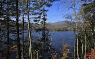
Cheoah Point Cabin 1
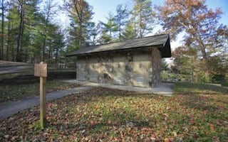
Cheoah Point Cabin 2

Cherokee / Great Smokies KOA Holiday
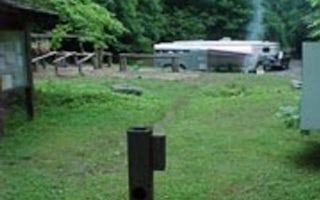
Tow String Horse Camp
Deep Creek Group Camp
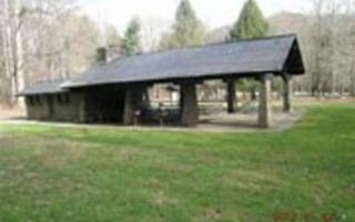
Deep Creek Picnic Pavilion


