Townsend, Tennessee
Looking for the best photography in Townsend? We've got you covered with the top trails, trips, hiking, backpacking, camping and more around Townsend. The detailed guides, photos, and reviews are all submitted by the Outbound community.
Top Photography Spots in and near Townsend
-
Tellico Plains, Tennessee
Drive the Cherohala Skyway National Scenic Byway
5.0The Cherohala Skway is one of the National Scenic byways in America it spans over 43 curvy miles from Tellico Planes, Tennessee to Robbinsville, North Carolina. On the Skyway there are many overlooks ranging elevations from 2000-5200 feet all have beautiful views and different view points. The pa...Read more -
Sylva, North Carolina
Hike to Cowee Bald Fire Tower
4.4 mi / 400 ft gainThe Cowee Bald Fire Tower is located in the Nantahala National Forest near Bryson City North Carolina. To get there you can either drive almost all the way to the top about .2 miles from the top but to get there you will need to have a 4WD or a higher clearance vehicle to cross a small stream. Ho...Read more -
Oak Ridge, Tennessee
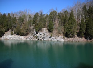
Hike to North Boundary Quarry
5.01 mi / 100 ft gainThe parking at the trailhead is right off of the Oak Ridge turnpike so its very easy to park and there are plenty of spots to park. The trail is very wide and is a great place for taking kids and riding your bike. There are more than one trail that you can take to get to the quarry from the trail...Read more -
Franklin, North Carolina
Photograph Wayah Bald Lookout Tower
0.1 mi / 0 ft gainThe Wayah Bald Lookout Tower is located in Nantahala National Forest in one of the oldest part of the protected land. It was first built in the 1920s then it was rebuilt throughout the years until it was finally made out of stone and concrete. The current tower that stands offers great views of t...Read more -
Maggie Valley, United States
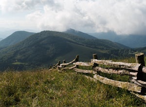
Hemphill Bald
Hemphill Bald is a quintessential Smoky Mountains vantage point and this moderate loop trail leading to it takes you through beautiful forest and rolling hills. This area is incredible in all seasons - wildflowers in the spring, colorful leaves in the fall, and with bare trees in the winter, the ...Read more -
Maggie Valley, North Carolina
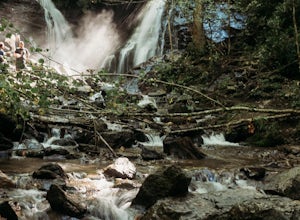
Soco Falls
5.00.09 mi / 0 ft gainThis double waterfall is located a mile and half off of the Blue Ridge Parkway in the Cherokee Indian Reservation. From the parking area, it's a short walk down a well-established trail to the viewing area of the falls. For an even closer view of the falls, you can follow a roped, steep path dow...Read more -
Franklin, North Carolina
Siler Bald from Wayah Gap
5.03.66 mi / 1060 ft gainThe Appalachian Trail does not need a lot of hype beyond its existing legendary status. However, there are certain parts of it that do stand out as being a little extra special. Siler Bald is one of those spots. A large clearing starting from Snowbird Gap and going all the way up to Siler Bald...Read more -
Hartford, Tennessee
Whitewater Rafting the Pigeon River
5.0The Pigeon River is a dam controlled river that winds its way through North Carolina and Eastern Tennessee just outside Great Smoky Mountains National Park. The river provides beautiful views as one paddles along via raft or kayak. Cutting through portions of the Pisgah and Cherokee National For...Read more -
Tellico Plains, Tennessee
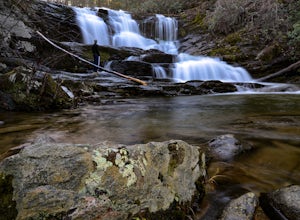
Hike to Conasauga Falls
4.51.5 mi / 400 ft gainGetting to the trailhead can be a challenge if there has been any heavy precipitation or icy conditions due to the fact the last two miles are one mile of broken pavement and the last mile a dirt road. You should be fine in good conditions in any car; however, just make sure to take it easy on th...Read more -
Rutledge, Tennessee
Buffalo Creek Falls
5.0Buffalo Creek is located near Rutledge, Tennessee and Cherokee lake. It is a wilderness area with a fish hatchery run by TWRA and a few acres of game land. You can drive straight up to the falls then hike around a little bit through the river to see the rest of the river and fishing areas. The be...Read more -
Newport, Tennessee
Explore Halls Top Fire Tower
4.01 mi / 200 ft gainHalls Top Fire Tower is a special untouched spot in the Cherokee National Forest. The road that leads you into the CNF is known as Halls Top Road just a few miles off of Interstate I-40. This road will take you 4.4 miles to the next turn onto Stone Mountain Road this road is 2.1 miles to the gat...Read more -
Newport, North Carolina
Hike to Mouse Creek Falls
5.04.2 mi / 605 ft gainFollow Big Creek Trail on a moderate climb to this 45-foot waterfall. Around 1.3 miles in, you will begin to hike alongside Big Creek, and shortly afterwards you will pass Midnight Hole, a particularly deep pool. There are a number of other small falls en route. In spring you should see a number ...Read more -
Sylva, North Carolina
Abandoned Cessna 414A at Waterrock Knob (Removed)
3.71.72 mi / 430 ft gainNOTE: The wreckage has now been removed. Please see the press release on NPS.gov for more details. Ever hiked to an abandoned plane in the middle of the woods? Yeah me neither until I heard of this gem. This is an AWESOME day hike for anyone looking to get outside for a few hours and see some ...Read more -
Sylva, North Carolina
Waterrock Knob Trail
5.01 mi / 407 ft gainThe trail begins paved and quickly climbs up into a heavily forested area. Once at a 1/4 of a mile in, you will come to a nice overlook that will give you your first real good view of the surrounding mountains. The trail then continues on, though now unpaved, with great views off to your left as ...Read more -
Maynardville, Tennessee
Photograph the Maynardville Fire Tower
3.5The maynardville fire tower is one that anyone can go too since you can drive straight to the base of it. From the base however there are about 100 steep stairs to the top. On the way up you will need to be extra careful because it is very old and was never built for safety. When you get to the t...Read more -
Waynesville, North Carolina
Explore Cataloochee Valley
5.0History, solitude and wildlife abound in this quiet corner of Great Smoky Mountains National Park, but getting here is not easy. Take the scenic route via Cove Creek Road from Cosby, TN. Drive 40 miles along the twisting, gravel road to Cataloochee, NC. The scenery along the way is outstanding, b...Read more


