Palmer, Tennessee
Top Spots in and near Palmer
-
Gruetli-Laager, Tennessee
Hike to Suter and Horsepound Falls
4.06 mi / 1794 ft gainLocated in South Cumberland State Park in the Savage Gulf section, this is a somewhat difficult 5 mile out-and-back viewing two waterfalls, cascades, creeks, rock shelters, and high bluffs. 2 miles past Suter Falls you'll come to Horsepound Falls, a unique waterfall formation with overlooks and l...Read more -
Palmer, Tennessee
Hike the North Plateau-North Rim Loop at Savage Gulf
4.014.7 mi / 2483 ft gainFrom the Savage Ranger Station, take the Savage Day Loop for roughly 2.2 miles until you reach the junction. From there take the North Plateau trail and return on the North Rim trail. The elevation gain on this trail is rather gradual and and subtle, but it is a long trek that requires endurance ...Read more -
Palmer, Tennessee
Savage Falls Trail
5.02.98 mi / 495 ft gainSavage Gulf Natural Area has more than 50 miles of trails, so be sure to start this adventure from the Savage Gulf Ranger Station entrance. To the right of the building, you'll find the trailhead for the Savage Day Loop. There, you can begin the 1.8-mile journey to the park's more-secluded waterf...Read more -
Beersheba Springs, Tennessee
Hike to Stone Door and Alum Gap Campground
6.8 mi / 825 ft gainThis is a fun and easy overnight trip that is good for all ages. Start at the Stone Door Ranger Station which has plenty of parking and public restrooms as well. Follow the signs to the Stone Door Trailhead and in a short 0.8 miles you'll arrive at the edge of the gulf (canyon) and the first sign...Read more -
Altamont, Tennessee
Hike the Falls Loop Trail in South Cumberland State Park
4.53.2 mi / 500 ft gainNestled in the Savage Gulf State Natural Area, the popular Falls Loop Trail begins across from the Greeter Falls parking lot. At 0.4 miles into the hike you'll reach a fork in the trail, take the left route towards Boardtree Falls. Right before reaching the waterfall you'll come upon a suspension...Read more -
Altamont, Tennessee
Greeter Falls and Blue Hole
4.91.79 mi / 417 ft gainAn easy, yet extremely beautiful and well marked drive leads to a pretty sizable parking lot at the trailhead. There are multiple trails to hike, depending on how much time you have or how long you want to hike. This particular trail makes for a perfect day trip from Nashville, Chattanooga or Kno...Read more -
Tracy City, Tennessee
Firey Gizzard, Dog Hole and Ravens Point
5.08.42 mi / 1302 ft gainFirey Gizzard, Dog Hole and Ravens Point is an out-and-back trail that takes you by a waterfall located near Tracy City, Tennessee.Read more -
Tracy City, Tennessee
Sycamore Falls
4.52.18 mi / 236 ft gainSycamore Falls is located in the Fiery Gizzard region of South Cumberland State Park. The trailhead is located just past Tracy City Elementary School on Fiery Gizzard Road. There is a large parking lot with restrooms at the trailhead. Start your hike at the south end of the parking lot. This ...Read more -
Tracy City, Tennessee
Hike the Fiery Gizzard Trail
5.013.5 miStart this journey from the Grundy Forest Trailhead, where you will quickly begin a decent along the Little Fiery Gizzard Creek. At the 0.7-mile split, be sure to turn left and cross the bridge to stay on the Fiery Gizzard Trail. For the next 0.8-mile journey, you'll encounter the gorgeous Black ...Read more -
Sequatchie, Tennessee
Foster Falls Loop
4.62.19 mi / 574 ft gainFoster Falls State Park is part of the South Cumberland State Park system. A short 45 minute drive from Chattanooga, Foster Falls boasts a stunning 60 foot waterfall that is worth visiting during any season of the year. The trailhead for this 2 mile hike starts from the Foster Falls parking lot a...Read more -
Sequatchie, Tennessee
Climb Gravity Boots and After Burner
Foster Falls State Park is a sport climber's paradise, with most climbs tailored to advanced and expert climbers. Gravity Boots and After Burner are two climbs found on the Rocket Slab which is a standalone piece of rock to the left of the Sanford Wall. Both climbs run about 40'-50' and are bol...Read more -
Sequatchie, Tennessee
Climb at Foster Falls SP
5.04.5 miFoster Falls will suit any climber. A novice climber can find routes here, and an expert can find new and exciting projects. There are a few camping sites near the climbing area. Father Adams which is a primitive spot, and Foster Falls campground which has a shower and toilets (around $16 a night...Read more -
Chattanooga, Tennessee
Snoopers Rock Trail
5.05.79 mi / 1339 ft gainSnoopers Rock Trail is an out-and-back trail that takes you by a river located near Chattanooga, Tennessee.Read more -
Chattanooga, Tennessee
Photograph Snoopers Rock
5.0To hit one of the best panoramic views of the Tennessee River Gorge, head into Prentice Cooper State Forest and head straight for Snoopers Rock. This 6,000+ acre protected park is home to over 35 miles of trails, campsites, and so much more.To access Snoopers Rock, you can drive through Prentice ...Read more -
Signal Mountain, Tennessee
Hike to Rainbow Falls
4.75.7 mi / 1500 ft gainMost Rainbow Lake Trail hikers have seen or heard the majestic Rainbow Falls, but fewer have ventured down the treacherous path to the falls themselves. Albeit a bit daunting, especially if there has been recent rain, the path from Rainbow Lake Trail down to Rainbow Falls is a rewarding trek for ...Read more -
Chattanooga, Tennessee
Hike to Middle Creek Falls
3.50.5 miMiddle Creek Falls, despite its proximity to the Cumberland Trail hikes, has no official designated trail. However, there is a pull-off on Suck Creek Road (informally marked by graffiti and bumper stickers adorning the guard rail) with room on either side of the street to park. The trail begins ...Read more
Top Activities
Camping and Lodging in Palmer

Trenton, Georgia
Lookout Mountain / Chattanooga West KOA Holiday
This quiet, secluded campground is the KOA closest to Lookout Mountain and many attractions: Ruby Falls, Rock City and the Incline Railwa...

McDonald, Tennessee
Chattanooga North / Cleveland KOA Journey
Chattanooga North/Cleveland KOA is located amid rolling hills between the Cum-berland Plateau and the Appalachians. Looking to sample the...

Sparta, Tennessee
Ragland Bottom
Overview
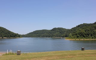
Ragland Bottom Campground is located on the shores of the scenic Center Hill Lake on central Tennessee's Highland Rim. The lake ...

Silver Point, Tennessee
Hurricane Bridge
Overview
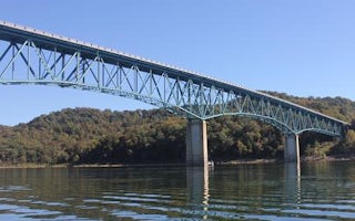
Hurricane Bridge Recreation Area is located on the shores of the scenic Center Hill Lake on central Tennessee's Highland Rim. Th...

Smithville, Tennessee
Floating Mill Park
Overview
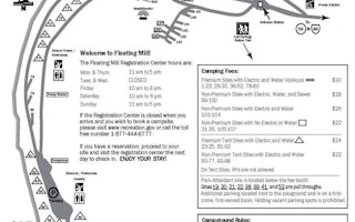
Floating Mill Park is located on the shores of the scenic Center Hill Lake on central Tennessee's Highland Rim. The lake stretch...


