Clarksville, Tennessee
Looking for the best hiking in Clarksville? We've got you covered with the top trails, trips, hiking, backpacking, camping and more around Clarksville. The detailed guides, photos, and reviews are all submitted by the Outbound community.
Top Hiking Spots in and near Clarksville
-
Clarksville, Tennessee
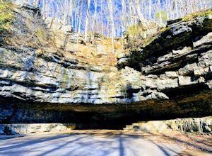
Explore Dunbar Cave State Park
5.00.5 mi / 16 ft gainDunbar Cave is located 60 minutes northwest of Nashville in Clarksville, TN. Dunbar Cave is the most prominent of several caves located in this designated natural area. In the entrance of the cave, square dances, radio shows, and big band era concerts were once held. Archeologists have found that...Read more -
Adams, Tennessee
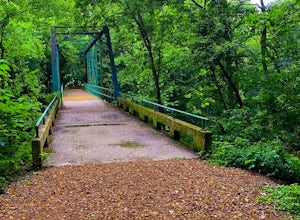
Port Royal State Historic Park
0.5 miThe town of Port Royal was established in 1797, one year after Tennessee became a state. This was a major port for flat boats transporting of tobacco and other goods. The Red River was the life blood of the entire region. Today, the park encompassing 30 acres, preserves and provides recreation ...Read more -
Dover, Tennessee
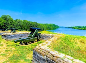
Hike the Fort Donelson Battlefield Loop Trail
3.4 mi / 465 ft gainOn this relativity easy trail, you will travel along the hand made trenches dug by Confederate Soldiers that protected Fort Donelson and the lower Cumberland River. Then you will pass a monument for the veterans who fought a bloody battle here. Afterwards, the trail will head towards the shorelin...Read more -
Kingston Springs, Tennessee
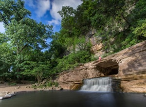
Narrows of the Harpeth
4.61 mi / 148 ft gainThe Harpeth River State Park has a handful of good trails to hike at the park. One of those trails includes the Bluff Overlook trail. That post can be read here. There are two trails leading to the tunnel waterfall. One is the tunnel trail that's connected to the Bluff Overlook trail. It is only ...Read more -
Kingston Springs, Tennessee
Bluff Overlook Trail
4.50.48 mi / 49 ft gainFrom the parking lot, walk up the same road the direction you entered. Just a little up the hill to the left, you will see the trailhead for the Bluff Overlook. It's only about a 0.25 mile hike, but the initial walk up the hill is steep. Once you reach the top, there are several points to sit and...Read more -
Burns, Tennessee
Backcountry Camp at the Wildcat Shelter
2.8 miStart this adventure by retrieving your backcountry camping permit from the park office. There is no option to reserve a campsite online, so give the staff a call and they'll have it ready upon your arrival. From the office, turn left as if you're exiting the park. Before exiting, turn right into...Read more -
Nashville, Tennessee
Hike the Trails at Fontanel
3.52.5 mi / 229 ft gainThe trailhead is located across from the Woods at Fontanel Music Venue, with the trail leading up and over the ridge behind the Fontanel Mansion and back down by the Woods at Fontanel VIP seating area. Keep in mind that the trails also connect to a mile of paved Metro Parks Greenway for foot and ...Read more -
Dover, Tennessee
Explore the 1850's Homeplace of Land Between the Lakes
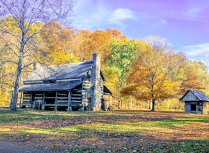
0.75 mi / 11 ft gainThe Homeplace 1850s Working Farm and Living History Museum is an interactive museum of a mid-19th-century two-generation farm. It is a working farm, which means the employees and volunteers work the farm much the way it was worked back in time. The farm includes restored buildings, livestock, fie...Read more -
Dover, Tennessee
Piney Campground
1.91 mi / 148 ft gainPiney Campground is a loop trail where you may see beautiful wildflowers located near Dover, Tennessee.Read more -
Nashville, Tennessee
Mossy Ridge Trail
4.64.5 mi / 781 ft gainThe Mossy Ridge Trail offers scenic views of small waterfalls along this 4.5-mile hike in Percy Warner Park. If you're looking for a little longer hike (add 2 miles), you can start at the Nature Center and use the connector trails to join the main loop. This loop is dog friendly on-leash.Read more -
Cadiz, Kentucky
Kayak Energy Lake
Before going to the Land Between the Lakes National Recreation Area I had heard numerous people explain how peaceful and beautiful the area was, and how empty the lake was dependent on the season. These rave reviews called for a road trip and a 5 day stay in August, which fittingly happened in an...Read more -
Franklin, Tennessee
Timberland Park Nature Trail
4.01.07 mi / 118 ft gainTimberland Park Nature Trail is a loop trail where you may see local wildlife located near Fairview, Tennessee.Read more -
Nashville, Tennessee
Hike around Radnor Lake
4.02.6 miIf you want a break from the city, take an early morning hike around Radnor Lake. Start this quiet trek by arriving at sunrise to snag a parking spot at the East Parking Lot. Walk down Otter Creek Road until you see the Lake Trail on the right. From there, enjoy a 1.4 mile scenic hike through the...Read more -
Eddyville, Kentucky
Hike Hematite Lake
4.02.4 mi / 111 ft gainThe Hematite Trail is a great loop for hikers and trail runners located in the heart of Land Between the Lakes Wilderness. Beginning your hike near the picnic grounds adjacent to the Nature Station, this hike is great year round and is good for all skill levels, including families. From awesome l...Read more

