Bethlehem, Pennsylvania
Looking for the best hiking in Bethlehem? We've got you covered with the top trails, trips, hiking, backpacking, camping and more around Bethlehem. The detailed guides, photos, and reviews are all submitted by the Outbound community.
Top Hiking Spots in and near Bethlehem
-
Phillipsburg, New Jersey
Marble Hill Ice Cave via Warren-Highlands Trail
3.01.89 mi / 371 ft gainMarble Hill Ice Cave via Warren-Highlands Trail is a loop trail that takes you by a river located near Phillipsburg, New Jersey.Read more -
Nazareth, Pennsylvania
Hike the Henry's Woods Loop in Jacobsburg State Park
5.01.9 mi / 200 ft gainOnly a short drive from the major Pennsylvania cities of Allentown, Bethlehem, and Easton lies Jacobsburg State Park and environmental center. The main feature of the park is most certainly the Henry's Woods loop. Although just under two miles, this trail encompasses a variety of terrain and ol...Read more -
Bloomsbury, New Jersey
Hiking in Musconetcong Gorge Preserve
3.3Start out on Ridge Trail (yellow blazes), found at the rear of the parking lot. Shortly, you will come to a stream crossing, followed by a set of wooden steps. Just before the next stream, turn left following the white blazes. This section of the trail makes a moderately rocky descent, as it foll...Read more -
Walnutport, Pennsylvania
Lehigh Gap via Appalachian Trail
4.52.15 mi / 817 ft gainLehigh Gap was formed by the Lehigh River carving a large hole in the foothills of the Appalachian Mountains. One side is owned and operated by the Lehigh Gap Nature Center and has some great hikes, but this side is government-owned. Parking for this portion of the Appalachian Travel is up a litt...Read more -
Washington, New Jersey
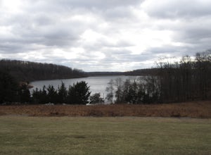
Merrill Creek Reservoir Perimeter Trail
4.05.33 mi / 371 ft gainMerrill Creek Reservoir Perimeter Trail is a loop trail that takes you by a lake located near Stewartsville, New Jersey.Read more -
Tinicum Township, Pennsylvania
Hike the High Rocks State Park Loop
4.61.5 miHigh Rocks State Park, a section of Ralph Stover State Park, offers visitors some of the best views in Eastern Pennsylvania. Across from the parking lot on Tory Road, you will find the main trailhead. This will lead you to several different trail options, all varying in length, and all bringing y...Read more -
Frenchtown, New Jersey
Hike to the Devil's Tea Table
3.00.5 mi / 20 ft gainApart from the rock, there's more trail to follow for a stunning overview and a great spot to hang out and relax. The view is a must-see, it is so much better in person. The hike is not challenging at all, it is basically a straight trail. Climbing some medium sized rocks might be required, but i...Read more -
Jim Thorpe, Pennsylvania
Hike to Bake Oven Knob
5.00.76 miThe trail is VERY rocky and stepping up the rocks requires proper footwear. From the beginning of the trail, hike until you reach an opening filled with rocks and boulders. Stay to the left of this and you will see the unmarked trail continue. After climbing up this, there is an overlook to the N...Read more -
Lehighton, Pennsylvania
Hike the Falls Trail at Beltzville State Park
4.05.5 miAt the Christman Trailhead, hike a quick, flat 2.5 miles following the yellow trail markers through farm meadows and birch forests to the Falls Trail loop/intersection. Here hike the Falls trail which is a 0.5 mile loop that links back to the 2.5 mile section back to the parking area. Bridges and...Read more -
Stockton, New Jersey
Explore Kugler Woods Waterfall
4.00.5 miDrive 5.2 miles north on Route 29 from the center of Stockton, NJ and you will come across a very small parking lot on the left side of the road. If you park your car there, walk back south on Route 29 about 50 feet, and cross over to the woods-side of the road. There you will find the trailhea...Read more -
Stockton, New Jersey
Hike to the Hidden Lockatong Waterfall
3.72 miIf you're on Kingwood Stockton Road, there will be a dirt road with a Lockatong Nature Preserve sign before it (going north on Kingwood Stockton Road, the sign will be on your left. If you're driving south, the sign will be on your right). Just drive all the way until the end of the dirt road and...Read more -
Jim Thorpe, Pennsylvania
Bike the Lehigh Gorge Trail: Lock #2
4 miIt was a rainy day, which brings along mud (but I think mountain biking is better in the rain and mud anyways).Enter the trail by going through the county parking lot and to the left end under the bridge. The trail starts along the tracks and you can admire the restored old rail cars. Cross ove...Read more -
Jim Thorpe, Pennsylvania
Bike the Switchback Trail around Mauch Chunk Lake Park
5.011 miThe trail entrance can be found by going up Broadway and taking Hill Road to the right at the Opera House. At the top of Hill Road will be the entrance to the trail; there is a nice little wooden sign so you don't miss it. This trail can be hiked or biked; we chose to do some mountain biking.Th...Read more -
Penn Forest Township, Pennsylvania
Tank Hollow Vista
4.03.33 mi / 272 ft gainThis is a simple, short hike to a fantastic vista looking out over the Lehigh River Gorge. The trailhead for the hike to Tank Hollow Vista is along Behrens Road just outside of Jim Thorpe, PA. Most of the hike is on state game lands. If the gate is open from the first lot, you can shorten this h...Read more -
Califon, New Jersey
Explore the Ken Lockwood Gorge
4.3One of New Jerseys best kept secrets has to be the Ken Lockwood Gorge. If you are looking for a relaxing, beautiful, and nature packs place then this area is perfect for you. You can access the gorge from two different points, either by driving down Raritan River Rd. and parking right before you ...Read more -
Jim Thorpe, Pennsylvania
Hike to Glen Onoko Falls
4.64.1 mi / 987 ft gain*Again, this hike is CURRENTLY CLOSEDThere are several WRONG ways to do this trail. Follow these simple instructions to get the most out of all Glen Onoko has to offer: Parking: Parking in the correct location is the most important step to this trail. Beware: typing in Glen Onoko Falls in Google ...Read more

