Gaston, Oregon
Looking for the best hiking in Gaston? We've got you covered with the top trails, trips, hiking, backpacking, camping and more around Gaston. The detailed guides, photos, and reviews are all submitted by the Outbound community.
Top Hiking Spots in and near Gaston
-
Gaston, Oregon
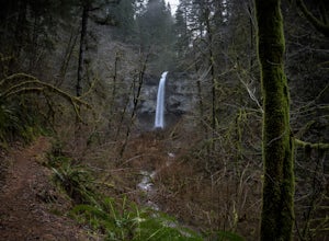
Short Hike to University Falls
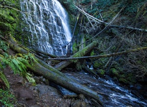
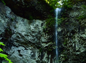
4.00.6 mi / 180 ft gainThe 0.3 mile hike to University Falls seems longer than it is because you'll be stopping to take pictures every step of the way. No, you're not in an enchanted forest, you're in the Tillamook National Forest. The waterfall you're about to find, however, certainly is enchanting.From Portland, head...Read more -
McMinnville, Oregon
Miller Woods
5.03.63 mi / 735 ft gainMiller Woods Trail is a loop trail where you may see beautiful wildflowers located near McMinnville, Oregon.Read more -
McMinnville, Oregon
Hike the Red Trail in Miller Woods
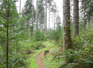
4.04 mi / 400 ft gainLocated three miles west of McMinnville and available for public hiking and activities, Miller Woods is owned and operated by Yamhill SWCD. You may choose different trails to take.From the parking lot the trails are marked by colors to go on the 4.0 mile loop go to the meadow and follow the red m...Read more -
Tillamook, Oregon
Wilson River Trail
3.018.58 mi / 4879 ft gainThis long trail provides hikers with great views of the corridor in the Coast Range. As the trail follows public land for the most part, there are a couple sections with steady elevation gains to avoid private land: near Lees Camp and Ryan Creek. Although the trail receives some of the most rain...Read more -
Tillamook, Oregon
King's Mountain
4.54.47 mi / 2461 ft gainKing's Mountain may be one of the most consistent hikes in the greater Portland area gaining 2,500 vertical-feet over 2.5 miles almost evenly the entire time. The trail starts out at a marked trailhead just west of the Elk Mountain campground (stop there for water and more restrooms in summer &a...Read more -
Timber, Oregon
Hike the Upper Salmonberry River Trail
4.112.5 mi / 1600 ft gainIf you are craving adventure and exploration in a unique hiking setting, then you have come to the right place! This is a hike where every time you turn a corner your eyes light up with excitement and your imagination runs wild. Be forewarned though…if you fear cold, dark, and creepy abandoned tr...Read more -
Beaverton, Oregon
Hike through Tualatin Hills Nature Park
2 miThis is an awesome place to escape to for a workout, or just a walk through the forest! You can make it a short walk, or turn it in to 6+ miles of loops! The one main trail is paved, but it’s not hard to find some single dirt track trails branching off and wandering through the trees, it can make...Read more -
Saint Paul, Oregon
Hike the Champoeg SP Loop
5.03.4 mi / 120 ft gainChampoeg was the first town to be settled in the Willamette Valley and the site of the formation of the first government in the northwest. The park offers historical sites as well as plentiful camping and some short day hikes. I decided to do the Townsite loop with my family on black friday #opto...Read more -
Portland, Oregon
Hiking the Ridge Trail in Forest Park
4.22.75 miThis is a great option for a quick hike when you don't have time to get out of the city but need to satisfy your craving to get outside and escape the noise of bustling Portland. Follow Firelane 7 from the Springville Trailhead up towards Leif Erickson Drive and the Ridge Trail. There are signs a...Read more -
Portland, Oregon
A Quick Escape to Sauvie Island
3.5During those summer days when you’re desperately seeking some sand between your toes, open space to soak up the sun, and nature to play around in…Sauvie Island is calling your name. Located just 10 miles outside of downtown Portland, Sauvie Island offers a convenient rural escape that’s just begg...Read more -
Portland, Oregon
Run the Saltzman Road Trail
4.56 mi / 700 ft gainThis trail is an easy out and back from either the west or east side of Forest Park. The east trailhead is off NW Skyline Blvd, on Saltzman Road, which is a dirt/gravel road like the trail. You'll park near the gates where there aren't No Parking signs up (the land around the trail at this point ...Read more -
Beaver, Oregon
Hike to Niagara Falls, OR
4.04 mi / 800 ft gainGetting There Get onto Highway 101. Between Tillamook and Lincoln City at the town of Beaver, turn east near mile marker 80 onto a paved road toward upper Nestucca River. Follow this scenic road 6.7 miles to the town of Blaine. Stay to the right and drive another 4.8 miles; between mile markers 1...Read more -
Portland, Oregon
Wildwood Trail in Washington Park
5.07.63 mi / 1503 ft gainTake the train to Washington Park and hike through Hoyt Arboretum. This will bypass a few miles of Wildwood Trail, but you won't miss much. In the arboretum, the trail twists and turns through the trees, will smaller trails jutting off to the sides, through other groups of trees (each trail is a...Read more -
Portland, Oregon
Hoyt Arboretum
1.4 mi / 148 ft gainFounded in 1928 to conserve endangered species and educate visitors, Hoyt Arboretum is a 190-acre park in the forest above Portland's NW area. It's only 15 minutes from downtown! There are 12+ miles of trails to explore, my favorite is the Redwood Trail that takes you through towering redwoods a...Read more -
Beaver, Oregon
Hike to Pheasant Creek Falls
4.04 mi / 800 ft gainHike: The hike to Pheasant Creek Falls is just short continuation of nearby Niagara Falls. After reaching Niagara Falls, continue on the trail for about another 300 feet and you'll reach the more impressive, Pheasant Creek Falls.For more detailed information including a trail map and directions ...Read more -
Portland, Oregon
Lower Macleay Park to Pittock Mansion
3.04.7 mi / 965 ft gainLower Macleay Park is one of most easily accessible trailheads in the city, especially during one of Portland’s rare snow years where even driving up to 500 feet of elevation can challenge your car. You can park within the park entrance cul-de-sac, around the intersection of Upshur St. & NW 2...Read more

