Clackamas, Oregon
Top Spots in and near Clackamas
-
Stevenson, Washington
Beacon Rock
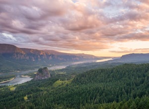
3.61.49 mi / 351 ft gainBeacon Rock is one of the most recognizable landmarks along the Columbia River Gorge. It’s an 848-foot basalt monolith (a singular piece of rock) that was once the core of an ancient volcano. To access the rock, park in a developed parking area at the rock’s base that has room for about 30 cars. ...Read more -
Stevenson, Washington
Hamilton Mountain
4.25.61 mi / 2336 ft gainHamilton Mountain has one of the best views in the Columbia Gorge. The hike starts out with a gradual uphill climb through an old-growth forest. After about a half-mile in you will come to a clearing where you can see the ridge line going up to the top of Hamilton Mountain. From there you'll pass...Read more -
Stevenson, Washington
Hardy and Rodney Falls
4.02.17 mi / 699 ft gainLocated along the Hamilton Mountain Trail, the Hardy and Rodney falls out and back hike is a good alternative for those looking for a shorter hike compared to the 7.6-mile hike to the top of Hamilton Mountain. From the Hamilton Mountain Trailhead, you will follow the trail through thick trees fo...Read more -
Cascade Locks, Oregon
Elowah Falls
4.81.36 mi / 512 ft gainMultnomah Falls, which is about 5 miles from Elowah [along the Historic Columbia River Highway] takes a large portion of the crowd due to its visibility from the highway. With that said, you may get a much more deserted Elowah Falls if you decide to take the short but steep 15-minute hike to it...Read more -
Cascade Locks, Oregon
Upper McCord Creek Falls
4.71.98 mi / 617 ft gainStarting at the John B Yeon Trailhead parking lot, begin to walk into the forest. After a little more than a quarter mile, you will see a fork in the road, with one way leading to Elowah Falls, and the other way leading to Upper McCord Creek Falls. Take the trail leading to Upper McCord Creek. Th...Read more -
Estacada, Oregon
Raft the Wild and Scenic Clackamas River
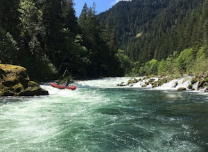
5.0The Wild and Scenic Clackamas River above the North Fork Reservoir is a great destination for paddlers and only about an hour drive from downtown Portland. This popular 13.5 mile section of river lies within the Mt. Hood National Forest and offers continuous class II-III boating with a little cla...Read more -
Rhododendron, Oregon
Frustration Falls
3.08.26 mi / 1854 ft gainThe hike and possible rappel to Frustration Falls begins at the Salmon River trailhead right outside of Welches, Oregon. From the trailhead you follow the trail for about 4 miles at which point you reach Canyon View (Shown in pictures 5-6 above). From the main trail this is the only view of Frust...Read more -
Clackamas County, Oregon
Salmon River Trail
4.54.4 mi / 50 ft gainLargely Flat Trail4.4 Miles roundtripOld Growth ForestRiver Scouting Opportunities There are seven trailheads all off to the right of E. Salmon River Road. All are easily accessible under normal conditions. The hike meanders alongside the river, providing ample opportunities to scout the river's...Read more -
Scotts Mills, Oregon
Abiqua Falls
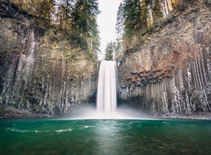
4.90.69 mi / 115 ft gainThis trail is unmarked and a little rough and rugged. The land is privately owned by Mount Angel Abbey, but they don't appear to have problems with courteous hikers. Walking out of the parking area back up the road in the direction you came from, you’ll pass one dirt trail right at the ending of ...Read more -
North Bonneville, Washington
Table Mountain via Aldrich Butte Trailhead
4.716 mi / 3350 ft gainHike up into the forest (take the right path, not the one going left), and follow it all the way until you get to "Carpenter Lake" (which always seems to be just an empty, marshy field). Keep going and do not take the right path at the first Y split off. Instead, stay left, until you come to anot...Read more -
Cascade Locks, Oregon
Wahclella Falls
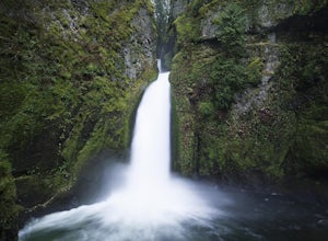
4.71.74 mi / 410 ft gainThis is a very short and fairly easy, 1 mile in – 1 mile out, hike with a little bit of elevation gain. I took my time hiking and enjoying the scenery with the intention of this being a photo heavy trip. When I got to the end I spent at least an hour shooting from every angle I saw fit. Once you ...Read more -
Cascade Locks, Oregon
Munra Point
4.94.12 mi / 1870 ft gainThis trail is temporarily closed. Please visit the Forest Service website for updates to trails in the Columbia River Gorge. This hike starts at the Wahclella Falls trailhead, but does not use that trail. Instead, walk back towards the freeway and take a left onto the Columbia River Highway Tr...Read more -
Cascade Locks, Oregon
Snow Hike to Wahclella Falls
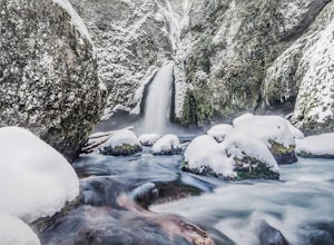
4.02 miThe wooden bridges, Munra Falls, beautiful canyon walls, and the mossy grotto at the end of the canyon itself would be enough of a draw for this hike, but you round the last corner and 65 foot Wahclella Falls comes in full view.The big snow covered river rocks looked like giant marshmallows, and ...Read more -
Scotts Mills, Oregon
Upper Butte Creek Falls
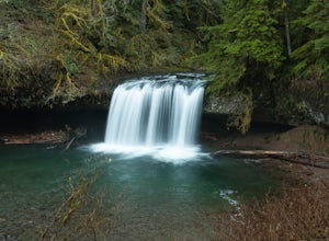
4.00.73 mi / 308 ft gainFrom Scott Mills Follow Crooked Finger RD NE for 13.3 Miles to the Upper Butte Creek Trailhead. The last 2-3 miles or so is gravel road with some potholes but most cars shouldn't have a problem. The path down to the falls starts near the bathrooms. A short .3 mile walk on a few switchbacks and...Read more -
Stevenson, Washington
Three Corner Rock
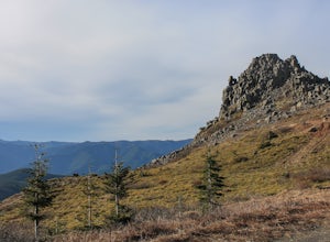
4.03.86 mi / 1093 ft gainFrom the Rock Creek Pass Trailhead, begin the short hike to Three Corner Rock by heading south on the Pacific Crest Trail from its crossing of Road CG 2090. After a steady 1.5-mile climb of roughly 600 feet, look for a large fallen sign marking the junction to Three Corner Rock. Shortly after, an...Read more -
Cascade Locks, Oregon
Backpack the Mark. O Hatfield Wilderness Via Eagle Creek
1.026 mi / 2300 ft gainThis is a somewhat incomplete report because we did not venture too far into the Mark O. Hatfield Wilderness. The sky had been threatening us with rain for the duration of our hike along Eagle Creek and we did not want to push our luck too far since we were hoping for an early start on our drive ...Read more

