Topton, North Carolina
Looking for the best hiking in Topton? We've got you covered with the top trails, trips, hiking, backpacking, camping and more around Topton. The detailed guides, photos, and reviews are all submitted by the Outbound community.
Top Hiking Spots in and near Topton
-
Tiger, Georgia
Hike to Glassy Mountain
5.01 mi / 3415 ft gainIn order to find this hidden gem, you'll have to drive quite a ways up the mountain first, otherwise it is a very steep incline. There will be limited parking at the gate that stops you from driving the whole way up. You will turn onto a road called "Glassy Mountain Rd" and that will be the road ...Read more -
Gatlinburg, Tennessee
Hike to Upper Meigs Falls
5.03.55 mi / 1000 ft gainParking available off of Little River Gorge Road (State Hwy. 73) at The Sinks/Meigs Creek Trailhead. The trail starts with winding elevation gain until it crests around 1 mile into the hike (notice pine trees at higher elevation). After the crest it starts descending towards Meigs Creek. While f...Read more -
Maggie Valley, North Carolina
Soco Falls
5.00.09 mi / 0 ft gainThis double waterfall is located a mile and half off of the Blue Ridge Parkway in the Cherokee Indian Reservation. From the parking area, it's a short walk down a well-established trail to the viewing area of the falls. For an even closer view of the falls, you can follow a roped, steep path dow...Read more -
Clayton, Georgia
Hike to Martin Creek Falls
5.00.6 miThere are two different ways to get to this waterfall.The easiest way is through a trail in the Warwoman Wildlife Management Area. To get to this trail head, drive east on Warwoman Road from Clayton, GA. At approximately 3.5 miles, take a left onto Finney Creek Road (FS 152). You will see a sign ...Read more -
Tuckasegee, North Carolina
Hike to Cedar Cliff Rock
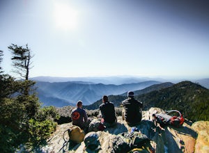
2.4 mi / 830 ft gainCedar Cliff Rock is one of those local places that exemplifies the Blue Ridge mountains oh-so-well. From the top you can see the Tuckaseegee River along with both Cedar Cliff and Bear Creek Reservoirs. While there are a few homes in between, much of the view is untouched, allowing a big mountain ...Read more -
Sylva, North Carolina
Waterrock Knob Trail
5.01 mi / 407 ft gainThe trail begins paved and quickly climbs up into a heavily forested area. Once at a 1/4 of a mile in, you will come to a nice overlook that will give you your first real good view of the surrounding mountains. The trail then continues on, though now unpaved, with great views off to your left as ...Read more -
Sylva, North Carolina
Abandoned Cessna 414A at Waterrock Knob
3.71.72 mi / 430 ft gainThis is an AWESOME day hike for anyone looking to get outside for a few hours and see some special views of the blue ridges, as well as check out the abandoned plane crash of a Cessna 414A that happened back in 1983. The remains of the plane are still scattered along the hillside making it a supe...Read more -
Vonore, Tennessee
Camp at Citico Creek
5.0There are a few options for getting to Citico Creek, you can either go up the windy gravel road from US 411 or get off of the Cherohala Skyway and go down the mountain past the Indian Boundary campground. The Citico Creek campground has about 5 or 6 spots but is rarely full because it is very sec...Read more -
Blairsville, Georgia
Hike to the Brasstown Bald Peak
4.31.42 mi / 430 ft gainOnce you make it to the parking area (parking fee required) to Brasstown Bald you will be at about 4284 feet elevation. From there you will have a short (0.6 mile) but steep hike to the tower that sits atop Brasstown Bald. Along the path you will see Rhododendron and various other blooms dependi...Read more -
Highlands, North Carolina
Bouldering Granite City
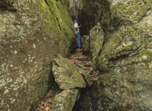
5.00.3 mi / 96 ft gainAt the foot of Blackrock Mountain just outside of Highlands, North Carolina, lies one of the most unique and secluded natural playgrounds around. Granite City is composed of several massive granite boulders, ranging between 10-40 feet tall. This spot is most popular for bouldering (mostly V0-V2...Read more -
Gatlinburg, Tennessee
Mount LeConte-Cliff Tops via Rainbow Falls Trail
4.513.37 mi / 3993 ft gainBegin at the Rainbow Falls trail parking lot. This is very popular area especially in the summer. If the parking area at the trail head is full there is additional parking located just past the main lot. From here the Rainbow Falls trail is just under 14 miles to the summit of Mount Leconte. Elev...Read more -
35.675929,-83.485764
Roaring Fork Motor Nature Trail
5.05.83 miThis 6 mile drive is a great way to spend a scenic day in the Smokies. The road is open to cars only (no trucks or RVs) and runs one-way. There are no visitors centers after you head out, so be sure to bring everything you need along. The drive begins at the historic Ogle farmstead, which is als...Read more -
Gatlinburg, Tennessee
Cataract Falls, Smoky Mountains
4.41.09 miYou will find the trailhead to this gravel path just to the left of the Sugarlands Visitor Center. The easy walk along Fighting Creek is scenic and tends not to be crowded, either. At the end of the hike you will find a beautiful 25-foot waterfall. Please refrain from climbing on or around the f...Read more -
Gatlinburg, Tennessee
Gatlinburg Trail
5.03.8 mi / 351 ft gainGatlinburg Trail is an out-and-back trail that takes you by a waterfall located near Gatlinburg, Tennessee.Read more -
Highlands, North Carolina
Explore Cashiers Sliding Rock
0.2 mi / 70 ft gainThis waterfall is located just outside of Cashiers, NC. The trailhead to the waterfall is right off of the road and has a good amount of parking. The trial itself is very nice and has new steps at the beginning of the trail. The trail is very wide and is mostly flat the entire way there. Once you...Read more -
Gatlinburg, Tennessee
Grotto Falls Trail
5.01.83 mi / 585 ft gainThis is an intermediate hike along Trillium Gap Trail. There are four stream crossings on your way to the falls as you hike through an idyll, often wildflower-sprinkled landscape. Late spring is best for catching blooms. Once at the waterfall, you can walk behind the cascade of water. This is a ...Read more

