Topton, North Carolina
Looking for the best hiking in Topton? We've got you covered with the top trails, trips, hiking, backpacking, camping and more around Topton. The detailed guides, photos, and reviews are all submitted by the Outbound community.
Top Hiking Spots in and near Topton
-
Tuckasegee, North Carolina
Paradise Falls
4.30.74 mi / 167 ft gainTo the north of Panthertown lies a chain of dammed lakes that are some of the most peaceful waters in Western North Carolina. These make up the headwaters of the East Fork of the Tuckasegee River. The gorges that run between the top lakes are wild, scenic, and adventurous to even the most experie...Read more -
Mountain Rest, South Carolina
Hike along the Chattooga River to Spoonauger Falls
1 mi / 100 ft gainSpoonauger falls housed in Sumter National Forest, received its name after the Spoonauger family which historically lived above the falls. From Walhalla SC, drive north on Highway 28 until it meets SC 107 (right under 10 miles). Take a slight right onto SC 107 and drive another 10 miles until yo...Read more -
Mountain Rest, South Carolina
Hike to Big Bend Falls
5.06.5 miThe hike to Big Bend Falls begins on the Chattooga River Trail at the Burrell's Ford Campground. To get here you take Burrell's Ford Road off of SC 107. There will be a good sized gravel parking area off to the left about 3 miles down Burrell's Ford Road. When you park the car you can walk down t...Read more -
Mountain Rest, South Carolina
Hike to Kings Creek Falls
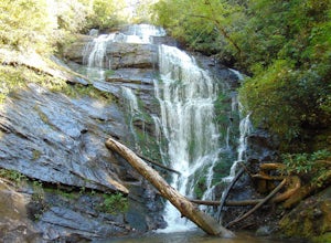
4.80.5 miThe trail to Kings Creek begins behind the bulletin board in the Burrells Ford primitive campground parking lot. It is an easy .5 mile trail to the falls. The falls are only 70ft high but they are beautiful, there is an area to the side of the falls with some nice sitting rocks and the area under...Read more -
Mountain Rest, South Carolina
Hike to King Creek Falls
0.6 miVery nice dog-friendly and family-friendly adventure! The hike is not long at all and the end result is a beautiful 70 ft waterfall with a pooled area at the bottom! Old logs are around for sitting on and relaxing while enjoying your lunch or snacks...Read more -
Gatlinburg, Tennessee
Hike to the Ramsey Cascades
4.97.83 mi / 2190 ft gainThis multi-tiered waterfall is known as the tallest in the park – a worthwhile reward for the steep and sometimes tricky terrain you'll face on the way up. The popular route to the falls also passes through an impressive old-growth forest, which apparently boasts some of the tallest trees in the...Read more -
Blairsville, Georgia
Hike to Horsetrough Falls
5.00.4 mi / 10 ft gainTo get to the trail head you will follow Wilks road five miles to Upper Chattahoochee River Campground. The five miles down the gravel road should be doable for a majority of cars as the gravel road is in good condition. Pretty much if you feel comfortable driving your car on a regular gravel roa...Read more -
Lake Toxaway, North Carolina
Hike to Schoolhouse Falls and Little Green
5.03 miTrail signs in Panthertown Valley are limited. Be sure to bring a map! Starting at the Cold Mountain parking lot, hike to Schoolhouse Falls. This is a nice waterfall with a pool at the bottom. In the summer, you are bound to run into other fellow hikers here. From Schoolhouse Falls, you have the...Read more -
Lake Toxaway, North Carolina
Hike to Warden, Jawbone, and Riding Ford Falls
4.5 miWarden, Jawbone, and Riding Ford Falls are three waterfalls located along the headwaters of the Tuckasegee River in Panthertown Valley. Not far from the Cold Mountain trailhead, these falls are quite popular in the summer. On a weekend, you will often find people playing in the pools below the fa...Read more -
Walland, Tennessee
Drive the Foothills Parkway National Scenic Byway
5.0The foothills parkway runs parallel to the Great Smoky Mountains. It is 38.6 miles in total with the longest section at 33.0 miles. There are a few different places to get on to the parkway. There is one entrance near Fontana, Walland, Wears Valley, and Cosby. However Cosby is a smaller section a...Read more -
Sautee Nacoochee, Georgia
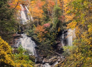
Anna Ruby Falls
4.01 mi / 374 ft gainThe hike to Anna Ruby Falls located in the Chattahoochee National Forest, bordering and often mistaken for being located in Unicoi State Park, begins at the Anna Ruby Falls Visitor Center. There is a $3 per person fee (16 years and under are free) to access the parking lot of the visitor center a...Read more -
Lake Toxaway, North Carolina
Hike to Raven Rock Falls
0.5 miIf you want to see a great waterfall without hiking all day, this is the perfect trail for you. Getting there - The trailhead is about 2 miles from the intersection of Cold Mountain and Panther Ridge Road (exact coordinates: 35.1594, -82.9801). There is a small grassy pull out where you can park...Read more -
Lakemont, Georgia
Minnehaha Falls
4.20.39 mi / 98 ft gainDespite their beauty, not many hikers know about Minnehaha Falls. Even more shocking, these are some of the most accessible falls in all of North Georgia. Round trip, the hike to the falls will only take about a half a mile. Hikers can park along the side of the road at the trailhead. Follow the ...Read more -
Blairsville, Georgia
Nottely Reservoir Trail
2.53 mi / 335 ft gainNottely Reservoir Trail is a loop trail that takes you by a river located near Blairsville, Georgia.Read more -
Brevard, North Carolina
Hike the Toxaway River Trail
5.01.25 miThis easy 1.25 mile hike is located within the Lake Toxaway community. The trail itself follows a small creek as it winds through the valley. Be warned - there are numerous stream crossings. Most of the crossings are fairly easy at normal water levels, but can be difficult if the water is high. S...Read more -
Cashiers, North Carolina
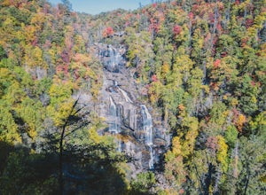
Explore Whitewater Falls
4.00.5 mi / 100 ft gainWhitewater Falls is the highest waterfall east of the Rocky Mountains with the upper falls alone dropping over 400 feet. The walk to the falls is very short and friendly for all ages and abilities - the path is paved so the falls are wheelchair accessible. The falls are beautiful in all seasons b...Read more

